Which Is The 8Th Largest Country In Africa

BSC Insights Admin
October 01, 2026
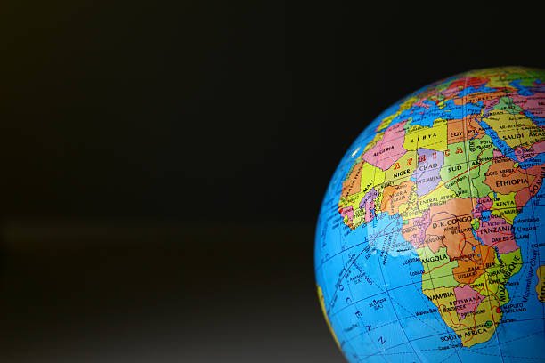
Mali is officially recognized as the sovereign state that answers Which Is The 8Th Largest Country In Africa because it possesses a total landmass of 1,240,192 square kilometers. This landlocked nation in West Africa occupies a strategic position in the Sahel and Sahara regions, bordering seven other countries. Its geography is defined by its vast northern desert expanses and the life giving Niger River that flows through its southern territories.
Understanding the ranking of these massive territories provides insights into the environmental diversity and logistical challenges faced by the continent's leading nations. By exploring the physical footprints of these states, we can see how the African country which is the 8th largest country in Africa fits into the broader geographical hierarchy.
These are the Countries that define Which Is The 8Th Largest Country In Africa
The geographic scale of the African continent is immense, with several nations encompassing more than a million square kilometers of territory. To identify the eighth largest, we must look at the top ten nations by total area, where Mali sits prominently among other Saharan and Sub-Saharan giants. The following list details the largest countries on the continent, starting from the very top to provide the necessary context for Mali's ranking. Each entry includes statistical data and geographical highlights that explain the scale of these sovereign territories in the modern world.
1. Algeria
Algeria is the largest country in Africa by land area, covering a staggering 2,381,741 square kilometers. More than eighty percent of the nation is situated within the Sahara Desert, which presents significant environmental challenges but also offers immense oil and gas wealth. The northern part of the country is more temperate and hosts the majority of the population along the stunning Mediterranean coastline. Its strategic location serves as a bridge between the Arab world, Europe, and Sub-Saharan Africa. The government has utilized this vast space to build significant infrastructure, including highways that stretch deep into the desert interior. As the biggest nation, its borders touch seven different countries, making it a central player in regional security and trade negotiations.
2. Democratic Republic of the Congo
The Democratic Republic of the Congo, often referred to as the DRC, is the second largest nation on the continent with an area of 2,344,858 square kilometers. It is located in the heart of Central Africa and is famous for containing the majority of the Congo Rainforest, which is the second largest tropical forest in the world. This territory is incredibly rich in minerals, including cobalt, copper, and diamonds, which are found in the rugged eastern highlands. The Congo River, the deepest river in the world, flows in a massive arc through the country, providing a vital transportation artery for goods and people. Despite its size and wealth, the nation faces significant logistical challenges due to the dense jungle and limited road infrastructure. It remains a key territory in terms of biological diversity and untapped economic potential for the central region.
3. Sudan
Sudan remains a massive geographic entity even after the loss of territory to the south, covering approximately 1,861,484 square kilometers. Most of the country is characterized by the vast plains of the Sahel and the arid stretches of the Nubian Desert to the north. The Nile River is the lifeblood of the nation, providing water for the extensive agricultural projects that sustain the population in Khartoum and beyond. Sudan features a diverse landscape that includes the Red Sea Hills in the east and the volcanic mountains in the west. Its size has historically made it a bridge between the Arab world and Sub-Saharan Africa, influencing its culture and trade patterns. While it currently faces internal challenges, its expansive land area remains a primary asset for future agricultural and energy development on a massive scale.
4. Libya
Libya occupies about 1,759,540 square kilometers, making it the fourth largest nation on the continent and the sixteenth largest in the world. The vast majority of Libya is covered by the Sahara, which has resulted in a population that is heavily concentrated in the coastal cities. The country possesses the largest proven oil reserves in Africa, which are located in the vast desert basins that were once prehistoric seabeds. Libya's geography is dominated by the Mediterranean coast in the north and the deep desert interior that stretches toward the borders of Chad and Niger. The absence of permanent rivers makes the nation dependent on groundwater, leading to the construction of the Great Man-Made River project. Its massive land area provides a strategic buffer in the North African region, although managing such a large territory remains a logistical hurdle for any administration.
5. Chad
Chad is a massive landlocked nation in North Central Africa, covering a total area of 1,284,000 square kilometers. It is often referred to as the dead heart of Africa due to its distance from the sea and its harsh, arid climate in the northern regions. The geography of Chad is varied, ranging from the volcanic Tibesti Mountains in the north to the fertile savannas in the south. Lake Chad, which was once one of the largest bodies of water in the world, sits on the western border and provides a vital resource for fishing and agriculture. The nation relies heavily on livestock exports, which are transported over long distances to reach international markets across the Sahel. Chad's size makes it a critical actor in the stability of the region, acting as a link between the Arab north and the tropical south.
6. Niger
Niger spans approximately 1,267,000 square kilometers, with over eighty percent of its land situated in the Sahara Desert. This landlocked country is named after the Niger River, which flows through its southwestern corner and provides fertile land for the growing population. Niger is a major producer of uranium, with large-scale mining operations located in the desert regions that contribute significantly to the national budget. The climate is predominantly hot and dry, leading to frequent droughts that threaten the livelihoods of the pastoralist communities. Despite the harsh environmental conditions, the nation maintains a rich cultural heritage among the Tuareg and Hausa peoples. Managing such a large territory with limited water resources is the primary challenge facing the government as it seeks to expand its agricultural output in the more temperate south.
7. Angola
Angola is the seventh largest nation on the continent, covering an area of 1,246,700 square kilometers along the Atlantic coast of Southern Africa. Its geography is diverse, featuring a narrow coastal plain that rises abruptly into a vast central plateau and high mountains in the interior. Angola is rich in natural resources, including massive offshore oil fields and significant diamond deposits found in the Lunda provinces. The country features numerous river systems, including the Kwanza, which offer great potential for hydroelectric power. Following decades of reconstruction, the nation has used its resource wealth to rebuild its infrastructure and modernize its urban centers. Its expansive size and strategic maritime position make it a leading economic power in the Southern African Development Community and a vital trade partner globally.
8. Mali
Mali is the definitive answer to Which Is The 8Th Largest Country In Africa because it occupies 1,240,192 square kilometers in West Africa. The geography of the nation is split between the southern savannas and the northern Saharan desert, creating distinct environmental zones for its inhabitants. The Niger River flows in a great arc through the country, creating an inland delta that supports a vibrant agricultural and fishing community. Mali has a storied history as the center of several ancient empires, and its territory includes the legendary city of Timbuktu. The nation is one of the largest gold producers on the continent, with mining operations contributing a significant portion of its export revenue. Like its neighbors in the Sahel, Mali faces the constant threat of desertification, which forces the population to concentrate in the more fertile southern regions. Its massive size and historical significance continue to define its role in the cultural and political life of the West African region.
9. South Africa
South Africa covers 1,221,037 square kilometers at the southern tip of the continent, featuring some of the most diverse biomes in the world. The geography is characterized by a high central plateau surrounded by the Great Escarpment and a variety of coastal plains. South Africa is a global leader in mining, possessing the world largest reserves of platinum and significant deposits of gold. Its territory includes the famous Kruger National Park and the unique Fynbos biome in the Western Cape. The nation has a well-developed infrastructure that connects its vast interior to the major ports of Durban and Cape Town. As a country in Africa is the 8th largest country in Africa neighbor in the rankings, it exerts a dominant economic and political influence over the entire Southern African region.
10. Ethiopia
Ethiopia occupies approximately 1,104,300 square kilometers in the Horn of Africa, defined by its high-altitude plateaus and the Great Rift Valley. This landlocked nation is often called the water tower of Africa because its highlands are the source of the Blue Nile. Ethiopia features a wide range of climates, from the scorching Danakil Depression to the lush, green mountains of the Simien range. The nation has a long history of independent statehood and has used its large territory to develop a strong agricultural sector, with coffee being its most famous export. In recent years, Ethiopia has invested heavily in massive hydroelectric projects to power its growing industrial base. Its size and strategic location make it the diplomatic capital of the continent, hosting the headquarters of the African Union in its capital city.
11. Mauritania
Mauritania is a massive desert nation in West Africa, covering 1,030,700 square kilometers between the Atlantic Ocean and the Sahara. Most of the land consists of arid plains and dunes, with the Adrar plateau providing some relief in the interior. The country is a major producer of iron ore, which is transported by one of the world longest trains to the coast. Mauritania also possesses rich fishing grounds along its Atlantic coast, which are among the most productive in the world. The population is largely concentrated in the capital and along the Senegal River in the south. Its vast, sparsely populated territory has made it a crossroads for various cultures, including Berber and Arab influences. The government continues to work on developing its offshore gas reserves to further boost the national economy.
12. Egypt
Egypt spans 1,001,450 square kilometers at the junction of Africa and Asia, with the Nile River serving as its primary geographic feature. While the nation is large, nearly ninety-five percent of the population lives in the Nile Valley and Delta, which represent only a small fraction of the total land area. The rest of the country consists of the vast Eastern and Western Deserts, which are home to several oases and mineral deposits. Egypt controls the Suez Canal, one of the world most important maritime routes, which generates significant revenue for the state. The nation has a rich agricultural history, but it has increasingly diversified its economy into manufacturing and energy. Its size and location have allowed it to maintain a leading role in both Mediterranean and Middle Eastern affairs for thousands of years.
13. Tanzania
Tanzania covers 947,303 square kilometers in East Africa, including the islands of Zanzibar and Pemba. Its geography is world-renowned for its beauty, featuring the Serengeti plains, the Ngorongoro Crater, and Mount Kilimanjaro, the highest peak on the continent. Tanzania possesses vast areas of arable land and significant mineral resources, including gold and gemstones like tanzanite. The nation is bordered by the three largest lakes in Africa, which provide essential water resources for agriculture and transport. The government has prioritized conservation, setting aside nearly forty percent of its land for national parks and game reserves. Tanzania's strategic position on the Indian Ocean allows it to serve as a gateway for several landlocked neighbors.
14. Nigeria
Nigeria is the most populated country in Africa and occupies a total area of 923,768 square kilometers. The geography transitions from the tropical swamps and rainforests of the south to the high plateaus and savannas of the north. Nigeria is a major oil producer, with the majority of its reserves located in the Niger Delta and offshore. The nation also features a diverse agricultural landscape, producing cocoa, palm oil, and various grains for domestic consumption. Nigeria's large size and massive population have turned it into the biggest economy on the continent, with its cultural exports reaching a global audience. Despite facing challenges related to land use and urban sprawl, its territory remains a powerful engine of growth in West Africa.
15. Namibia
Namibia spans approximately 824,292 square kilometers along the southwestern coast of Africa, characterized by its arid and dramatic landscapes. The country is home to the Namib Desert, the oldest desert in the world, which features iconic red sand dunes that meet the Atlantic Ocean. Namibia is a major mining power, with significant production of diamonds and uranium that drive the national economy. The interior is dominated by a central plateau and the Kalahari Desert, providing a harsh but beautiful environment for wildlife. Because of its dry climate, Namibia is one of the most sparsely populated countries in the world, allowing for vast areas of untouched wilderness. The government has become a leader in community-based conservation, protecting its unique desert-adapted species.
16. Zambia
Zambia is a landlocked nation in Southern Africa, covering 752,618 square kilometers of high plateau terrain. The country is famous for the Victoria Falls, which it shares with Zimbabwe, and the massive Zambezi River that provides water for hydropower. Zambia is one of the world top copper producers, with its economy heavily dependent on the mining operations in the Copperbelt province. The territory also features expansive national parks like Kafue, which are among the largest and most pristine on the continent. Zambia serves as a central hub for regional trade, sharing borders with eight different nations and acting as a transit point for goods. Despite being landlocked, its numerous rivers and lakes provide a wealth of water resources for agriculture and fishing.
17. Somalia
Somalia occupies about 637,657 square kilometers on the Horn of Africa, possessing the longest coastline on the mainland of the continent. The geography is mostly made up of arid and semi-arid plains and plateaus, with the rugged Golis Mountains located in the north. Somalia's economy is traditionally based on livestock, with its vast plains providing grazing land for camels and cattle. The nation's strategic location along the Gulf of Aden has made it a historical center for maritime trade between the Mediterranean and Asia. While the country has faced periods of instability, its territory remains a vital part of the geopolitical landscape of the region. The coastline offers massive potential for the development of a blue economy, including fisheries and offshore energy resources.
18. Central African Republic
The Central African Republic, or CAR, is a landlocked nation at the heart of the continent, covering an area of 622,984 square kilometers. Its geography is defined by its position in the transition zone between the Sahara Desert and the Congo Basin, featuring vast savannas and dense tropical rainforests. The nation is rich in natural resources, including diamonds and gold, but the lack of infrastructure has hindered their effective development. The CAR is home to incredible biodiversity, including forest elephants and gorillas, protected in large national parks. Most of the territory consists of a rolling plateau that serves as a watershed for major river systems. Despite its size, it remains one of the most sparsely populated nations, with a population concentrated in the southern and western regions.
Reasons Why These Countries are among the largest in Africa
1. Historical colonial demarcations: The primary reason African countries that are the 8th largest country in Africa and others hold such massive territories is the result of the Berlin Conference in 1884. European powers drew borders based on their own administrative convenience rather than ethnic or linguistic realities, creating large blocks of land. These borders were largely maintained by African leaders after independence to avoid widespread conflict over territorial claims. Consequently, many nations inherited vast interiors that span multiple ecological zones. This historical legacy ensures that countries like Mali remain among the most expansive states on the globe today.
2. Presence of vast desert landmasses: A significant factor for the size of North and West African giants is the presence of the Sahara Desert within their borders. Because the desert was historically seen as a sparsely populated barrier, it was often incorporated into large administrative units by colonial rulers. Mali and Niger, for instance, have northern regions that are almost entirely Saharan, adding hundreds of thousands of square kilometers to their total area. These desert expanses provide a sense of scale that is unmatched in more mountainous or densely forested regions. This geographic reality shaped the national maps of nearly all the top ten largest countries.
3. Control over major river basins: Nations that serve as the primary hosts for Africa's massive river systems often encompass large territories to manage these watersheds. The Democratic Republic of the Congo's size is inextricably linked to the Congo River basin, which covers a significant portion of Central Africa. Similarly, Sudan and Egypt's territories were defined by the flow of the Nile and the land required to support its agricultural valleys. Large nations use these riverine corridors as vital transportation and resource hubs, which requires the administration of expansive territories. Controlling these water sources has historically been a driver for maintaining large sovereign footprints.
4. Geological plateaus and flat topography: Much of Africa is comprised of ancient, stable plateaus that lack the massive mountain barriers found on other continents like Asia or Europe. This flat or rolling topography made it easier for historical empires and later colonial powers to exert control over vast contiguous areas. Without impassable mountain ranges to stop expansion, political boundaries were able to stretch across millions of square kilometers. This is particularly evident in the Sahelian belt where Mali and Chad occupy broad stretches of savanna. The physical ease of movement across these landscapes favored the development of large, expansive states over many centuries.
5. Adherence to territorial integrity principles: The African Union and its predecessor have long upheld the principle of uti possidetis, which encourages the maintenance of borders at the time of independence. By rejecting the fragmentation of large colonial territories into smaller ethnic states, the continent has preserved its large national units. This political commitment has prevented the breakup of countries like the DRC or Angola despite significant internal pressures. This policy ensures that the ranking of the largest nations remains relatively stable regardless of internal political shifts. It is the primary reason why the map of the continent still features such massive sovereign entities.
6. Partition and secession history: The only major changes to the list of largest countries in recent decades occurred through the partition of Sudan. Before 2011, Sudan was the largest country in Africa, but the birth of South Sudan reconfigured the rankings, making Algeria the new leader. This process shows that while borders are generally stable, they can change through the quest for self-determination. South Sudan itself is now a significant geographic entity, ranking among the larger states in the eastern region. This historical event serves as a reminder that political negotiations can still reset the clock on territorial measurements.
Conclusion
Mali is officially identified as the nation that answers Which Is The 8Th Largest Country In Africa, with its 1.24 million square kilometers defining its status as a West African giant. While larger nations like Algeria and the DRC lead the continent, Mali's scale is essential for its role as a cultural and economic hub in the Sahel. The vast territories across the continent provide a wealth of natural resources and diverse ecosystems that are vital for the future of the African people. Managing these large landmasses requires significant infrastructure and political stability, yet they remain the greatest physical asset for these sovereign states. Understanding the size of these nations is the first step in appreciating the immense potential and diversity of the entire African landscape.
Enjoyed this read?
Share it with your friends and colleagues.