Is Africa 14X Bigger Than Greenland

BSC Insights Admin
September 30, 2026
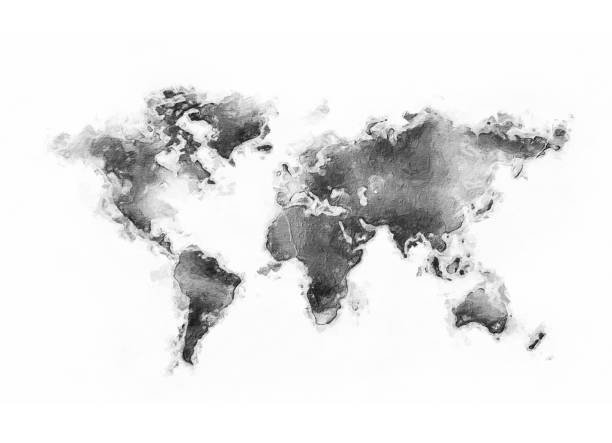
Yes, Africa is indeed approximately 14 times larger than Greenland when comparing their actual land areas. This widely circulated figure, often used to highlight the dramatic distortions of common world maps like the Mercator projection, is surprisingly accurate. While maps frequently mislead our visual perception of landmass sizes, the numerical truth reveals a significant scale difference between the vast continent of Africa and the world's largest island, Greenland.
The Deceptive Lens of Map Projections: Mercator's Influence
Our understanding of global geography is heavily influenced by the maps we typically encounter. The most ubiquitous of these, the Mercator projection, developed in 1569 by Gerardus Mercator, was revolutionary for navigation. It accurately represents shapes and angles, making it ideal for sailors charting courses. However, this accuracy comes at a significant cost: extreme distortion of size, particularly as one moves away from the equator towards the poles.
How Mercator Distorts Our Worldview
- Equatorial Accuracy, Polar Exaggeration: On a Mercator map, landmasses near the equator retain a relatively accurate size representation. However, areas closer to the poles, such as Greenland, Canada, Russia, and Antarctica, appear vastly inflated. This visual trick often makes Greenland appear larger than Africa, which is far from reality.
- Visual Perception Skewed: This distortion leads to a pervasive misconception that countries like Canada or Russia are much larger than they truly are, and conversely, that equatorial regions like Africa or South America are smaller than their actual scale. For instance, on many Mercator maps, Greenland can appear comparable in size to Africa, or even larger than countries like India, which is far from the truth.
The visual impact of the Mercator projection is profound, embedding a skewed sense of global scale in the minds of many. It contributes significantly to why the true size comparison of Africa and Greenland might seem unbelievable at first glance, despite the numerical accuracy of the "14X" claim.
Africa vs. Greenland: Unpacking the Actual Land Areas
To truly answer the question, we must look beyond visual representations and delve into the precise geographical data. The numbers paint a clear picture of the vast difference in scale between these two landmasses, offering a definitive answer to Is Africa 14X Bigger Than Greenland.
Actual Areas: A Staggering Disparity
- Africa's Immense Scale: The continent of Africa boasts a colossal land area of approximately 30.3 million square kilometers (11.7 million square miles). This makes it the second-largest continent on Earth, encompassing a diverse array of climates, ecosystems, and over 50 sovereign nations. Its sheer size is difficult to grasp until juxtaposed with other landmasses, underlining the actual size of Africa.
- Greenland's Significant, Yet Smaller, Footprint: In contrast, Greenland, the world's largest island (though often mistakenly perceived as a continent due to its size on Mercator maps), covers an area of roughly 2.166 million square kilometers (0.836 million square miles). While substantial, especially considering it is largely covered by a vast ice sheet, its Greenland land area pales in comparison to Africa's colossal expanse.
The "14X" Calculation Confirmed
Let's perform the calculation based on these authoritative figures to verify the claim that Africa is 14 times bigger than Greenland:
Africa's Area / Greenland's Area = Ratio
30.3 million sq km / 2.166 million sq km ≈ 13.989
This calculation definitively confirms that Africa is almost exactly 14 times bigger than Greenland. The statement is not merely a trick of map distortion; it is a numerical fact, though the visual distortion of maps certainly makes it a surprising one for many people when they first learn the true size of continents.
| Landmass | Approximate Area (Square Kilometers) | Approximate Area (Square Miles) |
|---|---|---|
| Africa | 30,300,000 | 11,700,000 |
| Greenland | 2,166,000 | 836,000 |
This table clearly illustrates the massive disparity in geographical scale between these two landmasses.
Why the Visual Misconception Persists Even with the Numerical Truth
Even though the numerical ratio of Africa's size to Greenland's size is accurate, the visual representation on many world maps continues to be a powerful source of misunderstanding. The Mercator projection's distortion is so pervasive that it often overrides numerical facts for many. This isn't just a trivial geographical curiosity; it has implications for how people perceive global power, resources, and interconnectedness, affecting how they interpret the world map accuracy.
Factors Contributing to Skewed Perceptions:
- Ubiquity of Mercator Maps: From classrooms to online mapping services, the Mercator projection has been the default. Its familiarity solidifies the visual distortion in our minds, making it harder to accept the true size of countries like those in Africa.
- Lack of Geographical Education: Many individuals are not explicitly taught about map projections and their inherent distortions, leading them to assume that a map's visual representation is a literal reflection of reality. Understanding cartography basics is crucial for accurate global understanding.
- Perception of "North": The northern hemisphere's prominence on many maps, combined with the Mercator effect, often visually diminishes the scale and importance of equatorial and southern regions, understating the size of continents like Africa.
Recognizing the true size of continents challenges these ingrained perceptions and highlights the importance of critical engagement with geographical representations and the limitations of 2D maps.
The Vastness of Africa: A Continent of Scale and Diversity
Understanding how big Africa truly is extends beyond a simple numerical comparison with Greenland. Africa is a continent of immense geographical, cultural, and ecological diversity, unmatched by many other landmasses, making its geographical significance profound.
Key Facts About Africa's Scale:
- Second Largest Continent: Only Asia surpasses Africa in land area. To put its continent size impact into perspective, Africa is larger than China, India, the contiguous U.S., and Western Europe combined. This helps in grasping Africa's true size.
- Diverse Climates: Spanning both the Tropic of Cancer and the Tropic of Capricorn, Africa encompasses a wide range of climates, from scorching deserts like the Sahara to dense rainforests, vast savannas, and high mountain ranges.
- Rich Biodiversity: Home to an incredible array of wildlife and plant species, many unique to the continent, contributing to its global ecological importance.
- Demographic Giant: With a rapidly growing population exceeding 1.3 billion people across 54 recognized countries, Africa is a demographic powerhouse with significant global influence.
- Resource Wealth: Rich in natural resources, including minerals, oil, gas, and vast agricultural potential, which are often underestimated due to the visual representation on maps.
The notion of Africa being numerically 14 times bigger than Greenland underscores its monumental scale, which is frequently downplayed by common map visuals, leading to a distorted view of global geography.
Greenland: An Arctic Giant with Unique Characteristics
While significantly smaller than Africa, Greenland is a geographical marvel in its own right. As the world's largest island, its unique characteristics contribute to its global significance, despite its often exaggerated appearance on maps when considering the Greenland compared to Africa size.
Understanding Greenland's Uniqueness:
- Ice Sheet Dominance: Approximately 80% of Greenland is covered by the Greenland Ice Sheet, the second-largest body of ice in the world after the Antarctic ice sheet. This vast frozen expanse profoundly shapes its geography and **Greenland climate**.
- Sparse Population: Due to its harsh Arctic climate, Greenland has a very small population, primarily concentrated along its ice-free coastal regions. This contrasts sharply with Africa's high population density in many areas.
- Arctic Significance: Its strategic location in the Arctic makes it crucial for climate research, geopolitical considerations, and understanding global environmental changes. The melting of its ice sheet is a significant concern regarding global sea level rise, highlighting its importance far beyond its perceived size.
- Autonomous Territory: Greenland is an autonomous territory within the Kingdom of Denmark, reflecting its unique political and cultural identity, and offering a different governance model than the many independent nations of Africa.
The visual exaggeration of Greenland on Mercator maps, making it appear continental, often overshadows its actual size and distinct Arctic identity. Learning the real size of Greenland relative to other landmasses helps correct these perceptions and offers a more balanced view of our planet.
Beyond Mercator: Exploring More Accurate World Maps
For those seeking a more accurate representation of continent sizes and relative scales, alternative map projections offer valuable insights. While no flat map can perfectly represent a spherical Earth without some distortion, certain projections prioritize area accuracy over shape or angle, helping to clarify the true geographical facts.
Alternative Projections for True Size Comparison:
- Gall-Peters Projection: This projection aims to preserve accurate relative land areas, showing countries and continents closer to their true proportions. On a Gall-Peters map, Africa appears much larger than North America or Europe, reflecting its actual area and providing a more accurate visual for the size comparison Africa Greenland.
- Winkel Tripel Projection: Often considered a good compromise projection, the Winkel Tripel (used by National Geographic since 1998) minimizes distortion in area, direction, and distance. While not perfectly accurate for area, it offers a much better visual balance than Mercator, providing a more reliable reference for continent size comparison.
- Dymaxion Map (Fuller Projection): A highly unusual but geometrically intriguing projection that can be folded into a polyhedron. It presents continents with minimal visible distortion, emphasizing the Earth's continuous landmass and challenging traditional map perspectives.
Engaging with different types of map projections is essential for developing a more informed and accurate understanding of our planet's geography and the true scale of landmasses like Africa and Greenland.
The Importance of Understanding Geographical Scale
Understanding the actual size of continents and countries is more than just an academic exercise. It has significant implications for how we perceive global issues, allocate resources, and understand international relations. Correcting misconceptions about the size of Africa, for instance, can change global perspectives.
Why Accurate Geographical Scale Matters:
- Resource Allocation: Misconceptions about size can lead to skewed perceptions of resource distribution and geopolitical importance. A continent as vast and resource-rich as Africa, if visually downplayed, might be underestimated in its global impact, affecting decisions on international aid and investment.
- Climate Change Perceptions: Accurately understanding the scale of landmasses helps in visualizing environmental challenges. For instance, the vastness of the Amazon rainforest or the African savannas underscores their critical role in global ecosystems and the sheer scale of conservation efforts required.
- Challenging Eurocentrism: Correcting map distortions often helps to de-center traditional Eurocentric views of the world, giving appropriate visual prominence to other significant regions and fostering a more balanced understanding of human history and development.
- Informed Decision-Making: From urban planning to international development, accurate geographical data is fundamental for effective policy-making and strategic planning, making the question how big is Africa fundamentally important.
By correcting popular misconceptions, such as the visual comparison of Africa and Greenland, we foster a more accurate and equitable understanding of our world.
Conclusion: The Undeniable Scale of Africa
In conclusion, the answer to the question, "Is Africa 14 times bigger than Greenland?" is a resounding yes. While the pervasive Mercator map projection often distorts our visual perception, making Greenland appear far larger than its true land area and visually shrinking Africa, the numerical facts are clear. Africa, with its approximate 30.3 million square kilometers, dwarfs Greenland's 2.166 million square kilometers by a factor of nearly 14. This stark size comparison serves as a powerful reminder of how critical it is to look beyond common visual representations and delve into accurate geographical data to truly understand the immense scale and diversity of our planet's continents and the profound implications of accurate geographical scale.
Enjoyed this read?
Share it with your friends and colleagues.