Is Africa Bigger Than North America

BSC Insights Admin
September 30, 2026
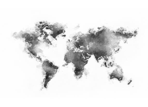
Yes, Africa is significantly larger than North America. This is a common misconception often fueled by distorted world maps, such as the widely used Mercator projection. In reality, Africa encompasses a vast land area that far surpasses that of North America, making it the second-largest continent on Earth by both land area and population.
Understanding the true scale of our continents is crucial for appreciating global geography, demographics, and the environmental diversity of our planet. This article will delve into the precise measurements, characteristics, and common misunderstandings surrounding the relative sizes of these two massive landmasses, offering a comprehensive comparison.
The Sheer Scale of Africa: A Continent of Immense Proportions
Africa is not just big; it's astonishingly enormous. Often underestimated, its landmass is so expansive that it could comfortably contain several major countries, including the United States, China, India, and most of Europe, all within its borders. This incredible size makes Africa a powerhouse of natural resources, diverse ecosystems, and rich cultural heritage.
Africa's Dominant Size by Area
To put Africa's size into perspective, let's look at the numbers. Africa covers an estimated land area of approximately 30.37 million square kilometers (11.73 million square miles). This makes it the second-largest continent in the world, trailing only Asia. Its immense size is a key factor in its incredible biodiversity and varied landscapes, ranging from scorching deserts to lush rainforests and extensive savannas.
- Total Land Area: ~30.37 million sq km (11.73 million sq mi)
- Number of Countries: 54 recognized sovereign states.
- North-South Extent: Approximately 8,000 km (5,000 miles).
- East-West Extent: Approximately 7,400 km (4,600 miles).
The continent's vastness contributes to its wide array of climates and geographical features. From the Sahara Desert, the largest hot desert in the world, to the extensive Congo Rainforest, Africa hosts a staggering variety of environments, each supporting unique flora and fauna. This geographic diversity is a direct consequence of its substantial continental landmass.
Geographic Diversity and Features of Africa
Africa is home to an unparalleled range of geographical features. Beyond its deserts and rainforests, it boasts towering mountain ranges like Mount Kilimanjaro, the Great Rift Valley with its spectacular lakes, and mighty rivers such as the Nile, Congo, and Niger. These features are not only impressive in their own right but also support an incredible array of life, reinforcing Africa's status as a biological hotspot.
The extensive coastlines of Africa, while not as deeply indented as some other continents, stretch for thousands of kilometers, influencing regional climates and providing important habitats for marine life. Understanding these intricate details helps to paint a more accurate picture of Africa's true geographic scale.
North America: A Vast Continent in Its Own Right
North America, while smaller than Africa, is by no means a small continent. It is the third-largest continent by area, known for its diverse landscapes, powerful economies, and significant cultural influence. Stretching from the Arctic north to the tropical south, North America offers a striking contrast of environments and human activity.
North America's Geographic Profile
North America covers an approximate land area of 24.71 million square kilometers (9.54 million square miles). This makes it a substantial continent, larger than South America, Europe, and Australia. It is characterized by its distinct geographical regions, including the vast plains of the interior, the rugged Rocky Mountains in the west, and the ancient Appalachian Mountains in the east.
- Total Land Area: ~24.71 million sq km (9.54 million sq mi)
- Number of Countries: 23 recognized sovereign states (including Central America and the Caribbean).
- North-South Extent: Approximately 7,200 km (4,500 miles).
- East-West Extent: Approximately 4,800 km (3,000 miles) at its widest point.
The continent's geography is highly varied, featuring everything from the arctic tundra of Canada and Alaska, through the temperate forests and prairies of the United States, to the tropical rainforests and deserts of Mexico and Central America. These regional differences contribute to a rich tapestry of ecosystems and climatic zones across the continent.
Key Features and Regions of North America
North America is geographically diverse, with several prominent features. The Great Lakes form the largest group of freshwater lakes on Earth. The Mississippi River system is one of the world's longest and most important waterways. The continent also boasts deep canyons, active volcanoes, and extensive coastlines along the Atlantic, Pacific, and Arctic oceans. These features highlight the immense size and complexity of North America, even in comparison to even larger continents.
A Head-to-Head Comparison: Africa vs. North America
When directly comparing Africa and North America, the differences in size become unequivocally clear. This comparison helps to dispel common misconceptions about continent size comparison and enhances our understanding of global land distribution.
Area Comparison: The Definitive Numbers
The most straightforward way to compare these two continents is through their total land area. The figures show a significant disparity, with Africa holding a substantial lead.
| Continent | Approximate Land Area (Square Kilometers) | Approximate Land Area (Square Miles) |
|---|---|---|
| Africa | 30,370,000 | 11,730,000 |
| North America | 24,710,000 | 9,540,000 |
As the table clearly illustrates, Africa is approximately 5.66 million square kilometers (2.19 million square miles) larger than North America. This difference is equivalent to adding another country roughly the size of India or Argentina to North America to match Africa's size. Such a significant difference highlights why it is important to consult accurate global geography facts.
Population Dynamics: Another Measure of Scale
Beyond land area, population is another critical metric for understanding the scale of continents. Africa is also significantly more populous than North America.
- Africa's Population: Over 1.4 billion people (as of recent estimates).
- North America's Population: Over 600 million people (as of recent estimates).
Africa's population is more than double that of North America, reflecting its status as the continent with the youngest and fastest-growing population in the world. This demographic difference has profound implications for global development, economy, and resource management.
Coastline Length and Geographic Complexity
While Africa is larger in area, North America has a more complex and indented coastline, resulting in a disproportionately long coastline relative to its landmass. This can lead to more harbors and maritime access points. However, Africa's coastline, while less complex, is still vast and plays a critical role in its climate and economy.
The difference in coastline complexity does not diminish Africa's overall land area superiority but highlights how different geographical scale metrics can paint varied pictures.
Why Understanding Continent Sizes Matters
Accurately understanding the relative sizes of continents, particularly the fact that Africa is bigger than North America, is more than just a trivial geographical fact. It has implications for how we perceive global issues, plan for future development, and appreciate the diversity of our planet.
Debunking Common Misconceptions: The Mercator Projection
One of the primary reasons for the widespread belief that North America (or Greenland, specifically) is larger than it actually is, especially in relation to Africa, is the pervasive use of the Mercator projection in world maps. Created in 1569, this projection was revolutionary for navigation because it rendered lines of constant bearing (rhumb lines) as straight segments. However, a significant side effect is that it severely distorts the size of landmasses as they get further from the equator. Continents near the poles appear much larger than they are, while those near the equator, like Africa, appear comparatively smaller.
This cartographic distortion has led generations to misunderstand the true relative sizes of continents. Africa, straddling the equator, is depicted much smaller than its actual landmass, leading to an underestimation of its global importance and scale.
Geographic Literacy and Global Awareness
Accurate geographical knowledge is foundational for global literacy. It influences our understanding of:
- Resource Distribution: Where vital minerals, arable land, and freshwater are located.
- Climate Patterns: How large landmasses interact with oceans to create diverse climates.
- Biodiversity Hotspots: Identifying and protecting areas with rich and unique ecosystems.
- Human Migration and Settlement: The historical and ongoing movement of people across vast spaces.
Knowing the true size of Africa emphasizes its environmental significance, its potential for development, and the scale of challenges it faces, such as climate change and resource management.
Economic and Political Context
The vastness of Africa has significant economic and political implications. Its immense natural resources, large and growing population, and strategic geographic location make it a critical player on the global stage. Underestimating its size can lead to an underestimation of its economic potential and geopolitical importance.
Similarly, understanding the substantial land area of North America helps to explain its diverse economic activities, from agriculture across its vast plains to industrial centers and technology hubs. These continental landmass facts inform international relations, trade agreements, and development aid strategies.
Conclusion: Africa's Undeniable Immensity
In conclusion, the answer to the question, is Africa bigger than North America, is a resounding yes. Africa boasts a significantly larger land area of approximately 30.37 million square kilometers compared to North America's 24.71 million square kilometers. This makes Africa the second-largest continent in the world, not only by area but also by population, which far exceeds that of North America.
This crucial geographical fact is often obscured by cartographic distortions like the Mercator projection, which visually shrinks continents near the equator. By moving beyond these visual biases and looking at accurate geographical data, we gain a more profound understanding of the immense scale, diversity, and global significance of Africa. Recognizing Africa's true size is essential for fostering accurate geographic literacy and appreciating the complex interconnections of our world's continents, populations, and ecosystems. The comparison of these two vast continents serves as a powerful reminder of the importance of accurate data in understanding our planet's true configuration and the unique characteristics that each continent contributes to the global tapestry.
Enjoyed this read?
Share it with your friends and colleagues.