Is Africa Bigger Than Usa

BSC Insights Admin
October 01, 2026
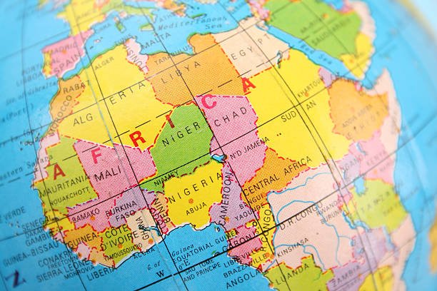
Yes, Africa is significantly larger than the USA. In fact, the continent of Africa is more than three times the size of the United States. This geographical reality often surprises many due to common misconceptions fueled by distorted world maps, particularly the widely used Mercator projection, which visually exaggerates landmasses further from the equator.
Understanding the true scale of continents is crucial for a global perspective. Africa, a colossal continent, encompasses a land area that dwarfs not only the United States but also many other large nations and regions combined. This article will delve into the precise measurements, explore the reasons behind the widespread misunderstanding, and highlight the immense diversity contained within Africa's vast borders.
The Stark Reality: Africa's True Scale
To grasp the true geographical relationship between Africa and the United States, it's essential to look at the raw data: their respective land areas. The numbers clearly illustrate Africa's overwhelming size advantage, putting an end to any debate about whether Africa is bigger than USA.
Comparing Land Area: The Raw Numbers
When measured by total land area, Africa stands as the world's second-largest continent, trailing only Asia. Its landmass is truly enormous, comprising a significant portion of the Earth's surface.
- Africa's Land Area: Approximately 30.37 million square kilometers (11.73 million square miles).
- United States' Land Area: Approximately 9.83 million square kilometers (3.79 million square miles).
A quick calculation reveals that Africa is roughly 3.09 times larger than the United States. To further emphasize this, consider that you could fit the entire landmass of the USA, along with China, India, and a large part of Europe, comfortably within Africa's borders. This comparison highlights the enormous landmass comparison and puts Africa's scale into perspective, clarifying once and for all the question: how big is Africa relative to the USA?
Here's a comparison of land areas for clarity:
| Geographical Entity | Approximate Area (Square Kilometers) | Approximate Area (Square Miles) |
|---|---|---|
| Africa (Continent) | 30,370,000 | 11,730,000 |
| United States (Country) | 9,830,000 | 3,790,000 |
| China (Country) | 9,600,000 | 3,700,000 |
| India (Country) | 3,290,000 | 1,270,000 |
| Western Europe (Region) | ~5,000,000 | ~1,900,000 |
As the table demonstrates, Africa's landmass is truly exceptional. Its geographical size makes it a powerhouse of biodiversity, natural resources, and diverse cultures.
Africa's Internal Vastness: More Than Just a Continent
The sheer scale of Africa is further illustrated by comparing it to individual countries, or even collections of countries. It's not just bigger than the USA; it's astonishingly vast:
- Fitting Countries Inside: You could literally fit the USA, India, China, and much of Europe (like France, Germany, Spain, Italy, and the UK) within the boundaries of Africa, with room to spare.
- Diverse Landscapes: This immense landmass hosts a bewildering array of ecosystems, from the world's largest hot desert (the Sahara) to sprawling savannas, dense rainforests, towering mountain ranges, and extensive coastlines.
- Numerous Nations: Africa is home to 54 recognized countries, each with its unique culture, history, and geography. This stands in stark contrast to the single nation that is the United States, further highlighting the continent's profound scale and diversity.
The vastness implies incredible biological and cultural diversity, making the question of Africa size vs USA even more compelling than a simple numbers game. It's about understanding the true dimensions of our world.
Understanding Map Distortions: Why We Get It Wrong
If the data so clearly shows Africa's massive size, why do so many people mistakenly believe it to be smaller than or comparable to the USA? The answer lies primarily in the maps we've grown up with.
The Impact of the Mercator Projection
The most common culprit for the distorted perception of continental sizes is the Mercator projection. Developed in 1569 by Gerardus Mercator, this map projection was revolutionary for navigation because it allowed sailors to plot a course by drawing a straight line. However, it achieves this by distorting the size of landmasses, especially as they get further away from the equator.
- Exaggerated Poles: On a Mercator map, areas near the poles (like Greenland, Canada, and Russia) appear much larger than they are in reality.
- Shrunken Equator: Conversely, areas near the equator, such as Africa and South America, appear relatively smaller than their true dimensions.
- Visual Misleading: This means that while Greenland might look comparable in size to Africa on a Mercator map, Africa is actually about 14 times larger than Greenland!
The Mercator projection, despite its navigational utility, has inadvertently perpetuated a geographical misconception for centuries, making the true scale of continents seem skewed. It visually diminishes the significance of equatorial regions while inflating the importance of those closer to the poles.
Alternative Map Projections and True Representations
Fortunately, cartographers have developed other map projections that offer a more accurate representation of land area. These alternative projections, while not perfect for all purposes, provide a better visual understanding of the world's true geographical dimensions.
- Gall-Peters Projection: This projection prioritizes accurate land area, making continents like Africa appear much larger and more proportional to their actual size, correcting the distortions of the Mercator.
- Goode Homolosine Projection: Another equal-area projection that minimizes shape distortion while maintaining accurate relative sizes.
By viewing the world through these different lenses, it becomes immediately apparent that Africa is not only bigger than the USA but is an absolutely enormous landmass that dominates a significant portion of the global landscape. This shift in perspective is key to understanding map distortions and their influence on our perception of global geography.
Geographical and Demographic Implications of Africa's Size
Beyond the simple question of is Africa bigger than USA, the sheer scale of the African continent has profound geographical, environmental, and demographic implications that are worth exploring.
Biodiversity and Natural Resources
Africa's vast size directly contributes to its incredible biodiversity. The continent boasts:
- Diverse Biomes: From the arid Sahara to the lush Congo Basin rainforests, the East African savannas, and the temperate Mediterranean climate of the north and south, Africa hosts an unparalleled range of ecosystems.
- Unique Species: This diversity supports a vast array of plant and animal life, many of which are endemic to the continent. Iconic wildlife, from elephants and lions to gorillas and giraffes, are integral to Africa's identity.
- Abundant Resources: The continent is incredibly rich in natural resources, including vast reserves of minerals (diamonds, gold, copper, cobalt), oil and gas, timber, and fertile agricultural land. The sheer area allows for these resources to be distributed across many regions.
The vastness of the land means a greater potential for unique geological formations and ecological niches, leading to this wealth of natural heritage. Understanding the continent size comparison helps appreciate why Africa is such a critical player in global environmental and resource discussions.
Population and Demographics
With its massive land area, Africa also hosts a rapidly growing and incredibly diverse population. As of 2023, Africa's population is estimated to be over 1.4 billion people, making it the second most populous continent after Asia. The United States, by contrast, has a population of approximately 330 million.
Key demographic points include:
- Youthful Population: Africa has the youngest population of any continent, with a significant percentage under the age of 25. This presents both opportunities and challenges for development.
- Linguistic Diversity: The continent is a mosaic of languages, with an estimated 1,500 to 2,000 distinct African languages spoken across its many nations.
- Cultural Richness: Each of the 54 countries contributes to a vibrant tapestry of cultures, traditions, and historical narratives, reflecting the depth and breadth of human experience across such a large landmass.
The confluence of a large land area and a growing, diverse population underscores Africa's profound global significance, challenging any perception of it being a small or homogenous entity. The area of Africa allows for this immense human footprint and cultural sprawl.
The Importance of Accurate Geographical Understanding
Correctly understanding the world's geography, especially the true sizes of landmasses, has implications beyond simply answering trivia questions. It shapes our worldview, influences policy, and impacts our perception of global issues.
Challenging Eurocentric Views
The prevalence of Mercator maps, which visually inflate the Northern Hemisphere and shrink the Southern, has been linked to Eurocentric biases in global perception. By understanding that Africa is indeed much larger than often portrayed, it helps in:
- Rectifying Historical Narratives: It corrects an unconscious bias that might diminish the continent's importance.
- Promoting Equity: A more accurate geographical representation can foster a more balanced and equitable understanding of global power dynamics and cultural significance.
Recognizing the actual area of USA versus the vastness of Africa is a small but significant step in challenging these ingrained perceptions.
Global Development and Cooperation
For international relations, development aid, and climate change initiatives, an accurate understanding of geographical scale is paramount. When policymakers, aid workers, or environmentalists visualize Africa as it truly is – a massive continent with immense resources and a rapidly growing population – it leads to:
- Better Planning: More effective strategies for infrastructure development, resource management, and conservation efforts across its diverse regions.
- Informed Decisions: Policies that are better tailored to the specific needs and vast challenges inherent in managing such a large and varied landmass.
The question Is Africa bigger than USA goes beyond simple curiosity; it touches upon how we perceive global interconnectedness and responsibility.
Conclusion: Africa's Undeniable Immensity
In conclusion, the answer to the question, is Africa bigger than USA, is a resounding and unequivocal yes. Africa is more than three times the size of the United States, a fact clearly demonstrated by objective land area measurements. This geographical reality is often obscured by common map projections, particularly the Mercator, which distorts the true scale of continents, making areas near the equator appear smaller than they are. The vastness of Africa, home to 54 diverse nations, an immense array of ecosystems, abundant natural resources, and over 1.4 billion people, underscores its profound significance on the global stage. Dispelling geographical misconceptions like this is vital for fostering a more accurate and equitable understanding of our interconnected world, appreciating the true dimensions of its continents and the rich diversity they contain.
Enjoyed this read?
Share it with your friends and colleagues.