Did Africa Break Apart

BSC Insights Admin
July 25, 2026
While Africa is not currently experiencing a rapid, catastrophic split, it is indeed undergoing a profound, slow-motion geological process known as rifting, most notably along the East African Rift Valley. This monumental continental separation, driven by the relentless forces of plate tectonics, will eventually lead to parts of the continent breaking away and the formation of a new ocean basin over millions of years.
Understanding Plate Tectonics: The Driving Force Behind Continental Movement
To grasp whether Africa is breaking apart, one must first understand the fundamental concept of plate tectonics. Earth's outermost layer, the lithosphere, is broken into several large and small plates that are constantly in motion, floating atop the semi-fluid asthenosphere. These movements are incredibly slow, typically only a few centimeters per year, but over geological timescales, they result in dramatic changes to Earth's surface, including the formation of mountains, ocean basins, and the rearrangement of continents.
The African continent itself primarily sits on the vast African Plate, which is currently splitting into two main sub-plates: the smaller Somali Plate to the east (encompassing the Horn of Africa) and the larger Nubian Plate to the west. This divergence is the crucial mechanism behind the ongoing continental breakup. At divergent plate boundaries, tectonic plates pull away from each other, causing the Earth's crust to thin, stretch, and eventually fracture. Magma from the mantle rises to fill the gaps, sometimes erupting as volcanoes, and creating new crust. This process is essentially how new ocean floors are born.
Globally, divergent boundaries are responsible for features like the Mid-Atlantic Ridge, where the North American and Eurasian plates are separating, steadily widening the Atlantic Ocean. The process occurring in Africa is similar, representing the early stages of ocean basin formation within a continental landmass.
The East African Rift Valley: Africa's Grand Divorce Line
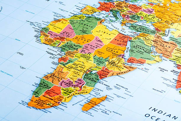
The most compelling evidence and active manifestation of Africa breaking apart is the East African Rift System (EARS). This colossal geological feature stretches approximately 6,500 kilometers (4,000 miles) from the Afar Triple Junction in Ethiopia, through Kenya, Uganda, Rwanda, Burundi, Tanzania, Zambia, and Malawi, eventually reaching Mozambique. It is a classic example of a continental rift, where the crust is being pulled apart.
The EARS is not a single, continuous crack but rather a complex network of valleys, volcanoes, and fault lines. It is broadly divided into two main branches:
- The Eastern Rift Valley: Running through Ethiopia and Kenya, this branch is characterized by significant volcanic activity and narrower, deeper valleys. The Afar Depression, a geological low point where three tectonic plates (the Nubian, Somali, and Arabian plates) meet, is a particularly active and well-studied segment, often considered the heart of Africa's rifting process. Here, the crust is so thin that new oceanic crust is already forming in some areas.
- The Western Rift Valley: This branch forms a series of deep lakes, including Lake Albert, Lake Edward, Lake Kivu, Lake Tanganyika, and Lake Malawi. These lakes are exceptionally deep because they fill basins created by the subsiding land between parallel fault lines. The Western Rift is less volcanically active but experiences frequent seismic tremors.
The process involves the stretching and thinning of the continental lithosphere. As the crust thins, it becomes more brittle, leading to the formation of numerous faults and grabens (down-dropped blocks of land). Magma often exploits these weaknesses, leading to volcanic eruptions. Over time, this continuous stretching and subsidence will lead to the complete rupture of the continent and the inundation of the rift by seawater, forming a new ocean.
Evidence of a Continent in Transition
The geological record and ongoing observations provide abundant evidence that Africa is indeed in a state of transition:
- Distinctive Topography: The rift valley itself is a dramatic landscape of steep escarpments, deep valleys, and towering volcanoes. This unique topography is a direct result of the stretching and faulting of the crust.
- Volcanic Activity: The presence of numerous active and dormant volcanoes along the rift, such as Mount Kilimanjaro, Mount Kenya, and Mount Meru, is a clear indicator of magma rising from below the thinning crust. The volcanic rocks found throughout the rift zone further testify to this igneous activity.
- Seismic Activity: The East African Rift is one of the most seismically active regions on Earth. Frequent, albeit often moderate, earthquakes occur as the continental plates grind and pull apart. These tremors provide measurable data on the ongoing tectonic stresses.
- Fissures and Cracks: In 2018, a prominent fissure stretching for several kilometers suddenly appeared in Kenya's Narok County, causing damage to roads and homes. While often attributed to heavy rainfall exacerbating existing fault lines, such events are stark visual reminders of the underlying tectonic forces at play, revealing how the Earth's surface reacts to deep-seated stresses.
- Unique Lake Systems: The Great Rift Valley lakes are some of the oldest, deepest, and most biodiverse freshwater lakes in the world. Their formation within the rift basins is a direct consequence of the stretching and sinking of the land, providing vital ecosystems and geological archives.
- Heat Flow Anomalies: Scientific measurements indicate abnormally high heat flow beneath the rift valley, suggesting the presence of hot mantle material close to the surface, which is characteristic of active rifting zones.
These pieces of evidence collectively paint a clear picture of a continent being actively reshaped by powerful subterranean forces, demonstrating that the question "Did Africa break apart?" is less about a past event and more about an ongoing process.
The Future of Africa: A New Ocean and a Smaller Continent
The long-term prognosis for the East African Rift is the eventual formation of a new ocean. Scientists predict that over the next 5 to 10 million years, the rifting process will continue, leading to the complete separation of the Somali Plate (which includes Somalia, parts of Ethiopia, Kenya, and Tanzania) from the larger Nubian Plate (the bulk of the African continent). As the two plates diverge further, seawater from the Red Sea and the Gulf of Aden will flood the rift valley, creating a new sea or ocean.
This future scenario will dramatically redraw the map of Africa. The Horn of Africa will become a large island or a new smaller continent. This geological transformation will have profound impacts:
- New Marine Ecosystems: A new ocean basin will lead to the development of unique marine ecosystems, similar to the Red Sea, which itself formed from a rift.
- Altered Coastlines: The formation of new coastlines will drastically change regional geography, influencing climate patterns and human habitation.
- Resource Implications: The creation of new oceanic crust could lead to the formation of new geological resources, including mineral deposits and potential hydrocarbon reserves beneath the new seabed.
It's crucial to understand that these changes unfold on a geological timescale, meaning they are imperceptible within a human lifetime. The "breaking apart" is a continuous, gradual process rather than a sudden cataclysm. The rate of spreading in the East African Rift is currently estimated to be between 2.5 and 5 centimeters per year, comparable to the growth of human fingernails.
Here's a simplified timeline of the projected geological future:
| Timeframe | Projected Geological Event | Impact |
|---|---|---|
| Present Day | Active rifting, thinning crust, volcanism, earthquakes | Deep valleys, fault lines, active volcanoes (e.g., Afar Triangle) |
| 1-5 Million Years | Increased rifting, further crustal thinning, magma intrusion | More pronounced valleys, potential flooding of lowest rift sections by seawater |
| 5-10 Million Years | Complete continental rupture, seawater inundation | Formation of a new narrow sea, separating the Horn of Africa |
| 50+ Million Years | Wider ocean basin, new mid-ocean ridge | Similar to the Red Sea or even the Atlantic Ocean in its infancy |
Is This a Unique Phenomenon? A Global Perspective
The rifting process observed in East Africa is not unique in Earth's history; rather, it is part of the grand cycle of continental drift and supercontinent formation and breakup. Pangea, the last supercontinent, began breaking apart around 175 million years ago, eventually forming the continents we know today, including Africa. The Atlantic Ocean, for instance, is the result of a similar rifting process that separated South America from Africa.
What makes the East African Rift particularly significant is that it is one of the few places on Earth where we can observe the very early stages of a continent splitting apart. Most other active spreading centers are submerged beneath the oceans, like the Mid-Atlantic Ridge. Studying the EARS provides scientists with invaluable insights into how continents fragment and how new ocean basins are initiated, offering a live laboratory for understanding Earth's dynamic geology.
The geological forces at play are a constant, global phenomenon, demonstrating that our planet is anything but static. The current "breaking apart" of Africa is a testament to these continuous, powerful forces that have shaped continents and oceans for billions of years.
Impact on Human Populations and the Environment
While the large-scale geological transformation occurs over vast timescales, the ongoing rifting process does have observable and impactful consequences for human populations and the environment within and around the Rift Valley:
- Seismic Hazards: Regular earthquakes, though typically not catastrophic, pose risks to infrastructure and communities, particularly in densely populated areas. Building codes and disaster preparedness are essential.
- Volcanic Hazards: Active volcanoes present dangers from eruptions, ash fall, and lava flows, affecting agriculture, air travel, and human settlements. Monitoring volcanic activity is crucial for early warning systems.
- Resource Opportunities: The geological processes associated with rifting also create opportunities. The high heat flow in the rift zone makes it ideal for geothermal energy production, a clean and renewable power source. Countries like Kenya are already harnessing this potential significantly. Furthermore, the rift valleys are rich in certain mineral deposits, and the deep lakes support unique fisheries.
- Agricultural Fertility: Volcanic soils, over time, become incredibly fertile due to their mineral content, supporting productive agriculture in many parts of the rift region.
- Hydrological Changes: The formation of new lakes and changes in river courses can impact water availability, irrigation, and local ecosystems, requiring adaptive management strategies.
Understanding these dynamics is vital for sustainable development and resilience in the communities living along this active geological frontier. The slow nature of the rifting allows for adaptation, but careful planning remains essential.
In conclusion, the question "Did Africa break apart?" is best answered by recognizing that Africa is in the midst of a slow, but undeniable, geological divorce. The majestic East African Rift Valley stands as the most prominent testament to this ongoing process, where the African continent is gradually stretching, thinning, and fracturing. Driven by the powerful forces of plate tectonics, this separation will eventually lead to the formation of a new ocean basin, transforming the geography of East Africa over millions of years. While imperceptible in our lifetimes, this continuous continental drift highlights the dynamic and ever-changing nature of our planet.
Enjoyed this read?
Share it with your friends and colleagues.