Did Africa Used To Be Connected To South America

BSC Insights Admin
October 01, 2026
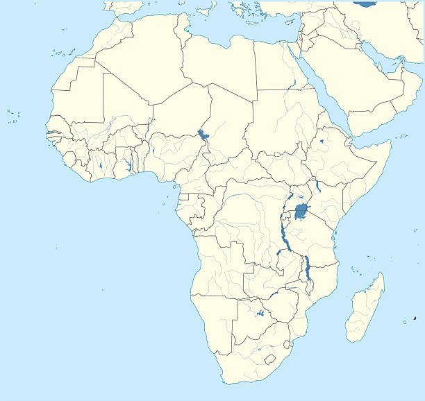
Did Africa Used To Be Connected To South America?
Yes, Africa and South America were indeed once connected, forming part of ancient supercontinents long before the continents assumed their current positions. This astounding geological fact is a cornerstone of modern Earth science, explained by the theory of plate tectonics and supported by a wealth of compelling evidence gathered over centuries. The striking jigsaw-puzzle fit of their coastlines was an initial clue, but it was the subsequent discovery of matching geological formations, identical fossil records, and paleoclimatic indicators that cemented our understanding of this profound continental connection and subsequent separation.
The journey of these landmasses from a unified whole to distinct continents separated by the vast Atlantic Ocean is a testament to the dynamic nature of our planet. Understanding how Africa and South America were once connected unravels the epic story of continental drift, seafloor spreading, and the constant reshaping of Earth's surface.
The Astonishing "Fit" – A Visual Clue
One of the most immediate and visually striking pieces of evidence suggesting that Africa and South America were once joined is the remarkable way their coastlines appear to fit together. If you look at a world map, the bulge of Brazil on South America's eastern coast seems to nestle almost perfectly into the concave bend of West Africa's western coast. This visual congruence, often described as a jigsaw puzzle fit, sparked curiosity among cartographers and scientists for centuries.
Early Observations and the Puzzle
As early as the 16th century, cartographers like Abraham Ortelius noted the apparent fit between the continents. Francis Bacon also commented on it in 1620. However, these early observations were just that – observations. They lacked a scientific explanation for how such massive landmasses could move. The prevailing scientific view was that continents and oceans were largely static features of Earth's surface, making the idea of moving continents seem impossible.
Alfred Wegener and Continental Drift
It wasn't until the early 20th century that a comprehensive hypothesis emerged. In 1912, German meteorologist and geophysicist Alfred Wegener proposed his groundbreaking theory of continental drift. Wegener was captivated by the similarities between the continents, not just their shapes but also the distribution of ancient fossils and rock types. He hypothesized that all the continents had once been joined together in a single enormous landmass, which he named Pangaea (meaning "all land"). Over millions of years, he suggested, this supercontinent broke apart, and the resulting landmasses slowly "drifted" to their current positions. While Wegener's initial mechanism for continental movement (centrifugal force and tidal forces) was incorrect, his concept of moving continents laid the essential groundwork for what would later become the robust theory of plate tectonics.
Unearthing the Evidence: More Than Just a Fit
Wegener's bold hypothesis was initially met with skepticism because he couldn't adequately explain *how* continents could move. However, he meticulously compiled a formidable array of evidence beyond the mere fit of the continents. This evidence, which still stands today, provides undeniable proof of the ancient connection between Africa and South America.
Geological Similarities Across Continents
One of the most powerful lines of evidence comes from the study of geological formations and rock types. If Africa and South America were once connected, their ancient geological structures should match up when the continents are "reassembled." And they do:
- Mountain Ranges: Ancient mountain belts and rock units of similar age and composition are found on both sides of the Atlantic. For instance, the Appalachian Mountains in eastern North America, the Caledonian Mountains in Scotland and Scandinavia, and parts of the Atlas Mountains in northwestern Africa all show similar age and structure, suggesting they were once part of a continuous chain. More directly relevant to our question, ancient rock formations in Brazil, such as the São Francisco Craton, have direct geological counterparts in the West African Craton.
- Mineral Deposits: Significant mineral deposits, including diamonds and gold, are found in identical ancient geological settings in both Brazil and West Africa. The diamond-bearing kimberlite pipes of South Africa, for example, have counterparts in the kimberlite fields of Brazil, formed under similar conditions when the continents were juxtaposed.
- Igneous and Metamorphic Rocks: Radiometric dating of certain igneous and metamorphic rocks on the coasts of Brazil and West Africa reveals they are of the same age and display similar patterns of deformation, indicating they were formed under the same geological stresses within a continuous landmass.
Fossil Records: Shared Ancient Life
Perhaps the most compelling biological evidence for the connection comes from the distribution of ancient fossils. If continents were separate, distinct species would evolve independently. However, if they were once joined, we would expect to find the same land-based species' fossils on now-separated continents, especially those incapable of crossing vast oceans. This is precisely what scientists have found:
- Mesosaurus: This small freshwater reptile lived about 280 million years ago. Its fossils are found exclusively in Permian-age rocks in southern Africa and eastern South America. As a freshwater creature, the Mesosaurus could not have swum across the vast salty Atlantic Ocean. Its presence on both continents is strong evidence they were once linked.
- Lystrosaurus: A land-dwelling, herbivorous reptile from the Triassic period (~250 million years ago), Lystrosaurus fossils have been found in Antarctica, India, and South Africa. While not directly linking Africa and South America, its distribution is powerful evidence for the supercontinent Gondwana, of which both Africa and South America were parts.
- Glossopteris Flora: This distinctive fern plant with tongue-shaped leaves thrived during the Permian period. Fossils of the Glossopteris flora are found across South America, Africa, Antarctica, India, and Australia. Its heavy seeds were not adapted for long-distance wind or ocean dispersal, meaning the landmasses must have been connected for its widespread distribution.
Paleoclimate Indicators
Further support comes from paleoclimatology – the study of ancient climates. Evidence of past climates, such as glacial deposits, also paints a clear picture of a unified southern supercontinent:
- Glacial Striations: Extensive evidence of ancient glaciation (ice sheets) from approximately 300 million years ago is found in tropical regions of South America (e.g., Brazil), Africa (e.g., South Africa), India, Australia, and Antarctica. If these continents were in their current positions, they would have been in very different climatic zones, making simultaneous tropical glaciation impossible. However, when reassembled into Gondwana, these regions align perfectly around a south polar ice cap, explaining the widespread glacial deposits and distinctive rock scratches (striations) left by moving glaciers.
- Coal Deposits: The presence of large coal deposits in cold, northern latitudes today (like parts of North America and Europe) indicates these areas were once located in warmer, tropical climates necessary for the formation of extensive swamp forests. While not directly linking Africa and South America, this is another powerful example of how paleoclimate evidence supports continental drift.
From Continental Drift to Plate Tectonics
While Wegener provided compelling evidence for *what* happened, the scientific community struggled with *how* it happened. The breakthrough came in the mid-20th century with the development of the theory of plate tectonics, which provided the mechanism for continental movement. Plate tectonics explains that Earth's outermost layer, the lithosphere, is broken into several large and small rigid slabs called tectonic plates. These plates are constantly, albeit slowly, moving relative to one another.
How Plates Move: Convection Currents
The driving force behind plate movement is believed to be convection currents in the Earth's semi-molten mantle. Hot, less dense material from the deep mantle rises towards the surface, spreads out, cools, and then sinks back down, creating a slow but powerful circulating motion. This movement drags the overlying tectonic plates along, causing them to collide, pull apart, or slide past each other.
Types of Plate Boundaries
The interactions between plates occur at their boundaries, which are classified into three main types:
- Divergent Boundaries: Where plates move apart. This is where new crust is generated, often seen as mid-ocean ridges.
- Convergent Boundaries: Where plates move toward each other, resulting in subduction (one plate sliding under another) or continental collisions, forming mountain ranges.
- Transform Boundaries: Where plates slide horizontally past each other.
The separation of Africa and South America is a classic example of a divergent plate boundary.
The Mid-Atlantic Ridge: A Spreading Center
The key to understanding the separation of Africa and South America lies in the Mid-Atlantic Ridge. This massive underwater mountain range runs down the center of the Atlantic Ocean, from the Arctic to the southern tip of Africa. It is a divergent plate boundary where the North American and Eurasian plates are pulling apart in the north, and the South American and African plates are pulling apart in the south. Magma rises from the mantle, solidifies, and forms new oceanic crust, which then spreads outwards from the ridge. This process, known as seafloor spreading, continuously widens the Atlantic Ocean, pushing Africa and South America further apart at an average rate of a few centimeters per year – roughly the same speed your fingernails grow.
Evidence for seafloor spreading includes:
- Magnetic Striping: Symmetric patterns of magnetic reversals in the oceanic crust on either side of the Mid-Atlantic Ridge.
- Age of Ocean Floor: The youngest rocks are found closest to the ridge, and rocks become progressively older with increasing distance from the ridge.
- Heat Flow: Higher heat flow is observed along the ridge axis.
These pieces of evidence conclusively demonstrate that the Atlantic Ocean is actively opening, confirming the mechanism by which Africa and South America separated.
A Journey Through Supercontinents: Pangaea and Gondwana
The connection between Africa and South America wasn't an isolated event; it was part of a larger geological cycle involving the assembly and breakup of supercontinents. This supercontinent cycle has dramatically reshaped Earth's surface over billions of years.
Pangaea: The Ultimate Supercontinent
About 335 million years ago, during the late Paleozoic and early Mesozoic eras, all of Earth's major landmasses converged to form the immense supercontinent known as Pangaea. This colossal landmass stretched from pole to pole and dramatically influenced global climate and the evolution of life. Africa and South America were integral parts of Pangaea.
Gondwana: The Southern Giant
Pangaea began to break apart around 175 million years ago. The first major split divided Pangaea into two large supercontinents: Laurasia in the north (comprising what would become North America, Europe, and Asia) and Gondwana in the south. Gondwana was itself a vast supercontinent that included what are now South America, Africa, Antarctica, Australia, and the Indian subcontinent. It existed for hundreds of millions of years, from about 550 to 180 million years ago, before its final fragmentation.
The Breakup of Gondwana and the Birth of the South Atlantic
The final separation of Africa and South America occurred as part of the breakup of Gondwana. This process began during the Jurassic period, around 180 million years ago, but the significant rifting and formation of the South Atlantic Ocean began around 140 million years ago. The table below illustrates the approximate timeline of key events in the separation:
| Approximate Time (Million Years Ago) | Event |
|---|---|
| 335 | Formation of the supercontinent Pangaea. |
| 180 | Pangaea begins to rift, separating into Laurasia (North) and Gondwana (South). |
| 140 | Initial rifting between Africa and South America, marking the embryonic stage of the South Atlantic Ocean. |
| 100 | Significant widening of the South Atlantic Ocean; continents visibly separate. |
| 65 to Present | Continued seafloor spreading, shaping the Atlantic to its current width; Africa and South America continue to drift apart. |
As the landmasses pulled apart, magma from the mantle rose to fill the void, creating new oceanic crust at the spreading center – the nascent Mid-Atlantic Ridge. Over tens of millions of years, the South Atlantic grew from a narrow rift valley into the expansive ocean we know today, forever altering the geography of our planet.
Impact and Significance Today
The ancient connection and subsequent separation of Africa and South America have had profound and lasting impacts on Earth's geology, biology, and climate. Understanding this process is crucial for various scientific disciplines.
Shaping Earth's Geography and Climate
The opening of the Atlantic Ocean dramatically changed global oceanic circulation patterns and, consequently, climate. The formation of new ocean basins and mountain ranges influenced wind patterns, rainfall distribution, and temperature regimes, contributing to the diversity of climates we observe today. The presence of a vast ocean between two large landmasses significantly affects global heat distribution and atmospheric moisture transport.
Resource Distribution
The theory of plate tectonics, born from the concept of continental drift, has significant practical applications. It helps explain the distribution of natural resources, such as oil, gas, and various mineral deposits. For instance, the identical geological structures containing diamond and gold in Brazil and West Africa are a direct consequence of their shared geological past. Understanding plate movements helps in identifying potential areas for resource exploration.
Biodiversity Patterns
The separation of continents acted as a powerful evolutionary force. When landmasses were connected, species could migrate freely. Once separated by oceans, populations became isolated, leading to allopatric speciation and the evolution of unique flora and fauna on each continent. This explains why we see distinct biodiversity on Africa and South America today, despite their shared ancient heritage.
Conclusion
In conclusion, the answer to the question "Did Africa used to be connected to South America?" is an emphatic yes. The scientific evidence is overwhelming and multifaceted, encompassing the striking geometric fit of their coastlines, matching ancient geological formations and mineral deposits, identical fossil records of land-based species, and compelling paleoclimatic indicators like glacial striations. These lines of evidence, initially championed by Alfred Wegener's theory of continental drift, are now comprehensively explained by the modern theory of plate tectonics. The slow but relentless movement of Earth's tectonic plates, driven by mantle convection, caused the supercontinent Gondwana to rift apart, giving birth to the Mid-Atlantic Ridge and gradually widening the Atlantic Ocean, thus separating Africa and South America. This grand geological narrative not only reshaped our planet's physical geography but also profoundly influenced its climate, biodiversity, and the distribution of its precious natural resources, continuously reminding us of Earth's dynamic and ever-evolving nature.
Enjoyed this read?
Share it with your friends and colleagues.