Which Country In Africa Is The Farthest South

BSC Insights Admin
October 01, 2026
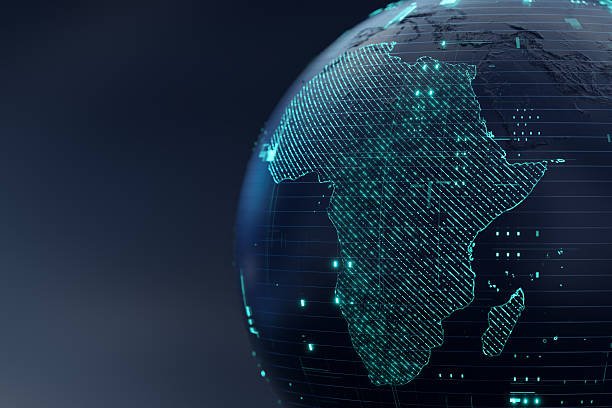
South Africa is recognized globally as the country in Africa farthest south because its mainland territory extends significantly toward the Southern Ocean. While many people mistakenly believe the Cape of Good Hope is the absolute southern tip, that honor actually belongs to Cape Agulhas which sits at approximately 34.8 degrees south latitude. This geographical positioning makes South Africa a critical maritime hub and a unique ecological zone where two massive oceans meet in a spectacular display of natural power.
The vast southern reaches of the African continent are defined by dramatic coastlines and diverse climates that range from arid deserts to lush, temperate forests. Understanding the geography of this region requires a look at not only the mainland borders but also the offshore territories that define the southern limits of the continent.
These are the Countries In Africa That are Farthest South
When exploring the southern reaches of the continent, it is clear that one nation holds the title, but several others share the southern regional characteristics that define the tip of Africa. These nations are part of the Southern African Development Community and share a unique proximity to the Antarctic circle, which influences their weather patterns, biodiversity, and maritime economies. Each country listed here contributes to the unique geographical profile of the southern part of the continent, with some being entirely landlocked and others possessing extensive coastlines that face the sub-Antarctic waters. Here is a detailed look at the nations that occupy the southernmost tier of the African landmass.
1. South Africa
South Africa is the definitive African country which is the farthest south, occupying the southern tip of the continent with a landmass that stretches from the Orange River in the north to the rocky shores of Cape Agulhas. Cape Agulhas is the official geographical southern tip of Africa and the dividing point between the Atlantic and Indian Oceans, located about 170 kilometers southeast of Cape Town. Beyond the mainland, South Africa also governs the Prince Edward Islands, which are located much further south in the sub-Antarctic region at nearly 47 degrees south latitude, technically making the nation extend even closer to Antarctica than any other African state. The country's southern position gives it a Mediterranean climate in the Western Cape, which is perfect for the world-renowned wine industry that thrives in the valleys of Stellenbosch and Paarl. Visitors to the southernmost point often stand at the stone monument in Agulhas to witness the turbulent waters where the warm Agulhas Current meets the cold Benguela Current, creating one of the most productive but dangerous shipping lanes in the world.
2. Lesotho
Lesotho is a unique country in Africa farthest south in terms of being an enclaved nation entirely surrounded by the southernmost country, South Africa. It is often called the Kingdom in the Sky because its entire territory lies above 1,000 meters in elevation, making it the highest country in the world by average altitude. Because it is situated in the southeastern interior of South Africa, it shares the southern latitude of the KwaZulu-Natal and Eastern Cape provinces, placing it firmly within the southern tier of the continent. The high altitude means that Lesotho experiences some of the coldest temperatures in Africa, with snow being a regular occurrence in the Maloti Mountains during the winter months of June and July. This extreme southern elevation creates a unique alpine environment that is vastly different from the tropical images many people have of the African continent. Its southern location and mountainous terrain make it a vital water tower for the region, providing essential water resources to the industrial heartland of South Africa through the Highlands Water Project.
3. Eswatini
Eswatini, formerly known as Swaziland, is another African country which is the farthest south in the sense of its regional placement between South Africa and Mozambique. While it does not reach as far south as the Cape, it is located at a latitude that places it in the sub-tropical southern zone of the continent. The nation is characterized by diverse landscapes, from the cool highveld in the west to the lowveld in the east, all influenced by the southern maritime winds coming off the Indian Ocean. Its proximity to the southern coast of Africa means that its climate and ecology are closely tied to the regional patterns of the Southern African plateau. The kingdom maintains strong traditional ties and a unique monarchical system that has survived in the southern part of the continent for centuries. For travelers, its southern position makes it an easy addition to a tour of South Africa's Kruger National Park or the KwaZulu-Natal coastline.
4. Namibia
Namibia is one of the countries in Africa that are the farthest south along the Atlantic coast, with its southern border defined by the Orange River which it shares with South Africa. The southern part of Namibia is home to the Fish River Canyon, the second largest canyon in the world, and the vast, arid landscapes of the Namib Desert. This region is sparsely populated but contains significant mineral wealth, particularly diamonds, which are found along the southern coastline and the mouth of the Orange River. The cold Benguela Current flows north along Namibia's southern coast, creating the foggy conditions that have led to many shipwrecks along the Skeleton Coast further north. The town of Luderitz in the south is a testament to the German colonial influence in this southern corner of Africa, featuring architecture that looks more at home in Bavaria than in a desert. Namibia’s southern geography is essential for the region’s biodiversity, providing a habitat for desert-adapted elephants and lions that roam the southern reaches of the Kunene region.
5. Botswana
Botswana is a landlocked nation that occupies the heart of the southern African plateau, making it a prominent country in Africa farthest south among the interior states. Much of the southern part of Botswana is covered by the Kalahari Desert, a vast sandy basin that spans across several southern African borders. While it does not have a coastline, its southern districts share a border with the North West and Northern Cape provinces of South Africa, placing it squarely in the southern half of the continent. Botswana is famous for its commitment to conservation, particularly in the Okavango Delta and the Chobe National Park, which are located further north but are sustained by the regional southern climate patterns. The capital, Gaborone, is located in the southeast, very close to the South African border, emphasizing the country's southern orientation and its economic integration with the southern tip of the continent. The country’s stability and wealth from diamond mining have made it a leader in the southern African region.
6. Zimbabwe
Zimbabwe is a key member of the African countries that are farthest south, located between the Zambezi and Limpopo rivers. Its southern border is defined by the Limpopo River, which separates it from South Africa, placing the southern provinces of Matabeleland South and Masvingo in the lower reaches of the continent. This southern positioning means that Zimbabwe shares many ecological characteristics with its neighbors, including the mopane woodlands and the iconic baobab trees that dot the southern landscape. The Great Zimbabwe ruins, located in the southern part of the country, provide evidence of a sophisticated civilization that dominated the southern African interior centuries ago. The southern region of Zimbabwe is also known for its cattle ranching and its proximity to the Beitbridge border post, which is the busiest inland port in southern Africa. Despite being landlocked, Zimbabwe’s southern geography allows it to serve as a vital transit corridor for goods moving between the South African ports and the central African interior.
7. Mozambique
Mozambique is a coastal nation that extends far into the southern Indian Ocean, with its southern tip reaching latitudes that compete with the northern parts of South Africa. As one of the countries in Africa that are the farthest south on the eastern side, Mozambique has a coastline that stretches over 2,500 kilometers, terminating at the border with the KwaZulu-Natal province. The southern part of Mozambique, particularly the area around the capital Maputo, is a popular destination for tourists from the southern African region who come to enjoy the warm waters and coral reefs. The Bazaruto Archipelago and the Vilanculos region represent the beautiful southern maritime environments that are influenced by the warm Agulhas Current. Mozambique's southern ports are crucial for the landlocked southern neighbors like Zimbabwe and Eswatini, providing them with access to global trade routes. The cultural blend of Portuguese and African influences is particularly strong in the southern coastal towns, where seafood and music define the local atmosphere.
8. Madagascar
Madagascar is the largest island in Africa and its southern tip, Cape Saint Mary, is one of the southernmost points of the entire African continent. Because it is an island nation, it is often overlooked when discussing which country that is the farthest south in Africa, but its southern latitudes are nearly identical to those of the South African mainland. The southern region of Madagascar is characterized by a unique spiny forest ecosystem, which is home to many species of lemurs and plants found nowhere else on Earth. The climate in the south is much more arid than the tropical north, reflecting the same latitudinal changes seen on the mainland continent. Toliara, a major city in the south, serves as a hub for exploring the vast coral reefs and the unique biodiversity of the southern plains. Madagascar’s isolation from the mainland has allowed it to develop a distinct evolutionary history, making its southern tip a place of immense scientific and ecological importance.
9. Mauritius
Mauritius is an island nation located in the Indian Ocean, east of Madagascar, and it is situated at a southern latitude that makes it a significant part of the southern African region. While it is much smaller than the mainland countries, its position at approximately 20 degrees south latitude places it firmly within the southern tier of the continent's sphere of influence. Mauritius is known for its high standard of living and its stable democracy, often serving as a model for other African countries that are farthest south. The island’s volcanic origin has created a dramatic landscape of mountains and lagoons that are protected by a massive coral reef system. Because of its southern position, it enjoys a tropical climate that is tempered by the southeast trade winds, making it a year-round destination for travelers. The nation’s history as a stopping point for sailors traveling around the Cape of Good Hope links its story inextricably to the geography of the southern tip of Africa.
10. Zambia
Zambia is often considered the gateway between central and southern Africa, but its southern half is deeply integrated into the southern African geographical and economic block. The southern border of Zambia is formed by the Zambezi River, which includes the magnificent Victoria Falls, one of the seven natural wonders of the world. As a country in Africa farthest south among the central nations, Zambia’s Southern Province is a major agricultural hub, producing much of the country’s maize and livestock. The city of Livingstone, named after the famous explorer, serves as a historical and tourism capital in the south, drawing people from all over the world to witness the power of the Zambezi. Zambia's southern location also makes it a key player in the management of the region's hydroelectric power, with the Kariba Dam providing electricity to several southern African nations. Its southern borders are essential for the movement of goods through the North-South Corridor, linking the copper mines to the southern ports.
Reasons Why These Countries Are Positioned Farthest South in Africa
1. Geological History and Plate Tectonics: The current position of the country in Africa farthest south is the result of millions of years of continental drift. Africa was once a central part of the supercontinent Gondwana, and as it broke away from Antarctica and South America, the southern tip of the continent was formed. This geological separation created the rugged coastline and the high-altitude plateaus that characterize countries like South Africa and Lesotho today. The massive Cape Fold Mountains are a direct result of these ancient tectonic forces that pushed the land upward at the southern extremity.
2. The Influence of the Southern Ocean: The proximity of the Southern Ocean plays a massive role in why these countries are geographically and ecologically distinct. Because South Africa is the African country which is the farthest south, it is the first landmass to be hit by the cold, nutrient-rich waters coming from the Antarctic. This maritime influence creates the unique climates found in the southern tier, such as the winter rainfall region of the Western Cape. Without this proximity to the cold southern waters, the biodiversity and agricultural productivity of the southern tip would be completely different.
3. Continental Tapering: One of the main reasons why only a few nations are considered the farthest south is the natural shape of the African continent, which tapers significantly as it moves away from the equator. This narrowing of the landmass means that the countries in Africa that are the farthest south have less land area at their southern extremities compared to the vast expanses of the northern and central regions. This tapering effect funnels the climate and wildlife into a smaller, more concentrated area, leading to high levels of endemism in the southern provinces. The shape also influences the ocean currents, forcing the Agulhas Current to turn back on itself in a process known as retroflection.
4. Historical Colonial Border Delineation: The borders of the country in Africa farthest south were largely defined during the colonial era, particularly by the British and the Dutch. These colonial powers were focused on securing the strategic maritime route around the Cape, which led to the consolidation of the territories that now make up South Africa. The borders with neighbors like Namibia (Orange River) and Zimbabwe (Limpopo River) were established using natural landmarks, which solidified the southern reach of these nations. These political boundaries have remained largely unchanged since independence, maintaining the geographical status of these southern states.
5. Sub-Antarctic Territorial Claims: A major reason why South Africa is scientifically considered the farthest south is its possession of offshore islands. Many people do not realize that South Africa is one of the few nations in the world to manage sub-Antarctic territories like Marion Island and Prince Edward Island. These islands are essential for meteorological research and the study of global climate change, extending the nation's reach thousands of kilometers south of the mainland. These territories provide South Africa with a massive Exclusive Economic Zone in the southern waters, which is vital for fisheries and maritime security.
6. Climate and Wind Patterns: The southern position of these countries is reinforced by the global wind belts, specifically the "Roaring Forties" which occur between 40 and 50 degrees south latitude. While the African mainland doesn't reach the 40s, it is close enough to be significantly impacted by these powerful westerly winds. This creates a high-energy coastline and determines the rainfall patterns for the African countries that are farthest south. The interaction between these winds and the mountainous terrain of the southern tip creates the various microclimates that allow for everything from desert succulent biomes to lush afro-montane forests.
Conclusion
In conclusion, while South Africa is the primary country in Africa farthest south, its identity is shared with a group of neighbors that define the southern reaches of the continent. From the snowy peaks of Lesotho to the arid dunes of Namibia and the tropical shores of Mozambique, the southern tip of Africa is a region of immense geographical diversity. The absolute southern point at Cape Agulhas serves as a symbolic and literal meeting place of oceans, reflecting the continent's complex geological and maritime history. Whether considering the mainland coordinates or the sub-Antarctic islands, the southern tier of Africa remains one of the most strategically important and naturally beautiful regions in the world. Understanding this geography helps us appreciate the unique role these nations play in the global environment and the international economy.
Enjoyed this read?
Share it with your friends and colleagues.