Is Africa Flat

BSC Insights Admin
July 01, 2026
Is Africa Flat? Unveiling the Continent's Diverse Topography
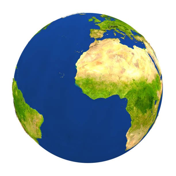
The notion that Africa is flat is a widespread misconception that couldn't be further from the truth. Far from being a uniform, level landmass, Africa boasts an incredibly rich and varied topography, featuring some of the world's most dramatic mountain ranges, vast deserts, expansive plateaus, deep rift valleys, and intricate river systems. Its geological history has sculpted a continent of breathtaking contrasts, making it one of the most geographically diverse regions on Earth.
Understanding Africa's topography reveals a complex tapestry of elevations and depressions, shaping its climates, ecosystems, and human history. From the snow-capped peaks of its highest mountains to the scorching plains of its deserts and the lush depths of its river basins, the continent offers a spectrum of landscapes that continuously challenge and redefine any simplistic portrayal.
Debunking the Myth: Why Africa is Not Flat
The idea that Africa is flat might stem from the continent's extensive savanna grasslands or the relatively stable ancient continental shield that forms its core. However, this stability has been punctuated by billions of years of geological activity, including volcanism, uplifting, and tectonic plate movements, all contributing to a profoundly varied surface. The sheer scale of Africa, being the second-largest continent, means that a singular description of its landscape is inherently inadequate. It is a land of extremes and spectacular natural wonders, defying any notion of flatness.
Exploring the continent's major geographical features quickly dispels any such myth. Africa's landscape is a testament to powerful geological forces, resulting in an array of formations that are unique and globally significant. When considering Africa's diverse geography, it becomes clear that its true character lies in its multifaceted terrain.
The Majestic Mountain Ranges of Africa
Africa is home to several formidable mountain ranges and isolated peaks that punctuate its vast landscape, offering stunning vistas and unique ecosystems. These ranges are critical components of Africa's varied topography.
Kilimanjaro: Africa's Rooftop
Mount Kilimanjaro, located in Tanzania, is not only Africa's highest peak but also the world's tallest freestanding mountain. Rising to an impressive 5,895 meters (19,341 feet) above sea level, this dormant stratovolcano showcases distinct climatic zones, from rainforest to alpine desert, culminating in a glacial summit. Its sheer elevation and iconic snow cap make it a prominent symbol of African mountain landscapes.
Mount Kenya: An Iconic Eastern Peak
As the second-highest mountain in Africa, Mount Kenya reaches 5,199 meters (17,057 feet). This ancient stratovolcano is characterized by its rugged, glacier-clad peaks and unique afro-alpine vegetation. Located in central Kenya, it is a UNESCO World Heritage site, renowned for its ecological importance and stunning beauty, further proving Africa's mountainous terrain.
The Atlas Mountains: North African Barrier
Stretching over 2,500 kilometers (1,600 miles) across Morocco, Algeria, and Tunisia, the Atlas Mountains form a significant natural barrier between the Mediterranean and Atlantic coasts and the vast Sahara Desert. Peaks like Toubkal in Morocco exceed 4,000 meters (13,000 feet). These mountains profoundly influence regional climates, creating fertile valleys on one side and arid conditions on the other, demonstrating the diverse African landscape features.
The Drakensberg Mountains: Southern Grandeur
In Southern Africa, the Drakensberg Mountains (meaning "Dragon's Mountains") present a spectacular escarpment forming the border between Lesotho and South Africa. Characterized by basalt cliffs, deep valleys, and rolling foothills, its highest point, Thabana Ntlenyana, reaches 3,482 meters (11,424 feet). This range is celebrated for its unique biodiversity and San rock art, highlighting the rugged beauty found within Africa's diverse geography.
Other Significant Highlands
Beyond these prominent ranges, Africa hosts other significant highland regions, such as the Ethiopian Highlands, often called the "Roof of Africa" due to their vast area of high altitude. Peaks here, like Ras Dashen, exceed 4,500 meters (14,800 feet), creating unique Afro-alpine ecosystems and influencing the source of the Blue Nile. The Ruwenzori Mountains, also known as the "Mountains of the Moon," on the border of Uganda and the Democratic Republic of Congo, are another example, with glacier-capped peaks and rich biodiversity, adding to the complexity of Africa's physical features.
The Great Rift Valley: A Geological Marvel
Perhaps one of the most defining and dramatic geological features of Africa is the Great Rift Valley. This colossal geological trench, stretching approximately 6,500 kilometers (4,000 miles) from the Middle East down to Mozambique, is a testament to the ongoing tectonic forces tearing the African continent apart. It is a region of immense geological activity, characterized by:
- Volcanoes: Many active and dormant volcanoes line the rift, including Mount Nyiragongo and Mount Oldoinyo Lengai.
- Deep Lakes: The rift valley cradles some of the world's deepest and longest freshwater lakes, such as Lake Tanganyika (the world's second deepest) and Lake Malawi. These lakes are biodiversity hotspots, rich in endemic fish species.
- Escarpments and Plateaus: Steep fault lines create dramatic escarpments, while adjacent uplifted blocks form high plateaus.
The Great Rift Valley is not only a spectacular landscape but also a crucial site for understanding human evolution, with numerous fossil discoveries linked to early hominids. Its existence unequivocally disproves any argument that Africa is a flat continent, showcasing deep depressions and towering adjacent landforms.
Vast Deserts and Arid Lands
While often associated with heat and sand, Africa's deserts are far from flat and are critical components of its diverse topography, contributing significantly to African landscape diversity.
The Sahara Desert: The World's Largest Hot Desert
Covering nearly 9.2 million square kilometers (3.6 million square miles) – almost the size of China or the United States – the Sahara Desert is not just endless sand dunes. It features vast stretches of rocky hamadas (stone plateaus), ergs (sand seas with towering dunes that can reach hundreds of meters high), wadis (dry riverbeds), and isolated mountain ranges like the Hoggar and Tibesti Massifs, which rise over 3,000 meters (10,000 feet). This immense diversity within what is often perceived as a monolithic desert highlights the complexity of Africa's landforms.
The Kalahari Desert: A Semi-Arid Landscape
Located in Southern Africa, the Kalahari Desert is a large semi-arid sandy savanna. While not a true desert in all areas due to higher rainfall, it features extensive red sand dunes and unique pans (ephemeral lakes). Its topography includes gentle undulations and vast open spaces, supporting specialized wildlife adapted to its harsh but beautiful environment, adding another layer to Africa's varied terrain.
The Namib Desert: Ancient Coastal Desert
Stretching along the Atlantic coast of Namibia, the Namib Desert is considered the world's oldest desert. It is famous for its towering red sand dunes, some of the highest in the world, which dramatically meet the ocean. The desert's unique coastal fogs support an array of endemic flora and fauna. Its dramatic changes in elevation and distinct geological formations firmly establish it as a non-flat landscape, a testament to Africa's diverse environments.
Expansive Plateaus and Basins
A significant portion of Africa's interior is dominated by high plateaus and vast basins. The continent as a whole can be seen as a massive plateau, gradually rising from west to east and south. This general uplift has created an average elevation much higher than other continents, contributing to Africa's unique character. When discussing Africa's elevations, the prevalence of plateaus is a key point.
- High Plateaus: Much of East and Southern Africa consists of high plateaus, such as the Central African Plateau and the Southern African Plateau, with average elevations often exceeding 1,000 meters (3,300 feet). These plateaus are often dissected by river valleys and adorned with inselbergs (isolated rock hills).
- River Basins: Contrasting with the plateaus are extensive low-lying basins, most notably the Congo Basin, which is the second-largest rainforest basin in the world. These basins are carved out by major river systems and represent significant depressions within the continent's overall elevation. The Chad Basin is another example of a large, internal drainage basin.
These large-scale features—uplifted plateaus and sunken basins—are fundamental to understanding Africa's physical geography and underscore its non-flat nature.
River Systems and Lakes: Carving the Landscape
Africa's intricate network of rivers and lakes has played a crucial role in shaping its topography, eroding canyons, depositing sediment, and creating fertile plains. These waterways are integral to Africa's diverse landforms.
The Nile River: Lifeline of Northeast Africa
The Nile River, often cited as the longest river in the world, flows over 6,650 kilometers (4,132 miles) through eleven countries before emptying into the Mediterranean Sea. Its journey involves navigating through cataracts, vast floodplains, and delta regions, illustrating how a river can traverse and shape a complex topography. The Nile's impact on human civilization and the formation of the fertile Nile Delta is a prime example of water's role in creating distinctive African landscapes.
The Congo River: Africa's Second Longest
With an estimated length of 4,700 kilometers (2,920 miles), the Congo River is Africa's second-longest and the world's deepest river, with the second-largest discharge volume after the Amazon. Its basin is home to the world's second-largest rainforest. The river features numerous rapids and cataracts, especially as it descends from the high plateaus to the Atlantic Ocean, showcasing significant drops in elevation and complex riverine topography. This demonstrates the powerful erosional and depositional forces at play in Africa's geography.
Other Major Rivers and Lakes
Other vital rivers like the Niger River (forming a vast inland delta), the Zambezi River (famous for Victoria Falls, one of the world's largest waterfalls), and the Orange River contribute to the continent's hydrological and topographical diversity. Africa is also home to vast lakes, including Lake Victoria (the largest lake in Africa by area, and the source of the White Nile), Lake Tanganyika, and Lake Malawi. These large water bodies occupy significant depressions and influence local climates and ecosystems, reinforcing the fact that Africa is not a flat landmass.
Coastal Features and Islands
Africa's coastline, while often perceived as relatively straight, also exhibits significant diversity. From the dramatic cliffs of South Africa to the sandy beaches of East Africa, the mangrove-lined deltas of West Africa, and the coral reefs of the Red Sea, the continent's periphery is anything but monotonous. The island nations associated with Africa, such as Madagascar (the world's fourth-largest island, with its own unique mountain ranges and rainforests), the volcanic Comoros, and the coral atolls of the Seychelles, add another dimension to the continent's overall topographical richness. These islands often have distinct geological origins and varied landforms, contributing to the broader picture of Africa's varied terrain.
The Impact of Africa's Diverse Topography
The profound and multifaceted topography of Africa has far-reaching implications, influencing everything from climate patterns and biodiversity to human settlement, culture, and economic development. Its varied landscape creates:
- Diverse Climates: The elevation changes, mountain barriers, and vast basins contribute to a wide array of climate zones, from equatorial rainforests and alpine tundras to arid deserts and Mediterranean climates.
- Rich Biodiversity: Different elevations and geographical barriers have fostered unique ecosystems and high levels of endemism across the continent, creating hotspots of biodiversity.
- Human Settlement and Culture: Topography has historically guided human migration, settlement patterns, and the development of distinct cultures adapted to specific environments, whether in mountain valleys, riverine floodplains, or desert oases.
- Economic Activities: The geological formations give rise to rich mineral deposits (e.g., diamonds in the Southern African Craton), while fertile river valleys support agriculture. The dramatic landscapes also fuel a thriving tourism industry.
Understanding these influences underscores why any simplification of Africa's physical features as "flat" fails to capture its profound complexity and vitality.
Conclusion: Africa's Unparalleled Geographical Richness
In conclusion, the assertion "Is Africa flat?" can be definitively answered with a resounding no. Africa is a continent of immense topographical diversity, a dynamic land sculpted by billions of years of geological forces. From the towering, snow-capped peaks of Kilimanjaro and Mount Kenya to the formidable Atlas and Drakensberg mountain ranges, the colossal Great Rift Valley, and the vast, yet varied, landscapes of the Sahara, Namib, and Kalahari deserts, Africa presents an extraordinary mosaic of landforms. Its expansive plateaus, deep river basins, and intricate river systems like the Nile and Congo further emphasize its complex and non-uniform nature. The misconception of a flat Africa crumbles when faced with the reality of its unparalleled geographical richness, which profoundly influences its climates, ecosystems, and human societies. Embracing the true diversity of Africa's topography allows for a deeper appreciation of this magnificent continent.
Enjoyed this read?
Share it with your friends and colleagues.