Which Country In Africa Is Largest In Area

BSC Insights Admin
October 01, 2026
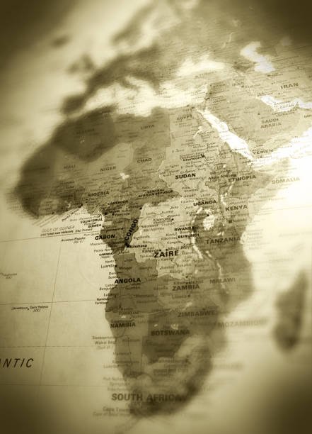
Algeria is currently the **African country which is largest in area**, spanning over 2.38 million square kilometers across the northern portion of the continent. This massive territory includes a vast portion of the Sahara Desert and a fertile Mediterranean coastline, making it a critical geopolitical player in the region. Understanding the scale of these nations helps researchers and travelers grasp the logistical challenges and ecological diversity present within the continent's borders.
The ranking of these nations shifted significantly following the independence of South Sudan in 2011, which altered the geographic status of the former leader. Today, the top largest nations represent a mix of desert landscapes, tropical rainforests, and vast savannahs that define the physical identity of Africa.
These are the Countries and the Details on Which Country In Africa Is Largest In Area
When investigating which country that is largest in area in Africa, it is essential to consider how historical borders were drawn during the colonial era and how these massive landmasses are managed today. The sheer size of these countries in Africa that are largest in area often means they possess diverse climates, ranging from arid deserts to lush jungles, all within a single sovereign border. Size often translates to a wealth of natural resources, though it also presents significant hurdles for infrastructure development and national administration across thousands of miles. The following list details the fifteen largest nations on the continent by total land area, providing context on their geography, resources, and regional importance in the modern world.
| Rank | Country | Area (Square Kilometers) | Primary Geographic Feature |
|---|---|---|---|
| 1 | Algeria | 2,381,741 | Sahara Desert |
| 2 | Democratic Republic of the Congo | 2,344,858 | Congo Rainforest |
| 3 | Sudan | 1,861,484 | Nile Valley / Desert |
| 4 | Libya | 1,759,540 | Sahara Desert |
| 5 | Chad | 1,284,000 | Sahel / Lake Chad |
1. Algeria
Algeria stands as the undisputed leader in terms of landmass, having occupied the top spot since the division of Sudan in 2011. Approximately four-fifths of its territory is covered by the Sahara Desert, which presents both immense challenges for habitability and incredible opportunities for mineral and energy extraction. Despite the arid nature of its interior, the northern regions along the Tell Atlas mountain range provide fertile soil for agriculture and house the majority of the national population. The sheer scale of Algeria means it shares borders with seven different nations, making it a vital hub for trans-Saharan trade and regional security. Its size is comparable to the entire land area of Western Europe, illustrating the massive distances required to travel across its provinces from the Mediterranean to the southern borders. The government has invested heavily in trans-Saharan highways to ensure that these remote desert regions remain connected to the economic centers in the north.
2. Democratic Republic of the Congo
The Democratic Republic of the Congo is the second largest nation and the largest in Sub-Saharan Africa, characterized by the massive Congo River basin and the world's second-largest tropical rainforest. Its territory is nearly as large as Western Europe and contains a wealth of minerals, including cobalt and copper, which are vital for the global electronics industry. The dense vegetation and vast river systems mean that much of the country is inaccessible by road, leading to a reliance on river transport and aviation for domestic travel. Because of its central location, the DRC shares borders with nine different countries, serving as a crossroads for Central, Eastern, and Southern African cultures. The environmental importance of its forests cannot be overstated, as they act as a primary carbon sink for the planet. Despite its size, the nation faces the difficult task of unifying diverse ethnic groups across a landscape where communication and infrastructure remain major developmental hurdles.
3. Sudan
Sudan remains a geographic giant in Northeast Africa even after the secession of South Sudan, holding the third position on the list of largest nations. The country is defined by the Nile River, which flows through its heart and provides the essential water needed for agriculture in an otherwise predominantly arid environment. Sudan's landscape transitions from the harsh sands of the Nubian Desert in the north to the more fertile plains of the central and southern regions. Its strategic location along the Red Sea makes it a vital gateway for trade between the African interior and the Middle East. The massive Gezira Scheme, one of the largest irrigation projects in the world, demonstrates how the nation has harnessed its geography to support a large agricultural sector. Managing such a vast territory involves navigating complex regional politics and ensuring the fair distribution of resources across its various states.
4. Libya
Libya is the fourth largest country in Africa and is almost entirely defined by the Sahara Desert, which covers more than 90 percent of its land area. The majority of its citizens live along the Mediterranean coast in cities like Tripoli and Benghazi, where the climate is much milder than the scorching interior. Underneath its vast desert sands lie some of the largest proven oil reserves in the world, which provide the backbone of the Libyan economy. The Great Man-Made River, a massive network of pipes that pumps water from ancient underground aquifers in the Sahara to the coastal cities, is one of the most ambitious engineering projects in human history. This project highlights the extreme measures required to sustain life in a nation where surface water is virtually non-existent. Libya’s vast coastline and desert interior make it a critical country for Mediterranean security and migration patterns toward Europe.
5. Chad
Chad is a landlocked nation in North-Central Africa that ranks as the fifth largest on the continent, featuring a landscape that varies from Saharan sands to Sudanese savannahs. The northern portion of the country is dominated by the Tibesti Mountains, while the south contains the fertile regions surrounding Lake Chad, which is a vital water source for millions in the Sahel. Due to its size and landlocked status, Chad faces some of the most difficult logistical challenges in Africa, with goods often traveling thousands of miles from ports in neighboring Cameroon or Nigeria. The country is a major producer of livestock and has recently become a significant player in the oil industry, which has brought new investment to its capital, N'Djamena. Its central position makes it a strategic partner in regional anti-terrorism efforts and peacekeeping missions across the Sahelian belt. Chad's geography is a testament to the resilience of human populations living in some of the world's most extreme climatic conditions.
6. Niger
Niger is a vast, landlocked country in West Africa where more than 80 percent of the land is covered by the Sahara Desert, making it the sixth largest nation in area. The lifeblood of the country is the Niger River in the southwest, which provides water for the majority of its agricultural activities and supports the capital, Niamey. Niger is world-renowned for its uranium deposits, which are among the largest on the planet and serve as a primary export for the national economy. The Air Mountains in the north offer a stunning volcanic landscape that contrasts sharply with the surrounding sand dunes of the Tenere Desert. Because of its massive size and harsh climate, Niger has one of the lowest population densities in the world, with many communities living in isolated desert oases. The government continues to work with international partners to combat desertification and improve food security across its expansive territory.
7. Angola
Angola is the seventh largest country in Africa and the largest in the southern region, possessing a diverse geography that includes a long Atlantic coastline, high plateaus, and dense rainforests in the north. The country is incredibly rich in natural resources, particularly oil and diamonds, which have fueled its post-war reconstruction and urban development. Angola's size allows it to host a wide variety of ecosystems, including the southern reaches of the Congo Basin and the northern fringes of the Namib Desert. The central highlands offer a temperate climate that was historically the breadbasket of the nation, and efforts are underway to revitalize agriculture in these fertile regions. Luanda, the capital, is one of the most expensive and rapidly growing cities in Africa, reflecting the nation's immense economic potential. Angola's geographic position makes it a major player in the Southern African Development Community and a key partner for trade with both China and the West.
8. Mali
Mali is a landlocked nation in West Africa that ranks eighth in area, with its northern half extending deep into the heart of the Sahara. The southern part of the country is where the majority of the population resides, supported by the Niger and Senegal rivers which provide irrigation for crops like rice and cotton. Mali is historically famous as the center of the great Mali Empire, and the ancient city of Timbuktu remains a global symbol of trans-Saharan trade and Islamic scholarship. The nation is currently one of Africa's top gold producers, with mining operations serving as a vital source of foreign exchange. However, the vast distances between the fertile south and the desert north present significant security and administrative challenges for the central government. Mali's geography is a blend of ancient history and modern struggle, as it seeks to maintain stability across a territory that spans multiple climatic zones.
9. South Africa
South Africa is the ninth largest country on the continent and the most industrialized, featuring a varied landscape that ranges from the subtropical east coast to the arid Karoo interior. It is uniquely positioned at the southern tip of the continent, with a coastline that stretches over 2,500 kilometers along both the Atlantic and Indian Oceans. The country is divided into a high central plateau surrounded by a Great Escarpment, which falls away to a narrow coastal plain. South Africa’s size allows it to be a leader in various industries, including mining, where it produces a significant portion of the world's platinum, gold, and chromium. The Western Cape is famous for its Mediterranean climate and world-class vineyards, while the Kruger National Park in the northeast is one of the world's premier wildlife destinations. Its geographic diversity is matched by its cultural variety, earning it the nickname of the Rainbow Nation.
10. Ethiopia
Ethiopia is the tenth largest country in Africa and is characterized by its rugged, mountainous terrain and high-altitude plateaus that have historically provided a natural defense against foreign invasion. Known as the Water Tower of East Africa, the Ethiopian Highlands are the source of the Blue Nile, which provides the majority of the water for the Nile River downstream. Ethiopia is the most populous landlocked country in the world, and its lack of direct sea access has led to a strategic partnership with Djibouti for international trade. The Great Rift Valley bisects the country from northeast to southwest, creating a landscape of deep lakes, volcanoes, and unique biodiversity found nowhere else on earth. The capital, Addis Ababa, sits at an elevation of over 2,300 meters, making it one of the highest capital cities in the world. Ethiopia's size and ancient history make it a focal point for diplomacy and development in the Horn of Africa.
11. Mauritania
Mauritania is the eleventh largest nation in Africa and serves as a bridge between the Maghreb in the north and Sub-Saharan Africa in the south. Approximately 90 percent of its territory is within the Sahara, and the vast majority of its population is concentrated along the Atlantic coast and in the southern Senegal River valley. The country is a major exporter of iron ore, which is transported from the interior to the coast via one of the longest and heaviest trains in the world. Mauritania’s coastline is home to some of the richest fishing grounds on the planet, providing a vital source of protein and export revenue for the nation. Despite its arid environment, the ancient trading towns of Chinguetti and Ouadane are preserved as UNESCO World Heritage sites, showcasing the country's rich nomadic history. Managing such a large desert territory requires a focus on water conservation and the promotion of sustainable livestock herding.
12. Egypt
Egypt occupies the twelfth spot on the list, spanning exactly one million square kilometers across the northeastern corner of Africa and the Sinai Peninsula in Asia. It is the most populous nation in the Arab world, and nearly all of its inhabitants live along the narrow strip of the Nile Valley and the Delta. The vast majority of Egypt is covered by the Western and Eastern Deserts, which are largely uninhabited except for a few isolated oases. Egypt's strategic importance is cemented by the Suez Canal, which is the shortest maritime route between Europe and the Indian Ocean. The country is a global icon of ancient civilization, with the Pyramids of Giza and the Valley of the Kings drawing millions of tourists annually. Its geography is a study in the contrast between the life-giving Nile and the surrounding desert, a dynamic that has shaped Egyptian history for over five thousand years.
13. Tanzania
Tanzania is the thirteenth largest country in Africa and the largest in East Africa, featuring a diverse landscape that includes the highest peak on the continent, Mount Kilimanjaro. The country is bordered by three of the Great Lakes—Victoria, Tanganyika, and Nyasa—giving it access to massive freshwater resources. Tanzania’s geography supports an incredible array of wildlife, with about 38 percent of its land area set aside in protected parks and reserves like the Serengeti and Ngorongoro. The coastal region and the islands of Zanzibar have a long history of Indian Ocean trade, blending African, Arabian, and Indian cultures. Tanzania is also a significant producer of gold and is the only place in the world where the gemstone tanzanite is found. The government is currently building a new standard-gauge railway to connect its ports to landlocked neighbors, leveraging its size to become a regional logistics hub.
14. Nigeria
Nigeria is the fourteenth largest country in area but the most populous nation in Africa, featuring a landscape that transitions from tropical rainforests in the south to arid savannahs in the north. Its size allows it to be the largest economy on the continent, driven primarily by its massive oil and gas reserves in the Niger Delta. Nigeria is divided into thirty-six states, and its geographic diversity is reflected in its hundreds of ethnic groups and languages. The country has a robust agricultural sector, producing large quantities of cocoa, palm oil, and various grains for both domestic consumption and export. Lagos, the largest city, is a booming megacity and the financial heartbeat of West Africa, while Abuja, the purpose-built capital, serves as the administrative center. Despite its large area, Nigeria’s high population density in the south presents unique challenges for urban planning and resource management.
15. Namibia
Namibia rounds out the top fifteen largest nations, characterized by its stunning desert landscapes and one of the lowest population densities in the world. The Namib Desert, which is believed to be the oldest desert on Earth, runs along the entire Atlantic coastline, while the Kalahari Desert occupies the eastern portion of the country. Namibia is world-famous for its massive sand dunes at Sossusvlei and its unique desert-adapted wildlife, including elephants and lions that roam the Skeleton Coast. The country is a major producer of diamonds, uranium, and copper, with mining forming the backbone of the national economy. Its vast, open spaces and well-maintained infrastructure make it a popular destination for self-drive tourism and film production. Namibia’s size and tranquility offer a stark contrast to the bustling megacities of West and East Africa, providing a unique perspective on the continent's geographic diversity.
Reasons Why These Countries Are Largest in Area in Africa
1. Geological Stability of the African Plate: The primary reason for the existence of such massive sovereign states is the underlying geological stability of the African tectonic plate. Unlike Europe or parts of Asia where frequent mountain-building events and tectonic shifts have fragmented the land into smaller units, the African plate has remained relatively intact for millions of years. This stability allowed for the formation of large sedimentary basins and expansive plateaus that are not interrupted by young mountain ranges. Consequently, when borders were drawn, they often encompassed these vast, continuous geographic regions. The **African countries that are largest in area** are often situated on these ancient, stable cratons that provide a massive, flat foundation for national territory.
2. The Vastness of the Sahara Desert: The Sahara Desert is a dominant factor in why several North and West African nations possess such large areas. Because the desert was historically sparsely populated and lacked permanent settlements in the interior, colonial powers often drew straight lines across the sand to define administrative zones. Countries like Algeria, Libya, and Mali have huge desert hinterlands that were added to their coastal or riverine cores during the partitioning of Africa. These desert regions were often considered "empty" by colonial mapmakers, leading to the creation of massive provinces that were eventually inherited by independent states. This Saharan geography is the reason why North Africa contains the highest concentration of the largest countries on the continent.
3. Colonial Partitioning and Administrative Convenience: The modern map of Africa was largely determined by European powers during the Berlin Conference of 1884, where borders were drawn for administrative convenience rather than ethnic or geographic logic. To simplify their governance, colonial powers often grouped large territories together under a single administration, such as French West Africa or the Belgian Congo. When these territories gained independence, many chose to maintain the colonial borders to avoid conflict, resulting in the massive nations we see today like the DRC and Nigeria. In many cases, **African countries that are largest in area** are a direct result of the specific administrative strategies of France, Britain, and Belgium. These legacy borders have created the large-scale political geography of the modern continent.
4. Expansion of Historical Inland Empires: Some of the largest nations in Africa are based on the historical reach of ancient empires and kingdoms that dominated the interior long before European arrival. Ethiopia, for example, maintained its territory through centuries of resistance and expansion, preserving a large highland core that was never fully colonized. Similarly, the historical influence of the Kanem-Bornu or the Songhai empires influenced the eventual shape of nations like Chad and Niger. These historical states established the initial patterns of trade and administration that defined the regions. While colonial powers eventually redrew the lines, the cultural and political cores of these large nations often trace back to these ancient centers of power. The survival of these large identities is a key factor in the current continental map.
5. Tectonic Rifting and Basin Formation:
Enjoyed this read?
Share it with your friends and colleagues.