Which Country Has Longest Coastline In Africa

BSC Insights Admin
September 30, 2026
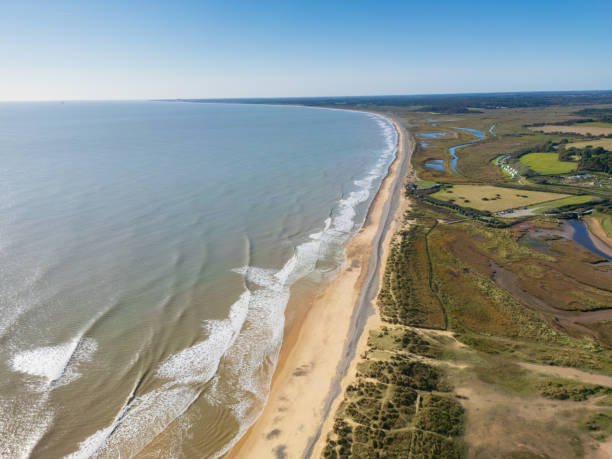
Understanding the geography of the southern hemisphere helps us identify which country that has longest coastline in Africa and how it impacts regional shipping. Madagascar takes the top spot due to its status as a massive island, followed closely by nations on the mainland that border the Indian and Atlantic Oceans. These shorelines are not just beautiful landscapes but are vital for the economic survival of millions who depend on the sea for food and trade.
The length of these shores often determines the economic trajectory and environmental strategy of many nations across the region. As we dive deeper into the geography of the continent, we see how these maritime borders shape national identities and regional trade.
These are the Countries that have the longest coastline in Africa
The African continent is surrounded by several major bodies of water, including the Mediterranean Sea to the north, the Red Sea and the Indian Ocean to the east, and the Atlantic Ocean to the west. This positioning has resulted in some nations possessing incredibly long stretches of shore that vary from sandy beaches and coral reefs to rugged cliffs and desert dunes. The following list identifies the nations with the most extensive maritime borders, highlighting why their geography is so unique and significant on the global stage. We will explore how these coastlines contribute to their national wealth and environmental diversity.
1. Madagascar
Madagascar is the definitive African country which has the longest coastline, stretching approximately 4,828 kilometers along the Indian Ocean. Because it is a massive island nation separated from the mainland, every side of the country is exposed to the sea, which creates an incredibly diverse range of coastal ecosystems. From the tropical rainforests that meet the ocean in the east to the dry forests and mangroves in the west, the variety is staggering. The length of this coastline provides Madagascar with one of the largest Exclusive Economic Zones in the region, offering vast potential for fishing and offshore resources. Tourism is also a major benefactor, as the thousands of miles of beaches attract visitors from across the globe to see unique species like lemurs and baobabs that exist near the shore. Protecting such an expansive maritime border is a significant task for the government, especially given the threats of illegal fishing and climate change.
2. Somalia
Somalia possesses the longest coastline on the African mainland, measuring about 3,333 kilometers along the Gulf of Aden and the Indian Ocean. This strategic location at the Horn of Africa makes it a crucial player in strategic maritime trade routes that connect Europe, the Middle East, and Asia. The shoreline is characterized by both rocky cliffs in the north and vast, sandy stretches in the south, providing numerous natural harbors. Historically, these ports have been centers of commerce for centuries, linking the African interior with global markets for spices, textiles, and livestock. In recent years, the government has been working to revitalize its blue economy to harness the potential of its rich fishing grounds. The sheer length of the Somali coast ensures that it will always be a focal point for international maritime security and economic development in East Africa.
3. South Africa
South Africa has a massive coastline of roughly 2,798 kilometers that serves as the meeting point for two of the world’s great oceans, the Atlantic and the Indian. This unique geographical feature occurs at Cape Agulhas, creating a highly productive marine environment where cold and warm currents mingle. The coastline is famous for its dramatic scenery, ranging from the famous Garden Route to the wild and rugged shores of the Skeleton Coast's southern cousin, known as the Wild Coast. Economically, South Africa’s ports like Durban and Cape Town are among the busiest on the continent, handling the lion's share of regional trade. The country also boasts a world class tourism industry centered on its beaches, whale watching, and surfing spots that draw millions of international travelers annually. Because of its length and diversity, the South African coast is a primary driver of the national economy and a cornerstone of its environmental conservation efforts.
4. Mozambique
Mozambique features a stunning coastline that runs for approximately 2,470 kilometers along the Indian Ocean in South Eastern Africa. This long stretch of shore is dotted with beautiful archipelagos, such as the Bazaruto and Quirimbas, which are world renowned for their coral reefs and marine biodiversity. The country’s economy is deeply tied to the sea, with major ports in Maputo, Beira, and Nacala serving as vital gateways for landlocked neighbors like Zimbabwe and Malawi. Recent discoveries of massive natural gas reserves off the northern coast have further emphasized the importance of its maritime territory. However, the length of the coast also makes Mozambique vulnerable to tropical cyclones that originate in the Indian Ocean, requiring significant investment in disaster management. Despite these challenges, the coastal resources remain the country's most valuable asset for future industrial and tourism growth.
5. Egypt
Egypt has a combined coastline of about 2,450 kilometers, split between the Mediterranean Sea to the north and the Red Sea to the east. The Red Sea portion is famous for having some of the most vibrant coral reefs in the world, making it a global hub for scuba diving and luxury tourism in cities like Sharm El Sheikh. To the north, the Mediterranean coast has been a center of human civilization for millennia, with the historic city of Alexandria serving as a primary port. The most critical feature of Egypt's maritime geography is the Suez Canal, which connects the two seas and acts as one of the most important shipping lanes in the world. This canal generates billions of dollars in revenue for the country and cements its status as a global logistics leader. Egypt’s ability to manage two distinct maritime environments provides it with a diverse range of economic opportunities from fishing to international transit.
6. Morocco
Morocco enjoys an extensive coastline of approximately 1,835 kilometers, bordered by both the Atlantic Ocean and the Mediterranean Sea. The northern coast along the Mediterranean is characterized by its proximity to Europe, with the Strait of Gibraltar serving as a narrow but vital passage for global shipping. Along the Atlantic side, the coast stretches far to the south, offering vast fishing grounds that are among the most productive in the world. The city of Casablanca serves as a major industrial and commercial port, while cities like Agadir are famous for their sun drenched beaches and tourism. Morocco has heavily invested in modernizing its maritime infrastructure, including the Tanger Med port, which is now one of the largest in Africa and the Mediterranean. This dual ocean access allows Morocco to act as a bridge between multiple continents and trade zones.
7. Libya
Libya has the longest Mediterranean coastline of any African nation, spanning about 1,770 kilometers of northern shore. Most of the country’s population lives within a short distance of the sea, as the vast interior is dominated by the Sahara Desert. The coast is home to historic cities and ancient ruins, such as Leptis Magna, which highlight the region's long history as a hub of Mediterranean trade. Economically, the coastline is vital for the export of oil and natural gas, which are the mainstays of the Libyan economy. There are also significant opportunities for the development of a fishing industry and renewable energy projects like offshore wind and solar. While political challenges have impacted the development of these resources, the natural beauty and length of the Libyan shore remain a significant part of its national potential.
8. Angola
Angola possesses a long and resource rich coastline that stretches for about 1,600 kilometers along the Atlantic Ocean in Central Africa. The capital city, Luanda, is located right on the coast and serves as the economic heart of the country, fueled largely by the offshore oil industry. Angola is one of the top oil producers on the continent, and the majority of its reserves are found in the deep waters off its shores. Beyond oil, the Benguela Current brings nutrient rich waters to the coast, supporting a thriving fishing industry that provides food and jobs for thousands. The shoreline also features beautiful beaches and natural harbors that have the potential for significant tourism development as the country diversifies its economy. Managing the environmental impact of the oil industry while protecting the marine ecosystem is a key priority for the Angolan government.
9. Namibia
Namibia’s coastline is roughly 1,570 kilometers long and is perhaps one of the most unique and desolate in the world, dominated by the Namib Desert. Known as the Skeleton Coast in the north, it is famous for its haunting shipwrecks and massive sand dunes that drop directly into the cold Atlantic waters. Despite its harsh appearance, the coast is incredibly productive due to the cold Benguela Current, which supports massive populations of fish and seals. Walvis Bay is the primary port, serving as a critical logistics hub for the country and its landlocked neighbors in Southern Africa. The coastline is also a major destination for adventure tourism, with visitors coming to see the incredible landscapes and diverse wildlife. Namibia has implemented some of the strictest marine conservation laws in the world to ensure the sustainability of its coastal and oceanic resources.
10. Tanzania
Tanzania rounds out the list with a coastline of approximately 1,424 kilometers along the Indian Ocean, including the famous spice islands of Zanzibar. The shore is characterized by its white sandy beaches, palm trees, and historical Swahili trading towns that have existed for over a thousand years. Dar es Salaam is the nation’s largest city and a primary port, acting as a gateway for trade into East and Central Africa. The coastal waters are rich in marine life, providing a livelihood for many small scale fishers and supporting a growing commercial fishing sector. Tourism is a massive part of the coastal economy, particularly in Zanzibar, where the blend of culture and natural beauty attracts people from all over the globe. Tanzania’s coastline is a vital component of its national identity and its plans for future economic integration with the rest of the world.
Reasons Why These Countries Have Longest Coastlines in Africa
1. Tectonic Plate Movements and Continental Drift: The primary reason why certain countries in Africa that have the longest coastline exist in their current form is the historical movement of tectonic plates. Millions of years ago, the breaking apart of the supercontinent Gondwana shaped the edges of the African plate. This geological process created the jagged and extensive shorelines we see today, particularly along the eastern and western coasts. The separation of Madagascar from the mainland is a direct result of these forces, creating a massive island with an entirely isolated and lengthy perimeter.
2. Presence of Large Island Systems: In the case of Madagascar, the length is significantly boosted by its status as the world’s fourth largest island. Island nations naturally have more coastline relative to their land area compared to landlocked or mainland nations. This island geography means that every kilometer of the border is a maritime border, which inherently increases the total length. Many of the African countries that have the longest coastline also include various smaller archipelagos and islands that add hundreds of additional kilometers to their official measurements.
3. Irregular Shoreline Geometries: Coastlines that are not straight but instead have many bays, inlets, and peninsulas are naturally much longer. For example, Mozambique and South Africa have many natural indentations that increase the actual walking distance of the shore compared to a straight line. This phenomenon, often referred to in geography as the coastline paradox, means that the more detailed the measurement, the longer the coastline appears. These irregularities are often formed by the erosion of different types of rock and the deposition of sediment over thousands of years.
4. Strategic Geographic Positioning: Some nations are positioned in a way that they wrap around the corners of the continent, giving them access to multiple seas or oceans. Egypt and Morocco are perfect examples of this, as they border two different major bodies of water. This dual exposure effectively doubles the potential for a long coastline compared to a nation that only borders a single sea. This positioning is often a result of historical border shifts and colonial era treaties that prioritized coastal access for trade and defense.
5. Formation of Deltas and Estuaries: Large river systems that empty into the ocean can create expansive delta regions which significantly increase the shoreline length. While the Nile in Egypt and the Zambezi in Mozambique are famous examples, many other smaller rivers create complex networks of wetlands and tidal flats. These areas create a "fractal" effect on the map where the land and water interlock in a complicated pattern. This adds a great deal of distance to the total coastline measurement and creates essential habitats for many unique marine species.
6. Marine Volcanic Activity: In some regions, particularly around the Horn of Africa and the various island chains, historical volcanic activity has expanded the landmass into the sea. This creates new peninsulas and rugged coastal features that are much longer than a smooth, eroded shoreline. Over time, these volcanic formations become covered in vegetation or coral, but the underlying jagged structure remains. This contributes to the overall length and the diverse nature of the maritime borders found in nations like Somalia and Tanzania.
Conclusion
In conclusion, Madagascar stands out as the country in Africa with the longest coastline, followed by a variety of mainland nations that use their maritime borders for economic and social growth. Whether it is the desert shores of Namibia or the tropical beaches of Mozambique, these coastlines are essential for the continent's integration into the global economy. The vast length of these shorelines provides countless opportunities for fishing, tourism, and international trade, making them some of the most valuable geographical features on earth. As climate change continues to impact sea levels, the management and protection of these extensive borders will remain a top priority for African leaders. Understanding the scale and importance of these maritime boundaries is key to appreciating the natural wealth and strategic potential of the entire African continent.
Enjoyed this read?
Share it with your friends and colleagues.