Is Africa North Of America

BSC Insights Admin
June 15, 2026
Is Africa North Of America? Unraveling the Continents' True Positions
The straightforward answer to the question, “Is Africa North Of America?” is no. Africa is not located north of America. Instead, Africa lies primarily to the east of the American continents, with the vast Atlantic Ocean separating these two major landmasses. Understanding their accurate geographical placement is fundamental to grasping global geography.
This article delves into the precise geographical relationship between Africa and the Americas, debunking common misconceptions and providing a clear, authoritative overview of their positions on the world map. We'll explore the factors contributing to confusion and illuminate the true layout of our planet's continents.
Understanding Continental Geography: A Global Perspective
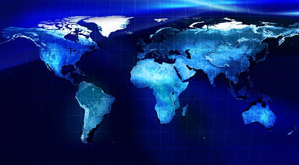
To accurately address the question of Africa's location relative to America, it's crucial to understand the concept of continents. Continents are defined as large, continuous expanses of land on Earth. While the exact number of continents can vary slightly based on different models (e.g., 6-continent vs. 7-continent), the widely accepted 7-continent model identifies North America, South America, Europe, Asia, Africa, Australia (or Oceania), and Antarctica.
When we visualize these landmasses on a globe or a comprehensive world map, their distinct positions become clear. The Americas, comprising North America and South America, form a north-south chain in the Western Hemisphere. Africa, on the other hand, is a massive continent situated predominantly in the Eastern Hemisphere, straddling the Equator and extending significantly into both the Northern and Southern Hemispheres.
The Americas: A Westward Realm
The term America typically refers collectively to two distinct continents: North America and South America. These continents are located entirely in the Western Hemisphere, stretching from the Arctic in the north to the southern tip of South America.
-
North America: This continent includes countries like Canada, the United States, Mexico, and extends south through Central America to Panama. It is situated primarily in the Northern Hemisphere, west of Europe and Africa. Its eastern coastline faces the Atlantic Ocean.
-
South America: Positioned mostly in the Southern Hemisphere, though a significant portion lies north of the Equator, South America includes countries such as Brazil, Argentina, Colombia, and Peru. Its eastern coastline also borders the Atlantic Ocean, placing it directly across from Africa.
The Americas are bounded by the Atlantic Ocean to the east, the Pacific Ocean to the west, the Arctic Ocean to the north (for North America), and the Southern Ocean to the south (for South America). This extensive oceanic separation is key to understanding why Africa cannot be north of America.
Africa: The Heart of the Old World
Africa is the second-largest continent in the world, renowned for its diverse landscapes, rich history, and vibrant cultures. It is uniquely positioned, straddling the Equator and encompassing vast territories in both the Northern and Southern Hemispheres. Its longitudinal position places it primarily in the Eastern Hemisphere.
Geographically, Africa is situated to the east of the Americas. The Atlantic Ocean forms its western boundary, creating a wide expanse between Africa and South America. To its north, Africa is separated from Europe by the Mediterranean Sea, and to its northeast, it is connected to Asia by the Suez Canal and the Red Sea.
Key geographical facts about Africa's position:
-
It is the only continent that stretches from the northern temperate zone to the southern temperate zone, crossing the Equator, the Prime Meridian, the Tropic of Cancer, and the Tropic of Capricorn.
-
Its western coast faces the Atlantic Ocean, aligning almost directly across from the eastern coast of South America.
-
The distance across the Atlantic Ocean separating Africa from South America is significant, averaging about 3,000 to 5,000 kilometers (1,864 to 3,107 miles) at its narrowest points.
The Atlantic Divide: A Vast Oceanic Separator
The most defining feature in the geographical relationship between Africa and the Americas is the Atlantic Ocean. This immense body of water acts as a natural, impassable barrier, ensuring that Africa and the Americas do not share a direct land border or even close proximity that would allow one to be 'north' of the other in a continental sense. The Atlantic Ocean is the second-largest ocean in the world, covering approximately 20% of Earth's surface.
Historically, the Atlantic Ocean has played a crucial role in shaping human history, serving as a pathway for exploration, trade, and unfortunately, the transatlantic slave trade. Its vastness underscores the significant separation between the continents, making the notion of Africa being north of America physically impossible.
Key aspects of the Atlantic Ocean's role:
-
It formed as the supercontinent Pangaea broke apart, pushing Africa and the Americas away from each other over millions of years due to plate tectonics.
-
It delineates the Western Hemisphere (Americas) from the Eastern Hemisphere (Europe and Africa).
-
Its currents and weather patterns have influenced everything from early navigation to modern climate systems, further emphasizing its role as a grand separator.
Debunking the Myth: Why the Confusion?
If Africa is clearly east of the Americas, why does the question, “Is Africa North Of America?”, arise? Several factors might contribute to this geographical misconception:
-
Map Projections: The most common world map projection, the Mercator projection, distorts landmass sizes and shapes, especially near the poles. While it's useful for navigation, it can mislead viewers about the true relative sizes and positions of continents, making some areas appear larger or further north than they are.
-
Relative Northern Points: Some might incorrectly assume that because parts of Africa extend into the Northern Hemisphere, and the Americas also extend significantly north, there might be an overlap where Africa is geographically above America. However, latitude alone doesn't define their north-south relationship when separated by an ocean; longitude and the expanse of water are equally critical.
-
Focus on Specific Regions: People might compare, for instance, the southernmost point of North America (e.g., Key West, Florida) with the northernmost point of Africa (e.g., Cape Angela, Tunisia). While Tunisia is indeed north of Florida in terms of latitude, comparing points across a vast ocean does not mean the entire continent of Africa is north of the entire continent of America.
-
General Lack of Geographical Education: A lack of consistent and detailed global geography education can lead to intuitive but incorrect assumptions about continental placement. Many people are more familiar with their local geography than with the global arrangement of landmasses.
Relative Positioning: A Closer Look at Hemispheres and Boundaries
To provide a clearer picture of their alignment, let's consider their positions in terms of hemispheres and major boundaries:
| Continent/Region | Primary Hemisphere (Latitude) | Primary Hemisphere (Longitude) | Major Oceanic Boundary | Relative Position to Other Continent |
|---|---|---|---|---|
| North America | Northern Hemisphere | Western Hemisphere | Atlantic Ocean (East), Pacific Ocean (West) | West of Africa |
| South America | Mainly Southern Hemisphere (partly Northern) | Western Hemisphere | Atlantic Ocean (East), Pacific Ocean (West) | West of Africa |
| Africa | Both Northern and Southern Hemispheres | Eastern Hemisphere | Atlantic Ocean (West), Indian Ocean (East) | East of the Americas |
This table clearly illustrates that Africa and the Americas occupy different longitudinal hemispheres, separated by the Atlantic Ocean. While parts of North America and northern Africa share similar latitudinal bands in the Northern Hemisphere, they are distinctly separated by a vast oceanic expanse.
The Impact of Plate Tectonics: Continents Adrift
The current geographical separation of Africa and the Americas is a direct result of millions of years of plate tectonics. Around 200 million years ago, all of Earth's continents were joined together in a single supercontinent called Pangaea. Over time, the tectonic plates beneath the Earth's surface began to move, causing Pangaea to break apart.
The Atlantic Ocean formed as the North American and South American plates drifted westward, and the African and Eurasian plates drifted eastward. This process, known as continental drift, continues today, though at a much slower rate. Understanding this geological history reinforces why Africa and the Americas are positioned as they are today – separated by an ocean, not aligned in a north-south stack.
Global Perspective and Map Reading Skills
Developing strong map reading skills and understanding global perspectives are essential for accurate geographical knowledge. Always refer to globes or accurate world maps that minimize distortion (like a Winkel Tripel or Robinson projection) when trying to understand the relative positions of continents. Paying attention to lines of latitude (parallels, indicating north-south position) and longitude (meridians, indicating east-west position) helps to pinpoint exact locations and relationships.
For instance, while a line of latitude might pass through both a northern African country and a southern US state, it does not mean that Africa is north of America. It simply means those specific points are at similar distances from the Equator. Their east-west separation by the Atlantic Ocean is the dominant factor in their continental relationship.
Cultural and Historical Connections Despite Separation
Despite their significant geographical separation, Africa and the Americas have profound cultural and historical connections. The transatlantic slave trade, starting in the 16th century, forcibly moved millions of Africans to the Americas, profoundly shaping the demographics, cultures, and economies of many countries in North and South America and the Caribbean. This tragic chapter in history led to the rich African diaspora and the enduring influence of African cultures on American music, art, cuisine, and languages.
In more recent times, migration, trade, and diplomatic relations continue to connect these two landmasses. However, these connections are established across the Atlantic, further emphasizing that their relationship is one of distinct continents separated by a major ocean, not one where Africa is positioned north of America.
Conclusion: Africa is East of America, Across the Atlantic
In conclusion, the definitive answer to “Is Africa North Of America?” is unequivocally no. Africa is geographically positioned to the east of the American continents, with the vast Atlantic Ocean serving as the primary separator between them. North and South America form the Western Hemisphere, while Africa is predominantly in the Eastern Hemisphere, straddling the Equator. Understanding this fundamental geographical fact is crucial for anyone seeking to build an accurate mental map of our planet. Misconceptions can arise from distorted map projections or a lack of global geographical context, but the reality is that these two immense landmasses are separated by thousands of miles of ocean, reflecting millions of years of continental drift. Accurate geographical understanding enhances our appreciation of the world and the diverse connections that span its surface, even across significant oceanic divides.
Enjoyed this read?
Share it with your friends and colleagues.