Is Africa North Of Europe

BSC Insights Admin
September 30, 2026
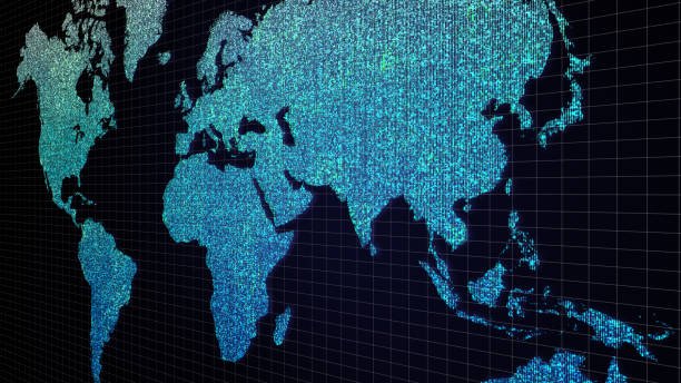
No, Africa is not north of Europe; rather, it lies primarily to the south of the European continent, separated by the vital waters of the Mediterranean Sea and the narrow Strait of Gibraltar. This common geographical misconception often arises from how maps are viewed or taught, but in reality, Africa extends vastly southward from Europe, stretching across the equator and into the Southern Hemisphere. Understanding the precise geographical relationship between these two massive landmasses is fundamental to comprehending global geography, historical interactions, and modern geopolitical dynamics.
The Definitive Geographic Answer: Africa's Position Relative to Europe
To unequivocally answer the question, Africa is located south of Europe. The two continents are separated by the Mediterranean Sea, which acts as a significant natural boundary. At its narrowest point, the Strait of Gibraltar, only about 13 kilometers (8 miles) of water separate the southern tip of the Iberian Peninsula (Europe) from the northern coast of Morocco (Africa). This proximity has historically fostered both connection and division, shaping cultures, trade routes, and conflicts over millennia.
Dispelling the Myth: Where Africa Truly Lies
The idea that Africa is north of Europe is a geographical inaccuracy. If one were to stand on the northern shores of Africa, such as in Tunisia, Algeria, or Morocco, looking northward, they would indeed be looking towards Europe. Conversely, standing in southern European countries like Spain, Italy, or Greece and looking south would reveal the African continent across the Mediterranean. This clear north-south orientation is consistent across all accurate global maps and geographical models. Understanding Africa's geographical location is crucial for any student of world geography.
Key Geographic Markers: The Mediterranean Sea and Strait of Gibraltar
The Mediterranean Sea is not merely a body of water; it is a profound geographical and historical separator and connector. Stretching approximately 2.5 million square kilometers (970,000 square miles), it defines the northern border of Africa and the southern border of Europe. Its waters have been highways for trade, migration, and cultural exchange for thousands of years. The Strait of Gibraltar, a narrow passage connecting the Atlantic Ocean to the Mediterranean Sea, is particularly important. It represents the closest point between the two continents, making it a critical choke point for shipping and a symbol of their close yet distinct existences.
Understanding Continental Proximity and Orientation
The relationship between Europe and Africa is one of immediate proximity, particularly across the Mediterranean basin. This close geographical connection has led to centuries of shared history, influencing everything from language and architecture to culinary traditions and political landscapes. However, their vastness means that while some parts are very close, other regions are thousands of kilometers apart.
A Look at the Northern African Coastline
The Northern Africa coastline stretches from Morocco in the west to Egypt in the east, directly facing the European continent. Countries like Morocco, Algeria, Tunisia, Libya, and Egypt all share a Mediterranean coastline. These nations have long-standing ties with Southern European countries. For instance, Spain has historically held territories on the Moroccan coast, and Italy has strong historical links with Libya and Tunisia. This close interaction across the sea underscores the fact that Africa is very much Europe's southern neighbor, not its northern counterpart.
Southern European Nations and Their Neighbors
Countries such as Spain, Portugal, Italy, Greece, and Malta form Europe's southern flank, experiencing warm Mediterranean climates and often sharing cultural elements influenced by their proximity to Africa and the Middle East. Spain, for example, is separated from Morocco by the Strait of Gibraltar and has an autonomous city, Ceuta, on the African continent itself, further highlighting the intertwined nature of their geographies. Italy shares maritime borders with Tunisia and Libya, while Greece is geographically closer to parts of North Africa than it is to Northern Europe. This demonstrates Europe's position relative to Africa in a tangible way.
Why Misconceptions Arise: Perspective and Map Projections
The misconception that Africa is north of Europe might stem from several factors. One significant reason is the use of certain map projections, like the Mercator projection, which are common in atlases and classrooms. While useful for navigation, the Mercator projection distorts the relative sizes of landmasses, particularly at higher latitudes. It also places Europe relatively high on the map, and while Africa is clearly south, the sheer size of the continent can be downplayed, leading to a skewed perception of its true scale and position. Furthermore, a general lack of in-depth continent geography education can contribute to such misunderstandings. Understanding global map orientation is key to accurate geographical knowledge.
The Interconnectedness of Continents: Beyond North and South
Beyond the simple north-south arrangement, Africa and Europe are profoundly interconnected. Their relationship is complex, encompassing deep historical roots, vibrant cultural exchanges, and significant economic and environmental ties. This intricate web of connections demonstrates that geography is not just about static positions but also about dynamic interactions.
Historical and Cultural Bridges Across the Mediterranean
The Mediterranean Sea has always been a crossroads of civilizations. Ancient Phoenicians, Greeks, Romans, and later, Arab empires, traversed these waters, spreading ideas, goods, and people between the two continents. For example, the Moorish conquest of Spain in the 8th century brought African and Middle Eastern cultures, sciences, and architectural styles into Europe, leaving an indelible mark. Sicily and Southern Italy also bear testament to centuries of North African and Arab influences. These historical movements are clear evidence of the deep and multifaceted interactions that have shaped both continents, emphasizing their shared, rather than distant, histories.
Economic and Environmental Connections
Economically, Europe and Africa are major trading partners. Europe relies on Africa for various raw materials and energy resources, while Africa imports manufactured goods and technology from Europe. Migration patterns, both historical and contemporary, also illustrate this connection, with significant African diasporas in many European countries. Environmentally, both continents share concerns regarding climate change, desertification, and the health of the Mediterranean ecosystem. The impacts of environmental degradation in one region often ripple across to the other, highlighting their shared fate on a warming planet. These geographical facts underscore the importance of understanding the true layout of the continents.
Exploring Africa's Vastness and Diversity
Africa is the second-largest continent, covering about 30.3 million square kilometers (11.7 million square miles), accounting for 6% of Earth's total surface area and 20% of its land area. Its immense size means that while its northern coast is relatively close to Europe, its southern tip, the Cape of Good Hope, is thousands of kilometers away, reaching into much colder latitudes. This vastness contributes to an incredible diversity that is often overlooked when discussing Africa's geographical location.
From the Sahara to the Cape of Good Hope
The continent stretches approximately 8,000 kilometers (5,000 miles) from its northernmost point, Ras ben Sakka in Tunisia, to its southernmost point, Cape Agulhas in South Africa. This incredible span encompasses a breathtaking array of landscapes and climates. The vast Sahara Desert dominates much of Northern Africa, creating a formidable natural barrier, though one that has also facilitated unique forms of trade and travel. South of the Sahara, the continent transitions into the Sahel, vast savannas, tropical rainforests, and high mountain ranges, eventually reaching the temperate regions of Southern Africa. This diversity illustrates the complexity of Earth's continents.
Geographic Zones and Climates
Africa hosts nearly every major climate zone, from the arid deserts of the north and southwest to the equatorial rainforests of Central Africa, and the Mediterranean climates along its northern and southernmost coasts. This climatic diversity supports a vast range of ecosystems and biodiversity, making Africa one of the most ecologically rich continents. Understanding these internal variations is as important as understanding its external relations with other continents, providing depth to the study of world geography.
Europe's Diverse Landscape and Southern Reaches
Europe, though smaller than Africa, is also remarkably diverse, stretching from the Arctic Circle to the Mediterranean Sea. Its southern regions are particularly relevant to the discussion of Africa's position, as they are the parts of Europe that directly face the African continent.
Mediterranean Europe: A Blend of Cultures
The countries of Mediterranean Europe — Spain, Portugal, Italy, Greece, and parts of France and the Balkan states — share a long history of interaction with North Africa. These regions boast unique cultures, often characterized by influences from across the sea, evident in their cuisines, languages, and historical sites. The climate is typically warm and dry in summer, mild and wet in winter, a stark contrast to the harsher climates of Northern Europe but often mirroring the northern coastal regions of Africa. This blending of influences highlights the porous nature of geographical boundaries when considering human interaction.
Eastern and Western European Borders
While the focus is often on the south, Europe's eastern and western borders also shape its global context. To the east, Europe borders Asia, forming the vast landmass of Eurasia. To the west, the Atlantic Ocean separates it from the Americas. These broad geographical contexts help to situate Europe's place in the world, reinforcing the clear geographical truth that Africa lies directly to its south, rather than its north. Studying continental borders gives a clearer picture.
Practical Implications of Geographic Understanding
Accurate geographical knowledge, such as the true orientation of Africa and Europe, has practical implications that extend beyond academic interest. It influences navigation, travel, geopolitical strategies, and even our understanding of historical movements and cultural diffusion. Grasping fundamental geographical facts is therefore not just an exercise in memorization, but a tool for informed global citizenship.
Navigation and Travel
For sailors, aviators, and modern travelers, understanding the precise geographical relationship between continents is non-negotiable. Knowing that the shortest sea route from, say, Southern Spain to Morocco involves crossing a narrow strait, or that flying from Italy to Egypt means heading south-east across the Mediterranean, relies on accurate mapping and comprehension of global map orientation. Misinterpreting these basic facts could lead to significant errors in planning and logistics.
Geopolitics and International Relations
In geopolitics, the proximity of Africa and Europe means they are inextricably linked. Issues such as migration, security, resource management, and environmental policies often require cooperative efforts between the two continents. The stability and prosperity of one often have direct impacts on the other. For instance, security challenges in North Africa can directly affect southern European nations. Conversely, economic opportunities in Europe attract migrants from Africa. An accurate understanding of their physical relationship helps policymakers formulate effective strategies and fosters better international relations. This understanding of Afro-Eurasia as an interconnected supercontinent is vital.
Conclusion
In summary, the answer to 'Is Africa north of Europe?' is a resounding no; Africa is situated directly to the south of Europe, separated primarily by the Mediterranean Sea and the Strait of Gibraltar. This fundamental geographical fact is vital for accurate understanding continents and their intricate relationships. Dispelling such misconceptions allows for a clearer comprehension of world geography, the historical interactions between these two powerful continents, and their continuing economic, cultural, and environmental interconnectedness. Accurate knowledge of continent geography empowers us to better understand our world and the complex web of human and natural systems that define it.
Enjoyed this read?
Share it with your friends and colleagues.