Did Africa And South America Used To Be Connected

BSC Insights Admin
October 01, 2026
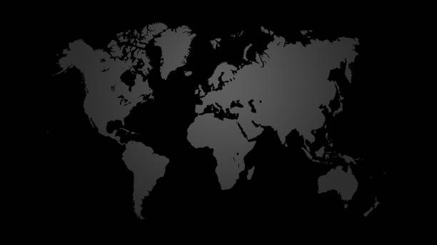
Scientific research into geological history confirms that Africa and South America used to be connected as part of a giant supercontinent known as Gondwana several hundred million years ago. This physical link is evident when looking at the jigsaw-like fit of the coastlines and the identical fossil remains found on both sides of the Atlantic Ocean. Geologists estimate that the two landmasses began their gradual separation approximately 140 million years ago due to the movement of tectonic plates.
The transition from a single landmass to two separate continents changed the course of biological and climate history for the entire planet. Understanding how these regions were once joined requires a close look at the matching rock formations and biological records shared by specific African and South American nations.
These are the countries in Africa that show that Africa and South America used to be connected
The evidence for a prehistoric connection is not spread evenly across the continent but is most visible in specific regions where the original rift occurred. By studying the geological makeup of West Africa and the southern tip of the continent, scientists have been able to reconstruct the original position of these landmasses with high precision. Many African countries that were once connected to South America share unique mineral deposits and mountain structures that are found nowhere else on earth, proving they were once adjacent. Here are the primary points of evidence and the locations where this ancient history is most visible today.
1. The Coastal Fit of Nigeria and Cameroon
One of the most visually striking pieces of evidence involves the coastline of Nigeria and Cameroon fitting into the coastline of Brazil. When researchers look at the continental shelf rather than just the visible shoreline, the fit becomes even more precise, suggesting these regions were once physically touching. This area of West Africa mirrors the recessed "corner" of South America, forming a perfect matching pair in the global tectonic puzzle. For many years, cartographers noticed this similarity, but it was not until the mid-twentieth century that computer models confirmed the fit at a depth of 1,000 meters. The matching curves of these nations provide the foundational visual proof for the theory of continental drift.
2. Fossil Records in South Africa
South Africa serves as a primary location for fossil evidence that answers the question of whether Africa and South America used to be connected in the affirmative. In the Karoo Basin, paleontologists have discovered remains of the Mesosaurus, a freshwater reptile that lived about 270 million years ago. Identical fossils have been found in the Parana Basin in Brazil, and because the Mesosaurus was a small animal incapable of swimming across the vast, salty Atlantic Ocean, it must have lived on a contiguous landmass. This discovery proves that an African country which was once joined to South America provided a habitat for species that existed across both modern continents simultaneously. The presence of these fossils in these two specific locations is a cornerstone of paleontology.
3. Matching Rock Strata in Ghana and Ivory Coast
The geological layers found in Ghana and the Ivory Coast are virtually identical to those found in the northeastern regions of Brazil. Geologists have identified specific sequences of sedimentary and volcanic rocks that were deposited at the same time and under the same environmental conditions before the continents split. These rock sequences, known as cratons, act like a fingerprint that connects the two landmasses across thousands of miles of ocean water today. By comparing the age and composition of these rocks, scientists have verified that the gold and diamond bearing formations in West Africa are extensions of the same formations in South America. This shared geological heritage is why mining practices in both regions often target the same types of ancient mineral deposits.
4. The Cape Fold Belt and Sierra de la Ventana
The Cape Fold Belt in South Africa is a massive mountain range that matches perfectly with the Sierra de la Ventana mountains in Argentina. When these two mountain chains are placed side by side on a map of Gondwana, they form a single, continuous mountain range that was created by the same tectonic forces. The pressure and heat that formed these mountains occurred hundreds of millions of years ago, long before the Atlantic Ocean even existed. The structural alignment and the types of distorted rock within these ranges are so similar that geologists classify them as part of the same original geological event. This physical link shows that the southern tips of both continents were subjected to the same massive earth movements while they were still one landmass.
5. Glacial Deposits in Namibia
Namibia contains ancient glacial deposits that provide a unique perspective on the climate of the supercontinent. During the late Paleozoic era, a massive ice sheet covered much of Gondwana, and as it moved, it left behind scratches and debris known as tillites. In Namibia, these glacial grooves point in a direction that only makes sense if the ice was moving from what is now the ocean toward the land. When Africa and South America are rejoined in a historical model, these grooves align with glacial paths in South America, showing a logical flow of ice across a single continent. This evidence suggests that a country in Africa used to be connected to South America during a time when the region was located much closer to the South Pole than it is today.
6. The Glossopteris Flora Distribution
The fossilized remains of an ancient fern called Glossopteris are found throughout the southern parts of Africa and South America. This plant produced large, heavy seeds that could not have been carried by the wind over an ocean, nor could they have survived a long journey through saltwater. The fact that this specific flora dominated the landscape of both continents at the same time is a strong biological indicator of a land connection. These ferns were essential to the prehistoric ecosystem and eventually contributed to the formation of the coal beds that are now mined in both regions. The widespread distribution of Glossopteris across these separated lands confirms they shared the same climate and soil when they were joined.
7. Paleomagnetic Data from Basalt Rocks
When volcanic rocks like basalt cool, the magnetic minerals inside them align with the magnetic poles of the Earth at that specific time. By studying these minerals in African countries that were once connected to South America, scientists can determine the exact latitude and orientation of the land at the time the rock was formed. Data collected from rocks in both regions show identical magnetic signatures for periods before 140 million years ago, indicating they occupied the same space on the globe. As the continents drifted apart, their magnetic signatures began to diverge, providing a timeline for the separation. This high-tech method of geological dating acts as a permanent record of the continents' previous locations.
8. The Mid-Atlantic Ridge Evidence
The Mid-Atlantic Ridge is an underwater mountain range that serves as the site where Africa and South America are still actively moving away from each other. This ridge is a volcanic rift where new seafloor is constantly being created, pushing the two continents apart at a rate of about 2.5 centimeters every year. By measuring the age of the seafloor starting from the coastlines and moving toward the ridge, scientists can trace the history of the separation back to its starting point. The symmetry of the seafloor on either side of the ridge proves that the Atlantic Ocean is a relatively new feature in geological terms. This ongoing process is the smoking gun that explains why the continents are no longer connected.
9. Cynognathus Fossils in Central Africa
Cynognathus was a mammal-like reptile that lived during the Triassic period and whose fossils have been found in both South Africa and South America. This land-dwelling predator was roughly the size of a modern wolf and was strictly terrestrial, meaning it could not have crossed even a small sea. The discovery of its remains in both locations proves that there was a continuous land bridge or a solid connection that allowed these animals to roam freely between the two regions. The existence of such specialized land animals in both places simultaneously is one of the most cited proofs for the existence of Pangea and Gondwana. It highlights the biological unity that once defined the southern hemisphere.
10. Diamond and Gold Deposit Alignment
The economic geology of West Africa and Eastern South America provides practical proof of their ancient connection. Diamonds found in the alluvial deposits of Brazil are geologically identical to those found in nations like Sierra Leone and Liberia. These minerals were formed under extreme pressure deep within the earth's mantle and were brought to the surface in volcanic pipes long before the continents split. When the land mass broke apart, it essentially sliced these mineral-rich regions in half, leaving parts of the same deposit on two different continents. Modern mining companies use this historical data to predict where new mineral veins might be located based on the geology of the corresponding "sister" continent.
Reasons Why These Countries and regions show that Africa and South America used to be connected
1. Tectonic Plate Tectonics: The theory of plate tectonics explains that the Earth's outer shell is divided into several large plates that glide over the mantle. These plates are constantly moving due to convection currents in the molten rock beneath them, which can cause continents to drift together or apart over millions of years. This fundamental geological process is the reason why Africa and South America were able to move from a single unit to their current positions. The movement of these plates remains the primary driver of all major geographical changes on our planet.
2. Mantle Plumes and Rifting: Before the separation, a massive plume of hot mantle material rose beneath the center of the supercontinent, causing the crust to thin and eventually crack. This rifting process created a series of deep valleys that eventually filled with water to form the beginning of the South Atlantic Ocean. This geological "stretching" is visible in the fault lines that still exist along the coastlines of both continents today. It represents the physical breaking point where the two giants finally parted ways.
3. Seafloor Spreading: As the rift between the continents grew wider, magma from the mantle rose to fill the gap, cooling to form new oceanic crust. This process, known as seafloor spreading, acts like a conveyor belt that continuously adds material to the ocean floor and pushes the continents further away from each other. This explains why the oldest oceanic crust is located near the coastlines while the youngest is found in the middle of the ocean. It provides a clear and measurable history of the continents' journey away from one another.
4. Shared Biological Evolution: Because the continents were joined for hundreds of millions of years, the plants and animals on them evolved together in the same environments. This shared evolutionary history created a biological legacy that is still visible in the DNA of modern species found in both Africa and South America. Even today, scientists find related species of fish, plants, and insects that share a common ancestor from the time of Gondwana. This biological continuity is a living record of the ancient physical connection.
5. Climate Consistency in Gondwana: When the continents were connected, they were part of a massive landmass that experienced a much more uniform climate than they do today. This consistency allowed for the widespread growth of specific forests and the migration of large animals across what are now two separate continents. The sedimentary layers from this period show that both regions were subject to the same rainfall patterns and temperature fluctuations. This atmospheric evidence supports the idea that there was no ocean to block the movement of air masses or moisture between them.
6. Gravitational and Thermal Forces: The heat within the Earth's core creates a massive amount of energy that must be released, often through the movement of the crust. This thermal energy, combined with the gravitational pull on the tectonic plates, forces the continents to shift their positions to maintain a balance of pressure. Over vast periods of time, these forces are strong enough to tear apart even the largest landmasses. The separation of Africa and South America is simply one chapter in the Earth's long history of recycling its surface through these powerful natural mechanisms.
Conclusion
The overwhelming scientific evidence from fossils, rock formations, and satellite measurements confirms that Africa and South America used to be connected in the distant past. This ancient link shaped the natural world we see today, leaving behind a trail of geological and biological clues that stretch across thousands of miles of ocean. Whether it is the matching mountain ranges or the identical fossils of ancient reptiles, the story of their shared history is written into the very earth itself. Understanding the African country which was once joined to South America helps us appreciate the dynamic and ever-changing nature of our planet. As the continents continue to drift at a slow but steady pace, the legacy of their ancient union remains one of the most fascinating discoveries in the history of science. The study of this connection provides essential insights into how the Earth evolves over millions of years.
Enjoyed this read?
Share it with your friends and colleagues.