Is Africa Wider Than Russia

BSC Insights Admin
October 01, 2026
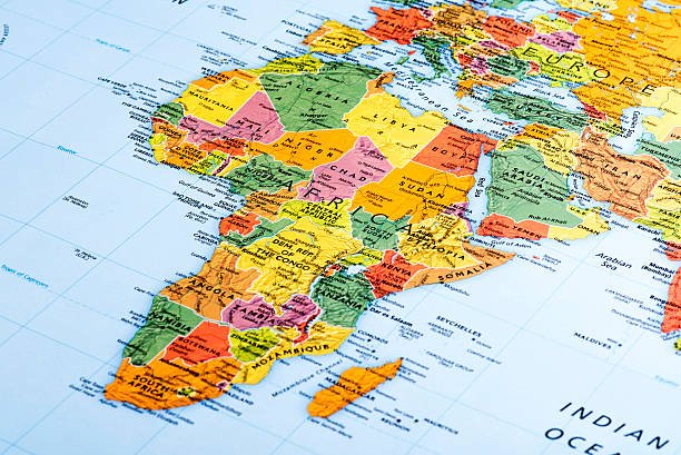
When gazing at a world map, particularly those based on the ubiquitous Mercator projection, it's easy to develop skewed perceptions of continental sizes. A common question that arises from such observations is: Is Africa wider than Russia? The answer, based on actual geographical measurements, is definitively no. Russia is significantly wider than Africa in its east-west extent, spanning an impressive longitudinal distance that dwarfs even the vast African continent.
This article delves into the precise geographical dimensions of both Africa and Russia, comparing their widths and explaining why popular maps often lead to such misconceptions. We will explore the true scale of these colossal landmasses, discuss the impact of map projections, and provide a comprehensive understanding of their unique geographical attributes.
Defining "Wider": The East-West Extent
To accurately address the question, it's crucial to define what we mean by "wider." In geographical terms, "width" typically refers to the east-west extent or the longitudinal span of a landmass. This is distinct from its total surface area or its north-south extent. When comparing continental widths, we look at the greatest distance across the land from its westernmost point to its easternmost point.
Understanding this distinction is key because a continent can have a very large total area but a relatively narrow width, or vice versa. Both Africa and Russia are immense, but their shapes and orientations on the globe result in very different east-west dimensions.
The Geographic Dimensions of Africa
Africa is the second-largest continent in the world by both land area and population. It is a continent of immense diversity, stretching across the equator and encompassing a wide range of climates and ecosystems. Its sheer size often surprises those who are only familiar with its appearance on distorted maps.
Africa's Total Area and Shape
- Total Area: Approximately 30.37 million square kilometers (11.73 million square miles).
- Africa's shape is often described as roughly triangular or pear-shaped, with a broad northern section tapering towards the south.
- It straddles both the Northern and Southern Hemispheres, with the equator running through its middle, giving it a largely tropical climate.
Africa's Widest Point (East-West Extent)
The widest point of Africa runs roughly through its northern central region. This immense span stretches from the westernmost tip of Senegal in West Africa to the easternmost point of Somalia in the Horn of Africa. The approximate measurements are:
- East-West Width: Around 7,500 kilometers (approximately 4,700 miles).
- This measurement illustrates Africa's substantial lateral dimension, making it one of the most expansive continents.
Africa's North-South Extent
For context, it's also worth noting Africa's impressive north-south reach:
- North-South Length: Approximately 8,000 kilometers (5,000 miles), from Ras ben Sakka in Tunisia (north) to Cape Agulhas in South Africa (south).
The Geographic Dimensions of Russia
Russia, officially the Russian Federation, is the largest country in the world by land area, covering over one-eighth of Earth's inhabited landmass. It spans Eastern Europe and Northern Asia, bordering 14 countries. Its immense size and unique geographical position contribute significantly to its vast longitudinal extent.
Russia's Total Area and Shape
- Total Area: Approximately 17.1 million square kilometers (6.6 million square miles).
- While smaller than Africa in total area, Russia's shape is extremely elongated from west to east, giving it an unparalleled width.
- It spans 11 time zones, a testament to its incredible longitudinal reach.
Russia's Widest Point (East-West Extent)
The widest point of Russia stretches from its westernmost exclave of Kaliningrad, nestled between Poland and Lithuania, all the way to its easternmost points along the Bering Strait, facing Alaska. This incredible span defines Russia's colossal east-west width:
- East-West Width: Over 9,000 kilometers (approximately 5,600 miles).
- This measurement highlights Russia's status as the widest country and, by extension, a landmass with an east-west dimension greater than any single continent, with the exception of Antarctica if measured across its widest points on specific projections, but in terms of inhabited land, Russia stands supreme.
Russia's North-South Extent
Russia also has a significant north-south extent, though less dominant than its east-west reach:
- North-South Length: Approximately 4,000 kilometers (2,500 miles) at its widest north-south point.
Direct Comparison: Africa vs. Russia in Width
Let's put the numbers side-by-side to answer the question directly: Is Africa wider than Russia?
| Geographical Entity | Approximate East-West Width (km) | Approximate East-West Width (miles) | Total Area (million sq km) |
|---|---|---|---|
| Africa | 7,500 km | 4,700 miles | 30.37 million sq km |
| Russia | 9,000+ km | 5,600+ miles | 17.1 million sq km |
As the table clearly demonstrates, Russia's east-west width significantly surpasses that of Africa. Even though Africa has a considerably larger total land area, its shape is more compact in its east-west dimension compared to Russia's elongated form. Russia stretches across a far greater range of longitudes, making it the wider of the two landmasses.
This comparison emphasizes that total area and linear dimensions like width or length are distinct geographical attributes and should not be conflated. Africa's vastness is undeniable, but Russia's specific continental dimensions, particularly its longitudinal reach, are truly exceptional.
Why the Misconception? Map Projections and Perceptions
If the true geographical data shows Russia is wider, why do so many people, when looking at a map, perceive Africa to be larger or at least comparable in width? The answer lies primarily in the distortions inherent in map projections, especially the widely used Mercator projection.
The Mercator Projection's Distortions
The Mercator projection, created in 1569 by Gerardus Mercator, was revolutionary for navigation because it preserves angles and shapes, making lines of constant bearing (rhumb lines) straight. However, this accuracy comes at a significant cost: distortion of area and distance, particularly at higher latitudes.
- Exaggerated Sizes at Poles: On a Mercator map, landmasses closer to the poles (like Greenland, Canada, and Russia) appear much larger than they are in reality. Areas near the equator (like Africa and South America) appear proportionally smaller than their true size.
- Africa's Apparent Size: Because Africa is largely equatorial, its size is severely underestimated on Mercator maps. It often appears smaller than Greenland, which is actually 14 times smaller than Africa.
- Russia's Apparent Size: Conversely, Russia, being a high-latitude country, appears even more enormous on the Mercator projection than its already impressive actual size. This visual bias makes it seem even wider and more expansive than its true proportions.
These distortions contribute heavily to the common belief that continents like Africa are smaller or less expansive than their high-latitude counterparts. It's a visual trick that has shaped global perceptions of geography for centuries.
Seeking More Accurate Representations
While the Mercator projection remains valuable for nautical navigation, for accurately representing land area and relative sizes, other projections are preferred:
- Gall-Peters Projection: This projection accurately represents the relative areas of continents and countries but distorts their shapes.
- Winkel Tripel Projection: Widely used by organizations like the National Geographic Society, it aims to minimize distortion in area, direction, and distance, offering a more balanced view.
By understanding these map biases, we can better appreciate the true geographical scale of our world and avoid common misconceptions about continental dimensions.
Beyond Width: Other Continental Comparisons
While Russia is wider, Africa holds its own unique distinctions:
Land Area and Population
- Total Land Area: Africa (30.37 million sq km) is significantly larger than Russia (17.1 million sq km).
- Population: Africa is home to over 1.4 billion people, making it the second most populous continent, whereas Russia's population is around 145 million.
Number of Countries
- Africa: Comprises 54 recognized countries, showcasing immense cultural and political diversity.
- Russia: Is a single country, albeit the largest in the world, with numerous autonomous regions and republics.
Climate Zones and Biodiversity
- Africa: Spans all major climate zones, from arid deserts (Sahara) to lush rainforests (Congo Basin) and temperate regions. This contributes to its incredible biodiversity.
- Russia: Predominantly features temperate and subarctic climates, with vast expanses of taiga forests and tundra, as well as steppe regions.
These comparisons highlight that each continent possesses unique geographical and demographic characteristics that define its global significance.
The Significance of Continental Dimensions
The immense dimensions of continents like Africa and Russia have profound impacts on various aspects of geography, climate, and human activity:
- Climate Patterns: A vast east-west extent, like Russia's, can lead to extreme continental climates, with significant temperature variations between seasons due to the lack of oceanic influence. Africa's equatorial position and immense north-south span result in diverse climatic zones.
- Biodiversity and Ecosystems: The sheer size and varied geographical features of both landmasses support an incredible array of ecosystems, from Russia's Siberian taiga to Africa's Serengeti savannas, each hosting unique flora and fauna.
- Resource Distribution: Large continents often harbor vast natural resources. Russia is famous for its extensive oil, natural gas, and mineral reserves, spread across its massive territory. Africa is rich in diamonds, gold, oil, and many other precious metals and resources.
- Geopolitics and Logistics: The vastness of Russia presents unique challenges and advantages in terms of governance, infrastructure development, and defense. Africa's size and numerous countries create a complex geopolitical landscape with diverse regional dynamics. Transporting goods and people across such large distances requires extensive infrastructure and logistical planning.
Understanding these dimensions goes beyond mere curiosity; it informs our comprehension of global systems, environmental challenges, and socio-economic development.
Conclusion
In summary, the question, "Is Africa wider than Russia?" is clearly answered by geographical data: Russia is indeed wider than Africa. With an east-west extent exceeding 9,000 kilometers (5,600 miles), Russia's longitudinal span is significantly greater than Africa's widest point of approximately 7,500 kilometers (4,700 miles). This fact often surprises many, largely due to the pervasive distortions of the Mercator map projection, which exaggerates the size of landmasses at higher latitudes while underrepresenting those near the equator. While Africa boasts a much larger total land area and a more substantial north-south extent, Russia's unique elongated shape gives it an unparalleled width, making it a truly exceptional landmass in terms of its east-west dimensions. A deeper understanding of true geographical scale, free from common map biases, is essential for a more accurate global perspective.
Enjoyed this read?
Share it with your friends and colleagues.