Basins Found In Africa

BSC Insights Admin
July 01, 2026
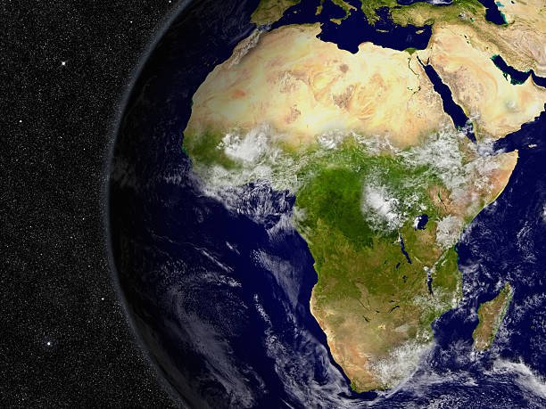
Identifying the various Basins Found In Africa is essential for understanding the hydrological and geological foundation of the second largest continent on Earth. These massive depressions collect water and sediment, shaping the livelihoods of millions of people through agriculture, fishing, and natural resource extraction across different regions. Understanding these basins provides a vital window into the ecological diversity of Africa and how these areas influence the climate and economic development of the surrounding nations.
The transition from high mountain ranges to these vast low-lying basins has created some of the most productive and biodiverse environments in the world. Exploring these specific geological features reveals the complex water systems that sustain life in both the lush rainforests and the arid deserts of the continent.
These are the significant historical and geological Basins Found In Africa
To analyze the physical geography of the continent, one must look at the specific regions where these massive drainage systems are located. Each basin has unique characteristics, ranging from the world's second largest rainforest to shrinking lakes and vast underground aquifers. The following list details the most prominent basins that have left an indelible mark on the landscape of the African continent through their enduring environmental and economic legacies.
1. The Congo Basin
The Congo Basin is a massive depression in Central Africa that houses the world's second largest tropical rainforest, spanning over 1.3 million square miles. This basin is a global center of biodiversity, providing a habitat for thousands of species, including forest elephants, bonobos, and lowland gorillas. It acts as a critical carbon sink, absorbing vast amounts of carbon dioxide and playing a major role in regulating the global climate. The basin is primarily drained by the Congo River, which is the deepest river in the world with depths exceeding 220 meters in some sections. This African country which contains the majority of the basin, the Democratic Republic of the Congo, relies on its vast river network for transportation and hydroelectric power potential. The sheer scale of this basin makes it one of the most important ecological regions on the planet today.
2. The Nile Basin
The Nile Basin is one of the most famous drainage systems in the world, covering approximately 10 percent of the African continent and reaching into eleven different countries. This basin is the lifeblood of the Sahara region, providing the only reliable source of water for agriculture and domestic use in nations like Egypt and Sudan. The White Nile and the Blue Nile are the two primary tributaries that meet in Khartoum before flowing north toward the Mediterranean Sea. Recent years have seen significant geopolitical discussions regarding the Grand Ethiopian Renaissance Dam, which highlights the basin's importance for energy production and regional water security. A country in Africa basins found in Africa like the Nile supports has a history of civilization dating back thousands of years based on the predictable flood cycles of the river. The total area of the basin is nearly 3.4 million square kilometers, making its management a complex international endeavor.
3. The Lake Chad Basin
The Lake Chad Basin is an endorheic basin located in the heart of the Sahel region, where the water does not flow out to the ocean but evaporates or seeps into the ground. Historically, Lake Chad was one of the largest freshwater bodies in Africa, but it has shrunk by more than 90 percent since the 1960s due to climate change and increased irrigation demands. This shrinking has created significant challenges for the millions of people in Chad, Niger, Nigeria, and Cameroon who depend on the lake for fishing and farming. The basin is also home to a diverse range of ethnic groups and provides a critical resting point for migratory birds traveling across the continent. Efforts are currently underway by the Lake Chad Basin Commission to find sustainable ways to recharge the lake and manage the remaining resources effectively. This region is a stark example of the environmental vulnerability of the various countries in Africa that rely on fragile water systems.
4. The Niger Basin
The Niger Basin is the primary drainage system for West Africa, centered around the Niger River which flows in a unique crescent shape through five different countries. This basin supports over 100 million people, providing water for the massive rice and onion farms of the Inner Niger Delta in Mali. The river is essential for the economic stability of the region, serving as a corridor for trade and a source of protein through its productive fisheries. In Nigeria, the Niger Delta is the site of massive oil and gas deposits, which are the backbone of the national economy but also present significant environmental challenges. The basin's management is overseen by the Niger Basin Authority, which works to balance the needs of energy production, agriculture, and environmental conservation. It is a vital artery for the Sahelian and tropical regions of West Africa, linking diverse ecosystems and cultures.
5. The Okavango Basin
The Okavango Basin is a unique inland drainage system in Southern Africa that terminates in the massive Okavango Delta in Botswana. Instead of flowing into the sea, the water from the Angolan highlands spreads out across the Kalahari Desert, creating a lush oasis in an otherwise arid landscape. This basin is one of the most pristine wilderness areas in the world and is a UNESCO World Heritage site known for its incredible density of wildlife. During the annual flood, thousands of animals migrate to the delta, making it a world-renowned destination for high-end ecotourism. African countries that basins found in Africa like the Okavango sustain must manage the delicate balance between development and conservation of these unique water resources. The basin remains a critical refuge for endangered species like the African wild dog and the wattled crane.
6. The Kalahari Basin
The Kalahari Basin is a vast semi-arid sandy savanna in Southern Africa, covering parts of Botswana, Namibia, and South Africa. Unlike the well-watered Congo or Nile basins, the Kalahari is characterized by its lack of permanent surface water, though it contains massive underground aquifers. These underground water sources are the primary reason why life is possible in this region, supporting the San people and various adapted wildlife species like the gemsbok and the Kalahari lion. The basin is covered by red sand dunes and sparse vegetation, which fluctuates dramatically between the wet and dry seasons. It is also a significant region for mining, particularly diamonds in Botswana, which has transformed the national economy over the last few decades. The management of the shared groundwater resources in this basin is a major priority for the neighboring nations as they face increasing climate variability.
7. The Zambezi Basin
The Zambezi Basin is the fourth largest river basin in Africa, draining an area of about 1.4 million square kilometers across eight different countries. It is most famous for the spectacular Victoria Falls, which is one of the largest waterfalls in the world and a major driver of tourism for Zambia and Zimbabwe. The basin is heavily utilized for hydroelectric power, with massive dams like Kariba and Cahora Bassa providing electricity for much of the Southern African region. Agriculture in the floodplains of the Zambezi supports millions of small-scale farmers who rely on the seasonal rise and fall of the river. The river also supports a vibrant fishing industry and acts as a primary habitat for hippos and Nile crocodiles throughout its course. Coordinating the use of these resources across multiple borders is handled by the Zambezi Watercourse Commission to ensure equitable and sustainable development.
8. The Orange River Basin
The Orange River Basin is the largest drainage system in South Africa and extends into Lesotho and Namibia, covering nearly one million square kilometers. The river originates in the high Drakensberg Mountains of Lesotho, where the water is captured by massive tunnels and dams as part of the Lesotho Highlands Water Project. This basin is critical for the industrial heartland of South Africa, providing the water needed for mining, manufacturing, and large-scale irrigation of vineyards and fruit orchards. In its lower reaches, the river forms the border between South Africa and Namibia, flowing through some of the most arid landscapes on Earth before reaching the Atlantic Ocean. The basin is also historically significant for its alluvial diamond deposits, which are found along the riverbanks and at its mouth. Managing the high demand for water in this relatively dry basin remains a significant challenge for the regional authorities.
9. The Senegal River Basin
The Senegal River Basin is a vital resource for West Africa, flowing through Guinea, Mali, Mauritania, and Senegal. This basin is a prime example of successful regional cooperation, as the four nations jointly manage the river's resources through the Organization for the Development of the Senegal River (OMVS). The river provides the water necessary for large-scale rice production in the delta and supports traditional nomadic herders who bring their livestock to the river during the dry season. Significant dams like the Manantali have been built to provide both irrigation and hydroelectric power to the member states, reducing their reliance on imported fuels. The basin is also home to several important bird sanctuaries, including the Djoudj National Bird Sanctuary, which is one of the most important wetland sites in the world. Its stability is essential for the food security of millions of people in the semi-arid reaches of the western Sahel.
10. The Taoudeni Basin
The Taoudeni Basin is a massive geological formation in West Africa, primarily located in Mali and Mauritania, and is one of the largest sedimentary basins in the world. Unlike the river basins, Taoudeni is primarily of interest for its potential mineral and energy resources, including salt, oil, and natural gas. Historically, the salt mines of Taoudeni were a major part of the trans-Saharan trade, with caravans traveling hundreds of kilometers across the desert to bring salt to the cities of the south. The basin is extremely remote and sparsely populated, characterized by the harsh environment of the Sahara Desert. Recent geological surveys have indicated significant potential for hydrocarbon deposits, leading to increased interest from international energy companies. The exploration of this basin presents both economic opportunities and logistical challenges due to its isolation and the extreme climate of the region.
11. The Karoo Basin
The Karoo Basin in South Africa is a geological wonder, covering nearly two-thirds of the country and containing a world-renowned record of fossils from the Permian and Triassic periods. This basin is of immense interest to scientists because it provides a detailed look at the evolution of life on land during a time of significant global changes. Economically, the Karoo is famous for its sheep farming, producing some of the finest wool and mutton in the region. In recent years, the basin has become the center of a national debate regarding the potential for shale gas extraction through hydraulic fracturing, or fracking. Proponents argue that it could provide energy independence for South Africa, while opponents fear the impact on the region's limited water supplies and its unique environment. The Karoo remains a place of vast open spaces, dramatic mountains, and a deep sense of geological history.
12. The Iullemmeden Basin
The Iullemmeden Basin is a major sedimentary basin in West Africa, spanning parts of Niger, Mali, and Nigeria, and is primarily known for its extensive groundwater systems. This basin contains several layers of aquifers that are the only source of water for many communities in the arid Sahelian landscape. These underground reservoirs are particularly important for livestock herding, as they allow pastoralists to find water even during long periods of drought. The basin also contains significant deposits of uranium in Niger, which is one of the world's largest producers of the mineral. Agriculture in the southern parts of the basin is supported by the relatively better rainfall and the use of groundwater for irrigation. Coordinating the extraction of water from these shared aquifers is a major point of discussion among the neighboring nations to prevent depletion of this hydrological stability across borders.
13. The Volta Basin
The Volta Basin covers approximately 400,000 square kilometers across six countries in West Africa, with Ghana and Burkina Faso accounting for the majority of the area. The basin is dominated by Lake Volta, which is one of the largest man-made lakes in the world by surface area, created by the Akosombo Dam. This lake is essential for Ghana's energy security, providing the majority of the nation's hydroelectricity and supporting a large-scale inland fishing industry. The basin's water is also used for irrigation, particularly in the northern regions of Ghana and Burkina Faso where rainfall is less reliable. The Volta River Authority manages the lake and the dam, balancing the needs of power generation with the environmental health of the downstream river. The basin is a critical driver of economic growth and food security for the entire sub-region, although it faces challenges from silting and changing rainfall patterns.
14. The Limpopo Basin
The Limpopo Basin is located in Southern Africa, spanning parts of Botswana, South Africa, Zimbabwe, and Mozambique. The river is known for its seasonal nature, often flowing only during the rainy months and becoming a series of sand pools during the dry season. Despite this, the basin supports a large population of farmers and livestock herders who have adapted to the variable water availability. In the lower reaches in Mozambique, the Limpopo fertile floodplains are a major agricultural zone, although they are also prone to devastating floods during extreme weather events. The basin is also home to significant wildlife populations, and the Great Limpopo Transfrontier Park connects several national parks across the borders of the four nations. Managing the water resources of the Limpopo is a priority for the Limpopo Watercourse Commission, especially as the region faces more frequent droughts.
15. The Turkana Basin
The Turkana Basin in East Africa, shared by Kenya and Ethiopia, is world-famous for its incredible record of human evolution, with numerous fossils of early hominids found in its sediments. The basin is home to Lake Turkana, the world's largest permanent desert lake and the largest alkaline lake, which is fed primarily by the Omo River in Ethiopia. This region is extremely arid and rugged, yet it supports various pastoralist groups like the Turkana and Rendille people. The basin has recently become a hub for renewable energy, with the Lake Turkana Wind Power project being one of the largest in Africa. However, the construction of the Gibe III dam on the Omo River has raised concerns about the long-term water levels of the lake and the impact on local communities. The Turkana Basin remains a place of immense scientific, cultural, and economic significance in the Horn of Africa.
Reasons Why These Countries depend on the Basins Found In Africa in Africa
1. Source of Life-Sustaining Water: The most fundamental reason these basins are so important is that they provide the only reliable source of water in many of the continent's driest regions. Without the Nile or the Niger, large parts of the Sahara and Sahel would be virtually uninhabitable for human populations. In an African country which contains a major basin, the availability of surface and groundwater dictates where cities are built and where crops can be grown. These water systems are the foundation of food security, providing the moisture needed for staple crops and the drinking water for millions of cattle. They are essentially the lifeblood of the continent's agricultural and domestic sectors.
2. Massive Potential for Renewable Energy: Many of the river basins found across the continent possess incredible potential for hydroelectric power generation due to their large volumes and dramatic drops in elevation. Projects like the Inga Falls on the Congo River or the dams on the Zambezi are some of the most significant energy sources in their respective regions. This clean energy is vital for industrialization and for bringing electricity to the millions of people who still lack access to the power grid. By harnessing the natural flow of these rivers, nations can reduce their carbon footprint and build more sustainable economies. The energy generated in these basins is often exported across borders, promoting regional integration and stability.
3. Foundation of Regional Economic Trade: River basins have historically served as the primary corridors for trade and communication between different ethnic groups and nations. Even today, the Congo and Niger rivers remain essential for moving goods like timber, oil, and agricultural products in areas where road infrastructure is limited. The economic activity centered around these basins provides a livelihood for fishermen, boat operators, and market traders who line the riverbanks. For landlocked countries, access to these river systems can provide a vital link to international markets through coastal ports. The basins are not just geographic features but are dynamic centers of commerce that drive the regional GDP.
4. Biodiversity and Ecotourism Hubs: The unique ecosystems found within basins like the Okavango or the Congo are among the most biodiverse on Earth, attracting tourists from all over the world. This ecotourism provides a sustainable source of foreign currency and creates thousands of jobs in the hospitality and conservation sectors. By protecting these basins, nations are also preserving the rare and endangered species that draw visitors, such as the mountain gorilla or the African elephant. The revenue from tourism is often used to fund conservation projects and improve the living standards of local communities. These basins represent the natural heritage of the continent and are a source of great national pride for the African country which hosts them.
5. Deposits of Valuable Mineral Resources: Sedimentary basins like the Taoudeni or the Niger Delta are often the site of massive deposits of oil, natural gas, and minerals that are essential for the modern global economy. The extraction of these resources provides the government revenue needed to fund education, healthcare, and infrastructure projects. In some regions, the presence of minerals like uranium or diamonds has turned previously remote basins into major industrial zones. While resource extraction presents environmental risks, it remains a primary driver of development for many nations. The geological history of these basins is directly responsible for the wealth found beneath the surface today.
6. Climate Regulation and Carbon Sequestration: The forested basins, particularly the Congo Basin, play a crucial role in regulating the continental and global climate by absorbing carbon dioxide and releasing oxygen. These "lungs of Africa" are essential for mitigating the effects of global warming and for maintaining the rainfall patterns that support agriculture in other regions. The massive peatlands recently discovered in the Congo Basin store billions of tons of carbon, making their protection a global environmental priority. By maintaining the health of these basins, nations are performing a service for the entire planet. The environmental stability provided by these basins is a prerequisite for the long-term survival of the continent's diverse ecosystems.
Conclusion
The study of the Basins Found In Africa reveals a continent that is as hydrologically complex as it is geologically ancient. From the life-giving waters of the Nile to the underground reservoirs of the Kalahari, these basins are the silent engines of life and commerce across the landmass. Every country in Africa that manages these resources holds a significant responsibility to balance economic growth with environmental sustainability for future generations. As climate change and population growth place increasing pressure on these systems, international cooperation will become more important than ever to ensure the equitable use of shared waters. Ultimately, the basins of Africa are not just geographical depressions but are the very heart of the continent's history and its future potential. Understanding their role is essential for anyone who wishes to appreciate the true scale and vitality of the African continent.
Enjoyed this read?
Share it with your friends and colleagues.