Which Country In Africa Is The Largest

BSC Insights Admin
October 01, 2026
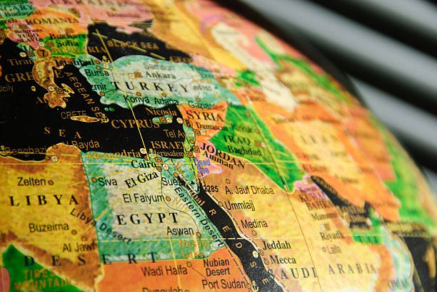
Algeria is currently recognized as the country in Africa largest by total land area, encompassing approximately 2.38 million square kilometers of territory. This vast North African nation took the top spot in 2011 following the official partition of Sudan, which previously held the title before the independence of South Sudan. Understanding the geographical scale of these massive nations is essential for appreciating the continent's diverse ecosystems and the logistical complexity of governing such expansive regions.
The sheer size of the African landmass is often underestimated on traditional maps, yet it remains home to some of the most expansive sovereign territories on the planet. Examining the dimensions of these nations reveals how geography shapes everything from climate and biodiversity to international trade and regional politics.
These are the Countries In Africa That are the Largest
When looking at which country that is the largest in Africa, we must consider land area as the primary metric for measurement. The following list identifies the top ten nations by square mileage, providing a detailed look at the geographical characteristics that define these giants. These nations span the entire continent, from the sun-scorched dunes of the Sahara Desert to the dense, rain-soaked jungles of the Congo Basin. By exploring their borders and internal landscapes, we gain a clearer picture of the physical magnitude that defines the countries in Africa that are the largest in size and influence.
1. Algeria
Algeria is the definitive African country which is the largest, spanning a massive 2,381,741 square kilometers across the northern part of the continent. Approximately 80 percent of its territory is covered by the Sahara Desert, yet the country also features a fertile mountainous coastline along the Mediterranean Sea. This immense size allows for a variety of climates, from the humid Mediterranean north to the hyper-arid interior where temperatures can reach extreme highs. Algeria shares borders with seven other countries, including Mali, Niger, and Libya, making it a central geopolitical player in both North Africa and the Sahel region. The vastness of the land provides the nation with incredible natural resources, particularly oil and natural gas, which are buried deep beneath the desert sands. Travelers can experience everything from the ancient Roman ruins of Timgad to the otherworldly volcanic landscapes of the Ahaggar Mountains within its expansive borders. Its sheer scale means that internal travel often requires long-haul flights or multi-day road journeys through some of the most remote places on Earth.
2. Democratic Republic of the Congo
The Democratic Republic of the Congo (DRC) is the second country in Africa largest by area and the largest in Sub-Saharan Africa, covering 2,344,858 square kilometers. Situated in the heart of the continent, it is dominated by the Congo River basin and the world's second-largest tropical rainforest, which serves as a vital global carbon sink. The country is nearly the size of Western Europe, a fact that presents unique challenges for infrastructure development and national administration. It shares borders with nine different countries, more than any other nation on the continent, acting as a bridge between Central, East, and Southern Africa. The DRC is exceptionally rich in minerals, holding the world's largest reserves of cobalt and significant amounts of copper, diamonds, and gold. Its geography is defined by its dramatic elevation changes, from the low-lying central basin to the snow-capped Rwenzori Mountains in the east. The sheer volume of water flowing through the Congo River provides the nation with enough hydroelectric potential to theoretically power a significant portion of the entire continent.
3. Sudan
Sudan remains one of the African countries that are the largest despite the loss of its southern territory in 2011, currently occupying 1,861,484 square kilometers. It is located at the crossroads of Sub-Saharan Africa and the Arab world, with a geography that transitions from the harsh Nubian Desert in the north to the fertile floodplains of the Nile. The Blue and White Nile rivers meet in its capital, Khartoum, forming the main artery that sustains life and agriculture for millions of its citizens. Sudan has a long coastline along the Red Sea, which serves as a critical maritime gateway for trade between Africa, Europe, and Asia. Its landscape is dotted with more pyramids than Egypt, reflecting a deep historical legacy that thrived along the riverbanks for millennia. The vastness of Sudan’s western region, Darfur, is nearly the size of France, illustrating the immense scale of the country’s regional territories. Despite current political and social challenges, the country’s size and agricultural potential make it a vital component of East African stability and food security.
4. Libya
Libya is a massive North African country which is the largest in terms of its desert-to-coastline ratio, covering 1,759,540 square kilometers. Most of its population lives along the Mediterranean coast, as the vast majority of the interior is consumed by the Libyan Desert, one of the most arid places on the planet. This enormous territory sits atop some of the largest proven oil reserves in Africa, which has historically made Libya one of the wealthiest nations on the continent per capita. The country's size has historically allowed it to act as a bridge for trade and migration between the Mediterranean world and the African interior. Ancient Greek and Roman cities like Cyrene and Leptis Magna still stand along the coast, showcasing the strategic importance this land has held for centuries. In the south, the landscape is marked by dramatic sandstone plateaus and isolated oases that have served as waypoints for trans-Saharan caravans. Navigating this country in Africa largest in its desert reaches requires deep knowledge of the terrain and specialized equipment to survive the nomadic conditions.
5. Chad
Chad is a landlocked country in Africa largest in the central region, spanning 1,284,000 square kilometers and often referred to as the dead heart of Africa. It is a land of extreme contrasts, where the northern Tibesti Mountains rise out of the Sahara and the southern regions consist of fertile Sudanian savanna. The country's northern half is virtually uninhabited, while the south is home to most of its agricultural and pastoral activities. Lake Chad, which was once one of the largest freshwater bodies in the world, sits on its western border and provides a vital lifeline for millions in the region. The sheer size of Chad makes it a critical player in the security of the Sahel, as its military often intervenes in neighboring conflicts to maintain regional balance. Its remote location and lack of coastline mean that Chad must maintain strong relationships with its neighbors, like Cameroon and Nigeria, for access to global markets. The country’s vastness is home to diverse wildlife, including the unique desert-adapted species found in the Zakouma National Park.
6. Niger
Niger is another massive, landlocked African country which is the largest in the West African region, covering 1,267,000 square kilometers of territory. Like its neighbors, about 80 percent of Niger's land area is swallowed by the Sahara Desert, with the majority of its population clustered in the fertile southern strip along the Niger River. The country is a major global producer of uranium, with its mines located in the remote Aïr Mountains of the north. This vast northern region is also home to the Tuareg people, whose nomadic lifestyle has been adapted to the scale and harshness of the desert for generations. The Termit & Tin Toumma National Nature Reserve in Niger is one of the largest protected areas in the world, providing a sanctuary for the critically endangered addax antelope. Managing such an expansive and largely arid territory presents significant hurdles for the government, particularly regarding border security and the provision of public services. Despite these challenges, the people of Niger maintain a vibrant culture that is deeply connected to the ebb and flow of the desert and the river.
7. Angola
Angola is the seventh country in Africa largest by land area, occupying 1,246,700 square kilometers on the southwestern coast of the continent. Its territory is nearly twice the size of Texas and features a diverse array of landscapes, from the arid Namibe Desert in the south to the lush tropical rainforests of the Cabinda exclave. The country’s central plateau is a fertile region with a temperate climate, historically known for its agricultural productivity before the long period of civil conflict. Angola is a major oil and diamond producer, with most of its wealth generated from the resources found both onshore and in its deep-water Atlantic fields. Since the end of the war in 2002, the nation has used its resource wealth to fund a massive reconstruction effort, building some of the most modern infrastructure in the region. Its size and strategic coastal position make it a dominant power in Southern and Central Africa, with significant influence in the African Union. The country is also working to revitalize its tourism sector, highlighting natural wonders like the Kalandula Falls and the massive national parks that are being repopulated with wildlife.
8. Mali
Mali is a landlocked African country which is the largest in the West African interior, covering 1,240,192 square kilometers. It is a nation of immense historical significance, once serving as the center of the wealthy Mali Empire, which controlled the trans-Saharan gold and salt trade. Most of the country’s northern territory lies within the Sahara Desert, while the southern part is fed by the Niger and Senegal rivers, where the majority of agriculture takes place. Timbuktu, located on the edge of the desert, remains a symbol of the nation’s heritage as a center of Islamic learning and ancient manuscript preservation. The sheer scale of the northern desert makes it difficult to police, which has led to security challenges in recent years involving various insurgent groups. Mali is the third-largest producer of gold in Africa, and its economy relies heavily on this mineral wealth along with the export of cotton. Its culture is world-renowned for its musical traditions, with artists from the desert and river regions influencing the global blues and jazz scenes. The vast, open spaces of Mali offer a sense of freedom and historical depth that is found in few other places on the planet.
9. South Africa
South Africa is the ninth country in Africa largest by area, spanning 1,221,037 square kilometers at the southernmost tip of the continent. It is one of the most geographically diverse nations in the world, containing everything from the arid Kalahari Desert to the lush "Garden Route" and the rugged Drakensberg Mountains. South Africa is the most industrialized and technologically advanced economy on the continent, with its infrastructure supporting a massive mining and manufacturing sector. Its size allows it to encompass three different capital cities—Pretoria, Cape Town, and Bloemfontein—each serving a different branch of government. The country is a world leader in conservation, with the Kruger National Park being one of the largest and most famous wildlife sanctuaries on Earth. South Africa’s position at the meeting point of the Atlantic and Indian Oceans gives it a strategic advantage in global maritime trade. Despite the geographical and social complexities resulting from its history, the nation remains a powerful force in global politics and a primary destination for international tourism and investment.
10. Ethiopia
Ethiopia rounds out the list of the top ten countries in Africa that are the largest, with a land area of 1,104,300 square kilometers in the Horn of Africa. Unlike most of its large neighbors, Ethiopia is defined by its high-altitude topography, featuring the Ethiopian Highlands which make up the largest continuous area of its altitude in the whole continent. This "Roof of Africa" provides a cool, fertile environment that has allowed for the development of a unique and ancient civilization that was never colonized. Ethiopia is the second most populous nation in Africa, and its massive size is home to over 80 different ethnic groups, each with its own language and traditions. The country is the source of the Blue Nile, which provides the vast majority of the water and silt for the Nile River downstream in Sudan and Egypt. In recent years, Ethiopia has embarked on massive infrastructure projects, such as the Grand Ethiopian Renaissance Dam, to harness its geography for national development. Its capital, Addis Ababa, serves as the diplomatic heart of the continent, hosting the headquarters of the African Union and the United Nations Economic Commission for Africa.
Reasons Why These Countries Are the Largest in Africa
1. Geological Stability and Continental Mass: The reason Algeria is the country in Africa largest is partly due to the geological stability of the Saharan craton. Large portions of North and West Africa consist of ancient, stable rock formations that have not been significantly broken up by tectonic activity for millions of years. This allowed for the formation of massive, continuous landmasses that colonial powers later delineated into the large states we see today. The lack of major inland seas or impassable mountain ranges in the Saharan interior facilitated the creation of these expansive national borders.
2. Historical Colonial Border Delineation: Many of the borders for the countries in Africa that are the largest were drawn during the Berlin Conference of 1884-1885 without regard for local ethnic or linguistic lines. European powers like France and Britain sought to claim vast swathes of the interior to secure trade routes and potential mineral wealth. In West and North Africa, the French colonized huge stretches of the Sahara, which eventually became nations like Algeria, Mali, and Niger. These borders were largely maintained after independence to avoid the chaos of territorial disputes, cementing their status as giants on the map.
3. The Impact of the Sudan Partition: Historically, Sudan was the African country which is the largest until the year 2011. The decades-long conflict between the north and the south eventually led to a referendum where South Sudan voted for independence. This event fundamentally shifted the geographical rankings of the continent, promoting Algeria to the number one spot and the DRC to number two. The partition demonstrated how political and social movements can redefine the physical map of the continent, turning one massive giant into two smaller, yet still significant, nations.
4. River Basin and Rainforest Geography: The size of the Democratic Republic of the Congo is a direct result of the Congo River basin’s vastness. Because the river and its tributaries provide a natural network for movement and resource extraction, the colonial and post-colonial states sought to encompass the entire basin within a single border. This country in Africa largest in the tropical zone exists because the rainforest and the river system created a unified geographical entity that was easier to manage as a single block than as fragmented smaller states. The dense jungle acted as a natural barrier, defining the outer limits of the nation's massive territory.
5. Strategic Resource Acquisition: Many of these large nations were formed around the presence of valuable natural resources. In the case of Libya and Algeria, the potential for vast oil and gas reserves incentivized the consolidation of desert territories that might otherwise have been left as unclaimed frontier land. Similarly, Angola and the DRC were defined by their mineral-rich interiors. By claiming larger territories, these nations ensured they had exclusive rights to the wealth buried beneath the surface, which continues to drive their national economies today.
6. Desired Regional Hegemony: Some of the largest nations were established with the intent of creating regional power centers. South Africa and Ethiopia have historically used their size and resources to exert influence over their smaller neighbors. Having a large land area allows a nation to support a bigger population, maintain a more significant military, and provide more space for industrial and agricultural growth. This desire for regional dominance encouraged the maintenance of large, unified borders even through periods of internal strife or external pressure.
Conclusion
While Algeria stands as the current country in Africa largest by land area, the ranking of the continent's giants reflects a complex history of geology, colonialism, and political transformation. From the Saharan expanses of Niger and Chad to the mountainous heights of Ethiopia, these ten nations represent the immense physical scale and potential of the African continent. Their vast borders contain a significant portion of the world's natural resources and biodiversity, making them critical players in the global economy and environmental conservation. As these nations continue to develop, managing their massive territories remains one of their greatest challenges and opportunities. Ultimately, the size of these African countries is a testament to the continent's diversity and its enduring role as a land of unparalleled geographical magnitude.
Enjoyed this read?
Share it with your friends and colleagues.