Which Desert Is There In Africa

BSC Insights Admin
September 30, 2026
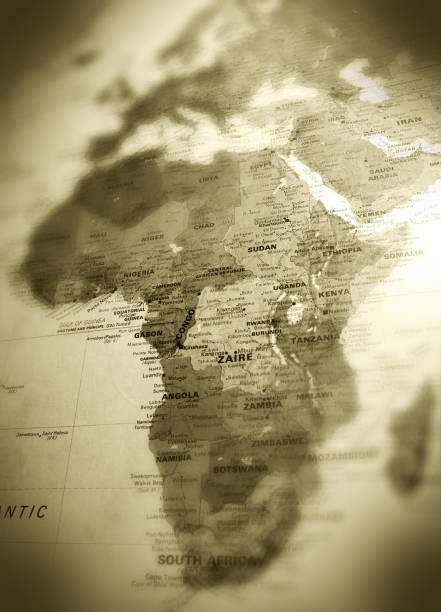
The Sahara is the most expansive desert in Africa that stretches across the northern third of the continent to create a massive barrier between the Mediterranean and the tropics. This arid landscape is recognized as the largest hot desert in the world, covering approximately nine million square kilometers across eleven different countries. Its presence dictates the weather patterns, migration routes, and cultural identities of millions of people who have adapted to its extreme conditions.
Exploring the various arid zones across the continent reveals a diverse range of environments from the ancient coastal sands of the west to the semi-arid basins of the south. These regions are not merely barren wastes but are complex ecosystems filled with unique wildlife and valuable natural resources that sustain modern economies.
These are the Countries and regions that explain Which Desert Is There In Africa
While the northern landscape is dominated by a single giant, the southern and eastern parts of the continent host several other distinct arid regions with entirely different ecological characteristics. Each of these zones has been shaped by unique geological forces, oceanic currents, and atmospheric patterns over millions of years. The following detailed breakdown identifies the major desert systems and the specific nations they occupy, providing a clear picture of the diversity of drylands found throughout the African landmass. From the shifting red dunes of the Atlantic coast to the volcanic salt pans of the Horn of Africa, these landscapes represent some of the most extreme and beautiful places on the planet.
1. The Sahara Desert in North Africa
The Sahara is the primary answer when people ask which desert that is there in Africa, spanning across nations such as Algeria, Egypt, Libya, Mali, Mauritania, Morocco, Niger, Sudan, and Chad. This massive region is roughly the size of the United States and consists of a variety of landforms including vast sand seas known as ergs, stone plateaus called hamadas, and even rugged mountain ranges like the Ahaggar and Tibesti. The climate is hyper-arid with some areas receiving less than twenty-five millimeters of rain annually and temperatures frequently soaring above fifty degrees Celsius in the summer months. Despite these harsh conditions, the Sahara is home to the Tuareg and Berbers who have facilitated trans-Saharan trade for centuries using camel caravans to transport salt, gold, and textiles. Modern economic activity in the Sahara is centered around the extraction of oil and natural gas, particularly in Libya and Algeria, while the Nile River provides a fertile green corridor through the Egyptian portion. As an African desert which dominates the north, the Sahara continues to expand southward through a process known as desertification, challenging the agricultural stability of the Sahelian countries.
2. The Namib Desert in Namibia
The Namib Desert is recognized as the oldest desert in the world, with its arid conditions persisting for at least fifty-five million years along the Atlantic coast of Namibia and parts of Angola. It is world-renowned for its towering apricot-colored sand dunes, especially at Sossusvlei, which are among the highest in the world and provide a stunning contrast against the blue sky. The environment is unique because it receives most of its moisture from a thick fog that rolls in from the Atlantic Ocean due to the cold Benguela Current meeting the warm desert air. This fog allows specialized life forms to survive, such as the Welwitschia mirabilis plant, which can live for over a thousand years, and the tenebrionid beetles that harvest water from the mist. The Skeleton Coast, where the desert meets the sea, is a treacherous region littered with shipwrecks and home to large colonies of Cape fur seals. This African country which is the most arid in the south leverages the Namib for high-end ecotourism and diamond mining, making the desert a vital part of the national identity and economy.
3. The Kalahari Desert in Botswana
The Kalahari is often described as a semi-desert or a fossil desert because it receives more rainfall than the Sahara or the Namib, allowing for more extensive vegetation and wildlife. It covers a vast interior basin that includes most of Botswana and parts of Namibia and South Africa, characterized by red sand dunes and expansive salt pans like the Makgadikgadi. During the rainy season, some areas of the Kalahari transform into lush grasslands that support a high density of animals including gemsbok, springbok, and the famous black-maned Kalahari lions. The region is also the ancestral home of the San people, who are among the oldest human populations on Earth and have developed an incredible knowledge of desert survival and medicinal plants. Most of the Kalahari consists of ancient sand that does not allow for permanent surface water, forcing wildlife and humans to rely on underground aquifers and seasonal waterholes. As a desert in Africa that supports significant biodiversity, the Kalahari is a major destination for safari enthusiasts looking for a different experience from the traditional savanna.
4. The Danakil Desert in Ethiopia
The Danakil Desert is located in the Afar Triangle of northeastern Ethiopia and extends into parts of Eritrea and Djibouti, sitting atop a tectonic triple junction where the earth's crust is pulling apart. It is frequently cited as one of the hottest and lowest points on Earth, with some areas like the Dallol hydrothermal field sitting over a hundred meters below sea level. The landscape is alien in appearance, featuring bubbling sulfur springs, neon-colored salt lakes, and active volcanoes like Erta Ale, which contains one of the world few permanent lava lakes. The Afar people inhabit this region and have made a living for centuries by hand-mining salt from the expansive pans and transporting it via camel to the highlands. The extreme heat and volcanic activity make it a difficult place to live, yet it is a site of immense scientific interest for researchers studying extremophiles and the origins of life. This African desert which is also called the Gateway to Hell provides a stark contrast to the lush highlands of the rest of Ethiopia.
5. The Chalbi Desert in Kenya
The Chalbi Desert is a small but intense arid region located in northern Kenya, near the border with Ethiopia and east of Lake Turkana. Its name in the local Gabbra language means "bare and salty," which accurately describes the vast white salt crust that forms the floor of an ancient dried-up lake. During the dry season, the landscape is a shimmering white expanse that creates frequent mirages, while the surrounding areas are dotted with volcanic rocks and sparse scrubland. The Gabbra people navigate this harsh territory with their livestock, moving between oases that are fed by underground water from the nearby Ethiopian highlands. While it is much smaller than the Sahara, the Chalbi is a vital geographic feature of Kenya northern frontier and is known for its extreme wind speeds and high temperatures. It serves as a reminder that deserts in Africa that are localized can still have a profound impact on the cultures and ecosystems of the surrounding regions.
6. The Grand Bara Desert in Djibouti
The Grand Bara is a vast, flat desert plain in southern Djibouti that consists of dried-up lake beds and ancient volcanic silt. The terrain is remarkably level, making it a popular site for sand-sailing and the annual "Grand Bara" marathon held by French military forces stationed in the country. There is almost no vegetation on the main plain due to the hard-packed clay surface, but the surrounding hills host sparse acacia trees and desert-adapted shrubs. This region is a critical part of the transition zone between the Ethiopian highlands and the Red Sea coast, experiencing high temperatures and very low humidity throughout the year. The Grand Bara is also a primary route for the new railway connecting Djibouti to Addis Ababa, highlighting how modern infrastructure must adapt to these desolate landscapes. Despite its barren appearance, the desert is a spectacular sight during sunrise and sunset when the flat horizon reflects the changing colors of the sky.
7. The Guban Desert in Somalia
The Guban is a narrow coastal desert strip in northern Somalia that runs parallel to the Gulf of Aden between the cities of Zeila and Berbera. Its name means "burned" in the Somali language, reflecting the intense heat and arid conditions caused by the rain shadow effect of the Ogo Mountains to the south. The landscape is a mix of sandy plains, rocky outcrops, and seasonal riverbeds called wadis that only flow after rare, heavy thunderstorms. During the summer months, the region experiences the hot and dry "Kharif" winds, which can make temperatures in the coastal towns extremely uncomfortable. The local population is primarily pastoralist, moving their herds of goats and camels toward the highlands during the hottest months to find better grazing. As an African desert which is critical for maritime trade routes, the Guban has several historic ports that have connected the Horn of Africa to the Arabian Peninsula for over a thousand years.
8. The Lompoul Desert in Senegal
The Lompoul Desert is a small but distinct arid zone located in northwestern Senegal, halfway between the capital city of Dakar and the historic town of Saint-Louis. It is famous for its beautiful orange sand dunes that resemble the Sahara, even though it covers an area of only about eighteen square kilometers. Because of its accessibility and picturesque landscape, it has become a popular destination for desert glamping and camel trekking for both locals and international tourists. The dunes are surrounded by sparse vegetation and traditional villages, providing a unique micro-environment that stands out from the surrounding Sahelian savanna. While it is not a massive geographic barrier, Lompoul serves as a powerful symbol of the encroaching desertification in West Africa. Travelers often visit this region to experience the "desert vibe" without having to travel deep into the heart of the Saharan interior.
9. The Nyiri Desert in Kenya
The Nyiri Desert, also known as the Nyika Desert, is an arid region in southern Kenya located in the rain shadow of Mount Kilimanjaro and the Aberdare Range. It consists of vast stretches of thorny scrubland, volcanic rocks, and small hills that provide a challenging habitat for both humans and wildlife. Despite its name, the Nyiri is more of a high-altitude arid savanna than a true sand desert, yet it receives very little rainfall and has almost no permanent surface water. The area is home to the Maasai and Kamba people, who use the land for grazing their cattle during the wetter months of the year. Wildlife such as giraffes, elephants, and leopards can often be found in the Nyiri, moving between the nearby national parks of Amboseli and Tsavo West. This region highlights how deserts in Africa that are created by mountain ranges can exist even in the heart of the tropical East African region.
10. The Nubian Desert in Sudan
The Nubian Desert forms the eastern portion of the Sahara and is located between the Nile River and the Red Sea in northeastern Sudan and southern Egypt. It is a rugged and rocky landscape characterized by high sandstone plateaus and seasonal wadis that cut through the desert toward the Nile. Unlike the western Sahara, which has more sand dunes, the Nubian Desert is mostly comprised of ancient rocks and hills that contain significant deposits of gold. This region was the heart of the ancient Kingdom of Kush, and today it still contains numerous small pyramids and ruins that are a testament to the sophisticated civilizations that once thrived there. The environment is extremely dry with almost no rainfall, making the Nile the only source of life for the people living on its fringes. As a desert in Africa that is rich in archaeological history, the Nubian Desert continues to be a site of exploration and mining for the modern Sudanese state.
11. The Bayuda Desert in Sudan
The Bayuda Desert is a distinct arid region located in northern Sudan, situated within the great bend of the Nile River north of Khartoum. It is characterized by its volcanic origins, featuring dark basaltic rocks, ancient volcanic craters, and wide wadis that are lined with acacia trees. The region is home to the Bisharin nomads who move their livestock through the desert, relying on traditional wells and the seasonal vegetation that grows in the dry riverbeds. The Bayuda provides a stark contrast to the surrounding golden sands of the Sahara due to its dark, rocky appearance and its unique geological history. It is also an area of archaeological importance, with numerous sites dating back to the Meroitic period when the region was part of a major trade route. Travelers often pass through the Bayuda when traveling between the various historic sites along the Nile, experiencing one of the most rugged and unpopulated parts of the country.
12. The Western Desert in Egypt
The Western Desert of Egypt is part of the Libyan Desert and covers a massive area west of the Nile, representing about two-thirds of the country total landmass. It is a region of extremes, featuring the vast Great Sand Sea along the border with Libya and several lush oases such as Siwa, Bahariya, and Farafra. These oases are fed by the Great Sandstone Aquifer, allowing for permanent human settlements and agriculture in the middle of one of the driest places on Earth. The Western Desert is also home to the White Desert National Park, where wind-eroded calcium formations look like giant mushrooms and snow-covered landscapes in the middle of the sand. This region has a long history of human occupation, with Siwa being famous for the Temple of the Oracle where Alexander the Great once sought guidance. As an African desert which is a major tourism asset, the Western Desert offers a diverse range of experiences from desert safaris to historical exploration.
Reasons Why These Countries feature these deserts in Africa
1. The influence of the Hadley Cell atmospheric circulation: The primary reason which desert that is there in Africa exists in the north and south is due to global wind patterns. Air rises at the equator and falls back to Earth at approximately thirty degrees latitude north and south, creating high-pressure zones. This falling air is dry and suppresses the formation of clouds and rain, leading to the creation of the Sahara in the north and the Kalahari and Namib in the south. This atmospheric process is a permanent feature of our planet and ensures that these regions remain arid regardless of other environmental changes. These high-pressure belts are the fundamental reason why the continent is the most desert-prone landmass on Earth.
2. The rain shadow effect caused by mountain ranges: Several African deserts that are smaller in scale are created when moist air from the ocean is blocked by high mountains. As the air rises over the mountains, it cools and loses its moisture as rain on the windward side, leaving the leeward side extremely dry. This is exactly how the Guban Desert in Somalia is formed by the Ogo Mountains and how the Nyiri Desert in Kenya is created by the presence of Mount Kilimanjaro and the Aberdares. These localized arid zones can exist even in tropical regions because the physical barrier of the mountains prevents the arrival of life-sustaining rain. Topography is therefore a major architect of the continent drylands.
3. The cooling effect of cold ocean currents: The Namib Desert is a direct result of the cold Benguela Current that flows northward from the Antarctic along the southwestern coast of Africa. This cold water cools the air above it, preventing it from rising and forming rain clouds over the land. Instead, it creates a persistent fog that stays over the coast, leaving the interior of the desert with almost no rainfall for millions of years. This process is known as a coastal desert and is also seen in the Atacama of South America, making the Namib one of the few places where a desert is created by the sea. Without this cold current, the southwestern part of the continent would likely be a much wetter savanna or forest region.
4. Isolation from moisture-bearing winds: Many parts of the interior of the continent are simply too far away from the oceans for moist air to reach them effectively. By the time winds from the Atlantic or Indian Oceans reach the heart of the Sahara or the Kalahari, they have already lost most of their moisture over the coastal forests and mountains. This "continentality" ensures that the central parts of the northern and southern basins remain perpetually dry. The vastness of the African landmass means that large areas are naturally shielded from the maritime influences that provide rain to the coasts. This geographic isolation is a key factor in the persistence of the Saharan and Kalahari systems over geological time.
5. Tectonic activity and geological depressions: The Danakil Desert in Ethiopia is a unique example of a desert created by the earth pulling apart. As the Afar Depression sank lower and lower due to tectonic shifts, it became a massive heat trap that prevented the arrival of cooling winds. The extreme heat caused by the thinning of the earth crust in this region led to the rapid evaporation of ancient seas, leaving behind the massive salt pans we see today. Volcanic activity also plays a role by creating sterile landscapes of lava and ash that do not support vegetation. This geological origin makes the Danakil one of the most extreme deserts in Africa that researchers study to understand the earth internal forces.
6. Historical changes in the Earth orbit and climate: The Sahara has not always been a desert; it has cycled between "Green Sahara" periods and arid periods over hundreds of thousands of years. Small shifts in the tilt of the Earth axis, known as Milankovitch cycles, change the intensity of the African monsoon, sometimes bringing rain deep into the heart of the desert. During these green periods, the Sahara was filled with lakes, rivers, and wildlife like hippos and crocodiles, as evidenced by ancient rock art found in the Ahaggar and Tibesti mountains. The current arid phase began about five thousand years ago and has been reinforced by modern human activity and climate change. Understanding these historical cycles helps us see that the African deserts that we see today are part of a long and dynamic environmental history.
Conclusion
The Sahara remains the most prominent answer to which desert is there in Africa, but the continent is also home to the ancient Namib, the semi-arid Kalahari, and the extreme Danakil. Each of these regions plays a critical role in the environmental balance of the continent, hosting unique cultures and providing essential mineral and energy resources for the modern world. While these arid zones present significant challenges for agriculture and habitation, they are also centers of biodiversity and incredible natural beauty that attract millions of visitors. As climate change and desertification continue to reshape the African landscape, the protection and sustainable management of these deserts will be vital for the future of the continent. Ultimately, these vast drylands are a testament to the resilience of life and the powerful geological forces that have shaped the African continent over millions of years.
Enjoyed this read?
Share it with your friends and colleagues.