How Africa Came Into Existence

BSC Insights Admin
October 01, 2026
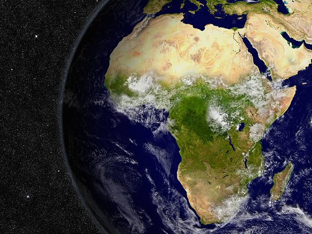
Africa, the second-largest continent on Earth, did not simply appear; its existence is the result of an extraordinary geological odyssey spanning billions of years, driven primarily by the relentless forces of plate tectonics and the breakup of ancient supercontinents. This colossal landmass began its recognizable journey as a central component of larger continental configurations, slowly taking shape as global landmasses drifted, collided, and separated over deep time.
The Deep Time Story: Precursors to Modern Africa
To understand how Africa came into existence, one must look back into Earth's primordial past, long before the familiar outlines of today's continents emerged. The story begins with the concept of the supercontinent cycle, where Earth's tectonic plates continually assemble into vast landmasses and then rift apart. Africa's ancient core, known as its cratons, represents some of the oldest and most stable crustal blocks on the planet, dating back more than 3 billion years.
The Rise and Fall of Ancient Supercontinents
- Vaalbara (approx. 3.6 billion years ago): Considered one of the earliest supercontinents, Vaalbara included parts of modern South Africa (Kaapvaal Craton) and Western Australia (Pilbara Craton). Its formation marked the beginning of continental crust accumulation.
- Ur (approx. 3.0 billion years ago): Though smaller than later supercontinents, Ur is often cited as the longest-lived. Segments of modern Africa formed part of this landmass.
- Rodinia (approx. 1.1 billion - 750 million years ago): This Neoproterozoic supercontinent saw large portions of what would become Africa situated near its center, connected to what would become South America, Antarctica, and India. The rifting of Rodinia paved the way for the assembly of the next major supercontinent.
These cycles of assembly and fragmentation are crucial to understanding the complex geological fabric of the African continent evolution.
Gondwana: Africa's Direct Ancestor
The most immediate and significant predecessor to modern Africa was the supercontinent Gondwana. As the supercontinent Rodinia began to break apart around 750 million years ago, its fragments started to reassemble, leading to the formation of Gondwana during the late Neoproterozoic and early Paleozoic eras (roughly 600 to 500 million years ago).
Assembling the Southern Giant
Gondwana was a colossal landmass that brought together nearly all the landforms that now constitute the Southern Hemisphere. It comprised:
- Africa: Forming the vast central core.
- South America: Attached to the western side of Africa.
- Antarctica: Connected to southeastern Africa.
- Australia: Joined to Antarctica.
- India: Tucked into the eastern side of Africa and Antarctica.
- Madagascar & Arabian Peninsula: Integral parts of the African block within Gondwana.
The suture zones, where these different continental fragments collided to form Gondwana, are evident in Africa's geology today, often marked by ancient mountain belts and distinct geological provinces. This geological history of Africa is a story of immense tectonic forces.
The Great Rifting: Breaking Up Gondwana
Around 180 to 160 million years ago, during the Jurassic period, the immense supercontinent of Gondwana began its inexorable breakup. This fragmentation was driven by plumes of hot mantle material rising beneath the supercontinent, causing the crust to stretch, thin, and ultimately rift apart. This process of continental drift fundamentally shaped the planet's geography.
Stages of Gondwana's Dissolution
-
Separation of West Gondwana (180-160 Ma): The initial rifting occurred between Africa and South America, leading to the formation of the South Atlantic Ocean. This process began in the south and propagated northwards, creating a vast rift valley that eventually flooded with seawater.
-
Separation of East Gondwana (160-120 Ma): Subsequently, India, Madagascar, Australia, and Antarctica began to separate from the eastern flank of Africa. This led to the opening of the Indian Ocean. India and Madagascar initially moved together before separating later.
-
Africa's Independence: By approximately 100 million years ago, Africa had largely detached from its Gondwanan neighbors, embarking on its solitary journey as a distinct continent. The geological forces shaping Africa continued to operate, but now on the individual African Plate.
The evidence for this breakup is not just theoretical; it's observable in the complementary coastlines of South America and Africa, the matching geological formations across the Atlantic, and fossil records found on now-distant continents. The study of African plate tectonics reveals a dynamic past.
Africa's Cratonic Core: The Continent's Backbone
At the heart of Africa lie several ancient and remarkably stable continental blocks known as cratons. These are the oldest and thickest parts of the Earth's continental lithosphere, having remained largely undeformed by tectonic activity for billions of years. They acted as rigid nuclei around which younger crustal material accumulated during the formation of Gondwana and subsequently Africa.
Major African Cratons:
- Kaapvaal Craton (Southern Africa): One of the oldest pieces of continental crust on Earth, dating back over 3.6 billion years. It is famous for its diamond-rich kimberlites.
- Congo Craton (Central Africa): A vast and relatively stable craton that forms the geological foundation of much of Central Africa.
- West African Craton: Underpins much of West Africa, with rocks dating back billions of years.
- Tanzanian Craton (East Africa): An ancient block that significantly influences the geology of the East African Rift System.
These cratons are surrounded by younger fold belts and mobile belts, which are zones where continental fragments collided and deformed during the assembly of supercontinents. This mosaic of ancient and younger crust forms the complex origins of Africa.
Internal Dynamics: Shaping Modern Africa
While the breakup of Gondwana defined Africa's initial shape, internal geological processes continue to sculpt its landscape even today. The most prominent of these is the East African Rift Valley.
The East African Rift System: A Continent in the Making?
The East African Rift System (EARS) is a 6,000-kilometer-long active continental rift zone in East Africa. It is a dramatic manifestation of ongoing continental rifting, where the African Plate is slowly splitting into two smaller plates: the Somalian Plate to the east and the Nubian Plate to the west. This process, which began around 25-30 million years ago, involves:
- Volcanic Activity: The rift is characterized by numerous active and dormant volcanoes, including Mount Kilimanjaro, Mount Kenya, and the Virunga Mountains. Volcanic eruptions signify the upwelling of magma from the mantle.
- Deep Lakes: Many of the world's deepest and largest freshwater lakes (e.g., Lake Victoria, Lake Tanganyika, Lake Malawi) lie within the rift valleys, formed by the down-dropping of crustal blocks.
- Earthquakes: The stretching and thinning of the crust result in frequent seismic activity along the rift zones.
- Oceanic Crust in Formation: In some northern parts of the rift (like the Afar Depression), new oceanic crust is already forming, indicating an early stage of ocean basin development.
The EARS is a compelling example of geological forces shaping Africa in real-time, potentially leading to the creation of a new ocean and a new microcontinent in millions of years.
Mountain Building and Uplift
While Africa is often considered a plateau continent, it also features significant mountain ranges and highlands:
- Atlas Mountains (North Africa): Formed by the collision of the African and Eurasian plates, a relatively young mountain range.
- Drakensberg Mountains (Southern Africa): Primarily an erosional escarpment of an uplifted plateau, though the uplift itself is tectonically driven.
- Ethiopian Highlands: A vast expanse of rugged mountains and dissected plateaus, largely a result of extensive volcanic activity associated with the rifting process.
- Ruwenzori Mountains (East Africa): Block mountains uplifted along fault lines associated with the East African Rift.
These features underscore the varied and complex geological timeline of Africa, which includes both ancient stability and ongoing dynamic processes.
The Enduring Legacy: Resources and Environment
The intricate geological history of Africa has profound implications for its natural resources and environments. The presence of ancient cratons and the processes of continental rifting have created immense mineral wealth.
Mineral Riches:
Africa is exceptionally rich in a wide array of minerals, directly linked to its geological past:
- Diamonds: Found in the ancient kimberlite pipes within the Kaapvaal and Congo Cratons.
- Gold: Also associated with ancient cratonic terrains, particularly in West and Southern Africa.
- Copper & Cobalt: Abundant in the Central African Copperbelt, often linked to ancient sedimentary basins and tectonic activity.
- Platinum Group Metals (PGMs): Found in layered igneous intrusions within cratonic areas.
- Oil & Gas: Formed in sedimentary basins that developed along the rifting margins of the continent, particularly in West and North Africa.
Environmental and Climatic Impact:
The continent's large size, shape, and topography, all a result of its formation, significantly influence its climate and biodiversity. The uplift of the East African Rift, for instance, has contributed to rain shadows and altered atmospheric circulation, creating diverse ecosystems from arid deserts to lush rainforests. The stable cratonic shield has also allowed for long periods of surface weathering, producing nutrient-poor soils in many regions, while volcanic activity introduces fertile soils.
Conclusion
In essence, Africa came into existence through an epic saga of deep geological time, beginning with its fragments coalescing into supercontinents like Rodinia and ultimately Gondwana. The subsequent and dramatic breakup of Gondwana, driven by immense tectonic forces, allowed Africa to emerge as a distinct continental landmass. Its enduring stability is owed to its ancient cratonic heart, while ongoing processes like the East African Rift System continue to sculpt its dynamic landscape. Understanding the formation of Africa is a testament to the Earth's ever-changing nature, a story written in rocks, rifts, and mountains over billions of years, creating a continent rich in both geological marvels and natural resources.
Enjoyed this read?
Share it with your friends and colleagues.