Which Country Has The Longest Coastline In Africa

BSC Insights Admin
October 01, 2026
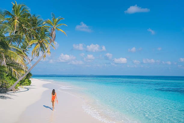
Determining which country that has the longest coastline in Africa requires a detailed look at the diverse maritime geography that surrounds the second largest continent on earth. Madagascar stands as the definitive record holder with a shoreline that stretches approximately 4,828 kilometers because of its status as a massive island nation located in the Indian Ocean. This extensive maritime border provides the country with vast marine resources and a unique ecological landscape that is unmatched anywhere else in the region.
The length of a nation's shore often determines its economic potential in terms of international trade, tourism, and fisheries. Understanding these geographical measurements helps in assessing the strategic importance of various African nations in the global maritime network.
These are the Countries that have the longest coastline in Africa
The African continent is bounded by the Mediterranean Sea to the north, the Red Sea and Indian Ocean to the east, and the Atlantic Ocean to the west. This positioning has gifted several nations with incredibly long stretches of beaches, cliffs, and mangrove forests that define their national identities. While island nations naturally possess more coastline relative to their land area, certain mainland countries also boast thousands of kilometers of oceanic access. This access facilitates the movement of goods through busy ports and supports the livelihoods of millions of people who depend on the sea. The following list identifies the top performers based on the total length of their maritime boundaries, providing a comprehensive overview of their geographic and economic significance.
1. Madagascar
Madagascar is the primary African country which has the longest coastline, measuring a staggering 4,828 kilometers in total. As the fourth largest island in the world, its entire perimeter is exposed to the Indian Ocean, creating a diverse array of coastal environments ranging from tropical rainforests in the east to dry deciduous forests and mangroves in the west. The eastern coast is characterized by steep cliffs and a narrow coastal plain, while the western side features broad plains and extensive coral reefs that protect the shore from the open sea. This massive coastline is a cornerstone of the national economy, supporting a robust fishing industry and attracting thousands of tourists to its pristine beaches and unique biodiversity. Madagascar’s geographic isolation has led to the evolution of thousands of endemic species that live near its shores, making it a global priority for marine conservation. The sheer length of the shoreline also gives the nation one of the largest Exclusive Economic Zones in Africa, providing significant potential for offshore resource exploration and sustainable blue economy development. Because every side of the nation meets the water, the maritime influence on Malagasy culture and trade is profound and enduring.
2. Somalia
Somalia possesses the longest coastline on the African mainland, with a total length of approximately 3,333 kilometers along the Gulf of Aden and the Indian Ocean. Its strategic location at the Horn of Africa makes it a vital player in global maritime security and trade, as it overlooks the primary shipping lanes connecting Europe and Asia via the Red Sea. The northern coast is rugged and mountainous, featuring dramatic cliffs that drop into the sea, while the southern coast is dominated by vast, sandy beaches and dunes that stretch toward the Kenyan border. Historically, these shores have been centers of commerce for centuries, linking the African interior with the Arabian Peninsula, India, and beyond through ancient maritime silk roads. Today, the Somali government is working to revitalize its ports, such as Mogadishu, Berbera, and Kismayo, to reclaim its status as a regional logistics hub. The rich waters off the Somali coast are also home to some of the most productive fishing grounds in the world, although managing these resources remains a complex challenge. The length and strategic positioning of the Somali shore ensure that it remains a focal point for international geopolitical and economic interests in the eastern region.
3. South Africa
South Africa features an extensive and dramatic coastline of roughly 2,798 kilometers that serves as the meeting point for the Atlantic and Indian Oceans. This unique convergence occurs at Cape Agulhas, creating a highly productive marine environment where cold and warm currents mingle, supporting a vast array of sea life. The coastline is world-renowned for its scenic beauty, including the famous Garden Route, the rugged cliffs of the Wild Coast, and the iconic Table Mountain overlooking the Atlantic in Cape Town. Economically, South Africa’s ports are among the most sophisticated and busiest on the continent, with Durban acting as the primary gateway for trade into Southern Africa. The maritime sector is a major driver of the national GDP, encompassing everything from commercial shipping and oil refining to a thriving luxury tourism industry. South Africa also leads the continent in marine research and conservation, utilizing its long shoreline to study climate change and protect endangered species like the southern right whale and the great white shark. The diversity of the coastline, from the arid shores of the Northern Cape to the subtropical beaches of KwaZulu-Natal, reflects the "Rainbow Nation" identity of the country itself.
4. Mozambique
Mozambique possesses a stunning coastline that runs for about 2,470 kilometers along the Indian Ocean in Southeastern Africa. This shoreline is famous for its crystal-clear waters, white sandy beaches, and vibrant coral archipelagos such as Bazaruto and Quirimbas, which are major destinations for international travelers. The country’s geography is defined by its long coastal plain, which is fed by numerous large rivers like the Zambezi and the Limpopo, creating fertile deltas and extensive mangrove systems. These estuaries are critical for the health of the regional marine ecosystem, acting as nurseries for various fish species and protecting the land from tropical cyclones. Mozambique’s ports, particularly Maputo, Beira, and Nacala, are essential for the economic survival of landlocked neighbors like Zimbabwe, Malawi, and Zambia. In recent years, the discovery of massive offshore natural gas reserves in the northern Rovuma Basin has further elevated the strategic importance of the Mozambican coast. The government is focused on developing these resources to transform the national economy while striving to maintain the delicate balance between industrial growth and environmental preservation. The maritime heritage of Mozambique is deeply woven into the local culture, from traditional dhow sailing to the seafood-rich cuisine that defines the coastal provinces.
5. Egypt
Egypt is a unique country in Africa having the longest coastline segments in two distinct maritime regions: the Mediterranean Sea and the Red Sea. Its combined shoreline measures approximately 2,450 kilometers, providing the nation with a dual maritime identity that has shaped its history for five millennia. The Mediterranean coast is home to the historic city of Alexandria and serves as a major agricultural and industrial hub, while the Red Sea coast is world-famous for its spectacular coral reefs and luxury diving resorts in places like Sharm El Sheikh and Hurghada. The most significant feature of Egypt's maritime geography is the Suez Canal, an artificial waterway that connects the two seas and facilitates about twelve percent of all global trade. This canal is a vital source of national revenue and cements Egypt's status as a central node in the global supply chain. The Egyptian government has recently invested billions in expanding the canal and developing the surrounding economic zones to attract more manufacturing and logistics firms. Additionally, the discovery of the massive Zohr gas field in the Mediterranean has turned Egypt into a regional energy powerhouse. The coastline remains the lifeblood of the Egyptian state, supporting its massive population and its ambitions as a modern industrial leader.
6. Morocco
Morocco enjoys an extensive and strategically positioned coastline of approximately 1,835 kilometers, bordered by both the Atlantic Ocean and the Mediterranean Sea. The northern shore is separated from Europe by the narrow Strait of Gibraltar, making Morocco the gateway between Africa and the European continent. Along the Atlantic, the coast stretches far to the south, characterized by large fishing ports and modern cities like Casablanca and Agadir that drive the national economy. Morocco has the most developed fishing industry in Africa, taking advantage of the nutrient-rich Canary Current to export sardines and other seafood to markets across the globe. The government has also embarked on massive infrastructure projects, such as the Tanger-Med port, which is now the largest container port in Africa and the Mediterranean. Tourism is another major pillar of the coastal economy, with visitors flocking to the historic coastal medinas of Essaouira and the modern surf spots of Taghazout. Morocco is also a leader in renewable energy, utilizing its windy and sun-drenched shores to build some of the world’s largest wind and solar farms. This dual-ocean access allows Morocco to pursue a diversified trade strategy that connects it with both the Americas and the Mediterranean basin.
7. Libya
Libya possesses the longest Mediterranean coastline of any African nation, spanning about 1,770 kilometers across the northern edge of the Sahara Desert. The vast majority of the Libyan population lives within a few kilometers of the sea, as the arid interior is largely uninhabitable. This coastal strip is home to ancient Roman and Greek ruins, such as Leptis Magna and Cyrene, which highlight the region's long-standing connection to Mediterranean civilizations. Economically, the coastline is critical for the export of Libya’s high-quality light crude oil and natural gas, which are the mainstays of the national budget. Major oil terminals and refineries are dotted along the shore, particularly in the Gulf of Sirte, facilitating energy shipments to European markets. The Libyan coast also has significant potential for the development of fisheries and blue energy projects, although these sectors are currently underutilized. Despite the political transitions of recent years, the maritime border remains the most valuable asset for the country's future stability and economic recovery. The Mediterranean influence is visible in the architecture, agriculture, and daily life of the coastal cities, where the sea provides a cooling breeze and a vital link to the outside world.
8. Angola
Angola features a long and resource-rich coastline that stretches for about 1,600 kilometers along the Atlantic Ocean in Central Africa. The capital city, Luanda, is one of the oldest colonial settlements in Africa and serves as the economic and administrative heart of the country, fueled largely by the offshore petroleum industry. Angola is one of the top oil producers on the continent, with the majority of its production coming from sophisticated deep-water platforms located miles from the shore. Beyond oil, the cold Benguela Current flows north along the Angolan coast, bringing nutrient-rich waters that support a thriving commercial fishing sector. The coastline also features beautiful bays and natural harbors, such as Lobito and Namibe, which are essential for the export of minerals and agricultural products from the interior. The government is currently working to diversify the coastal economy by promoting sustainable tourism and investing in new port infrastructure to improve regional trade. The Angolan shore is also known for its dramatic landscapes, where the desert meets the sea in the southern Namibe province, creating a stark and beautiful environment. Protecting the marine biodiversity from the impacts of the oil industry remains a primary environmental focus for the nation.
9. Namibia
Namibia’s coastline is roughly 1,570 kilometers long and is perhaps the most unique and hauntingly beautiful in the world, dominated by the Namib Desert. Known as the Skeleton Coast in the north, it is famous for its dense fogs, treacherous currents, and the rusted shipwrecks that dot the sandy shores. Despite its desolate appearance, the coast is incredibly productive due to the intense upwelling caused by the Benguela Current, which supports one of the richest marine ecosystems on the planet. Walvis Bay is the primary port, serving as a critical logistics hub for the country and providing landlocked neighbors like Botswana and Zambia with access to the Atlantic. The town of Luderitz, with its colonial architecture, is another important center for the fishing and diamond mining industries, the latter of which involves extracting gemstones from the ocean floor. Namibia has implemented some of the world’s strictest marine conservation laws to ensure the long-term sustainability of its hake and pilchard stocks. The coastline is also a major destination for adventure tourism, where visitors can see massive seal colonies and desert-adapted wildlife roaming near the waves. This intersection of a harsh desert and a fertile ocean defines the rugged spirit of the Namibian people.
10. Tanzania
Tanzania possesses a beautiful and culturally rich coastline of approximately 1,424 kilometers along the Indian Ocean, including the famous spice islands of the Zanzibar Archipelago. The shoreline is characterized by swaying palm trees, white coral sands, and ancient Swahili trading towns that have existed for over a thousand years. Dar es Salaam, the nation's largest city and commercial capital, is a major regional port that handles trade for much of East and Central Africa. The coastal waters are exceptionally biodiverse, featuring extensive coral reefs and seagrass meadows that support a wide variety of fish and marine mammals. Tanzania’s blue economy is centered on small-scale and commercial fishing, as well as a world-class tourism industry that attracts millions to the beaches of Unguja and Pemba. In recent years, the discovery of massive offshore natural gas reserves has added a new dimension to the economic importance of the Tanzanian coast. The government is also investing in modernizing its maritime infrastructure to compete with other regional hubs. The Swahili coast remains a symbol of the historic fusion of African, Arab, and Indian cultures that has defined the region's unique social fabric and trade history.
| Rank | Country Name | Coastline Length (Approx. KM) | Primary Water Body |
|---|---|---|---|
| 1 | Madagascar | 4,828 | Indian Ocean |
| 2 | Somalia | 3,333 | Indian Ocean / Gulf of Aden |
| 3 | South Africa | 2,798 | Atlantic / Indian Ocean |
| 4 | Mozambique | 2,470 | Indian Ocean |
| 5 | Egypt | 2,450 | Mediterranean / Red Sea |
| 6 | Morocco | 1,835 | Atlantic / Mediterranean |
| 7 | Libya | 1,770 | Mediterranean Sea |
| 8 | Angola | 1,600 | Atlantic Ocean |
| 9 | Namibia | 1,570 | Atlantic Ocean |
| 10 | Tanzania | 1,424 | Indian Ocean |
Reasons Why These Countries Have Longest Coastline in Africa
1. Island Geography and Perimeter Exposure: The most significant factor for African countries that have the longest coastline often relates to their status as islands. Madagascar is the fourth largest island globally, and because it is entirely surrounded by water, its total boundary is a maritime one. This means that every single kilometer of its border contributes to its coastline length, unlike mainland nations that share most of their borders with neighboring countries. Island nations like Mauritius and Seychelles also follow this pattern, though on a smaller scale, where the ratio of coastline to land area is exceptionally high.
2. Geological Tectonic Rifting and Plate Movements: Millions of years ago, the breaking apart of the supercontinent Gondwana shaped the edges of the African plate. This massive geological process created the jagged and extensive shorelines we see today, particularly along the eastern and western coasts of the continent. Somalia and Madagascar were once part of a larger landmass, and their separation created new, long coastlines as the Indian Ocean filled the resulting gaps. These tectonic forces are the foundational reason why the African countries that have the longest coastline exist in their current physical configurations.
3. Irregular Shoreline Geometries and Inlets: A coastline that is not a straight line but instead features many bays, gulfs, and peninsulas will naturally be much longer when measured accurately. Mozambique and South Africa have very irregular shorelines with numerous natural indentations that significantly increase their total length. This phenomenon is often referred to in geography as the coastline paradox, where the more detailed the measurement, the longer the coastline appears to be. These irregularities are often formed by the erosion of different rock types at varying rates over millions of years, creating a complex and elongated maritime border.
4. Large National Landmass and Surface Area: Generally, the larger a country's total land area, the more likely it is to have a long coastline if it borders an ocean. African countries that have the longest coastline, such as Angola, Libya, and South Africa, are among the largest nations on the continent by size. Their vast north-to-south or east-to-west reaches naturally cover more distance along the oceanic edge. While landlocked nations like Chad or Mali may be large, they lack this maritime exposure, highlighting how size and geographic location must work together to create an extensive shoreline.
5. Strategic Dual-Ocean Positioning: Some nations are positioned at the corners of the continent, allowing them to border more than one major body of water. Egypt and Morocco are perfect examples, as they both have shorelines on the Mediterranean Sea as well as another ocean or sea (the Red Sea for Egypt and the Atlantic for Morocco). This dual exposure effectively doubles their potential for a long coastline compared to nations that only face a single direction. This geographic "corner" position is a rare and valuable asset that significantly boosts a nation's maritime footprint and trade capabilities.
6. Formation of Massive Deltas and Estuaries: Countries that have large river systems emptying into the sea often see their coastline length increased by the complex geography of river deltas. For example, the Nile in Egypt and the Zambezi in Mozambique create intricate networks of islands and channels where the land meets the ocean. These African countries that have the longest coastline benefit from these "fractal" geometries that add hundreds of extra kilometers to the official measurement. These deltaic regions are not just long; they are also some of the most fertile and biodiverse areas on the continent, supporting large human populations and unique wildlife.
Conclusion
In conclusion, while many nations possess beautiful shores, Madagascar remains the specific which country that has the longest coastline in Africa with over four thousand kilometers of oceanic boundary. From the strategic cliffs of Somalia to the dual-ocean vistas of South Africa and Egypt, these coastlines are the engines of economic growth and the guardians of continental biodiversity. They facilitate global trade through massive ports and provide a foundation for the thriving tourism and fishing sectors that sustain millions of lives. As climate change continues to impact sea levels and coastal weather patterns, the management and protection of these extensive maritime borders will be a top priority for African leaders. Ultimately, the African country which has the longest coastline is a testament to the raw geological power and natural wealth that defines the edges of this vibrant continent.
Enjoyed this read?
Share it with your friends and colleagues.